by The Goat | Jan 10, 2022 | Grand Canyon
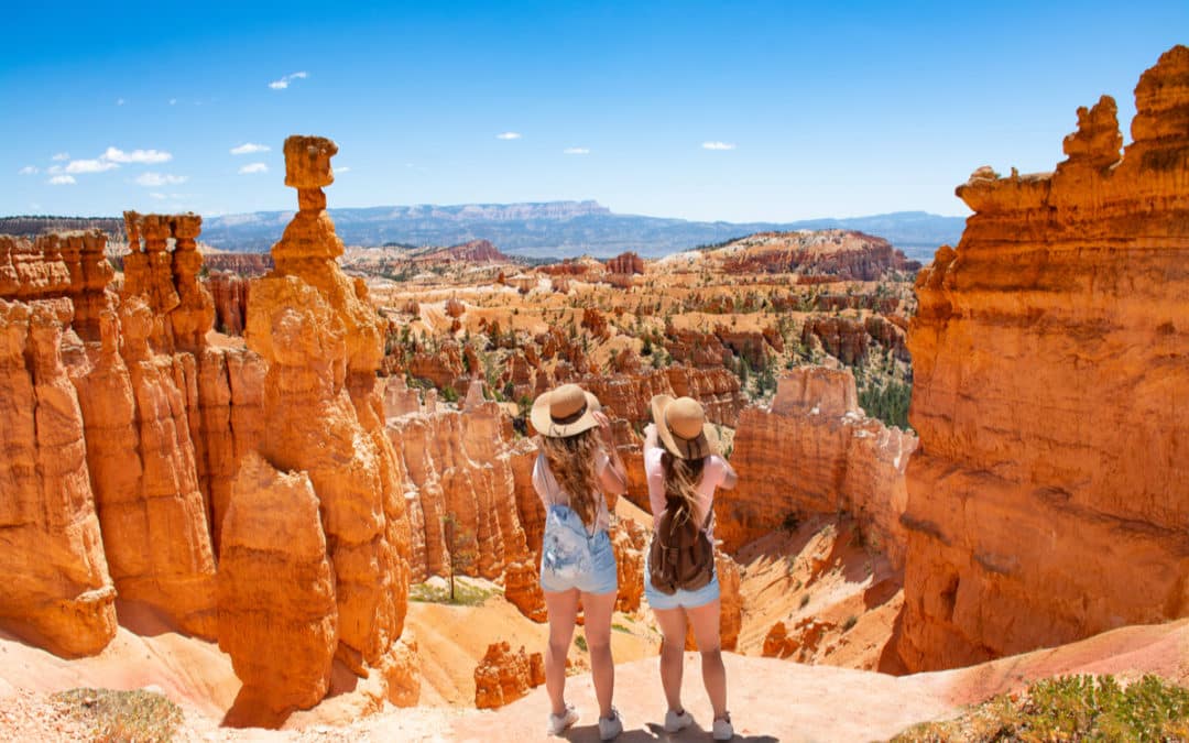
Planning the ultimate girls’ trip can be a daunting task. Trying to find something for your group of friends to do together that hasn’t already been done may seem nearly impossible. We’ve all had plenty of the run-of-the-mill girls’ nights out with dinner and drinks, and shopping till we drop isn’t always everyone’s cup of tea.
What we need more than anything is time to re-connect with our friends. We want to laugh, engage, connect, and make new memories with the friends that are essential parts of our lives. Girls’ trips can be magical, healing, and exciting. All we have to do is choose an excursion that checks the boxes of food, friends, and new experiences to enjoy together.
An Immersive Experience To Remember
When considering ideas for a girls’ trip, keep in mind that adventure promotes memorable experiences. Immersive excursions that create the backdrop for you to engage with each other on a deeper level can offer your group the ultimate bonding experience.
Imagine you and your friends set out on a luxury, guided, chef-driven outdoor experience among the canyons of the wild west. These professionally guided immersive excursions are designed to envelop you in wonders and sights of nature while elevating your experience with five-star cuisine.
Bonding Beyond Brunch
You and your friends will embark on an inspired hike into world-renowned canyons, creating moments of bonding that extend well beyond what any brunch could provide. Surrounded by the brilliant colors of the landscape and stopping to take in the awe-inspiring views from within the canyons, your girls’ trip will be like none you’ve had together.
Not only can you choose your level of exertion, but you’ll be feted with the culinary delights of professional chefs who create personalized cuisine to soothe your soul. No worries about making dinner reservations, who brings the snacks, and what paths to take, your luxury guided canyon tour takes care of everything. At the same time, you simply enjoy an extraordinary time glamping with your friends.
Nature And Nurture Work Magic On Your Girls’ Trip
While we may be tempted to plan a girls’ trip around neon lights and avenues dotted with boutiques, stepping out of the norm and into the unknown is an extraordinary adventure. When you take a chef-inspired luxury canyon trip, you and your crew will embark on a wild and delicious journey together filled with unforgettable moments.
The best of both worlds, nature, and nurture, will work magic on your girls’ trip, giving you every opportunity to bond with those you love. When it’s your turn to plan your group’s next trip together, go wild in the lap of luxury.
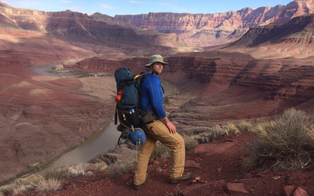
by The Goat | Mar 26, 2020 | Backpacking, Grand Canyon, Hiking, National Parks, Rim-to-Rim Grand Canyon
What are the Best Backpacking Trips in Grand Canyon?
Grand Canyon National Park can be a nearly overwhelming place. What do I do? Where should I go? Even for seasoned backpackers, the choices can be endless and exhausting. The Goat has compiled a list especially for you, outlining backpacking trips in Grand Canyon for all skill and experience levels. Enjoy!
5. The Hermit Loop
Time: 3 days, 2 nights
Distance: 18 miles
Difficulty: Undergraduate+ (Check out our difficulty ratings)
The Hermit Loop is a truly classic Grand Canyon backpacking trip that can be easily accomplished over a long weekend. It is a great hike for those who are looking to take their first backpacking foray into the big ditch, and truly hits all the highlights. Sweeping vistas, interesting side trips, and excellent canyon history await on a trail forged originally by the “hermit of the Grand Canyon”, Mr. Louis Boucher. The route was later improved by the Santa Fe Railroad Line in an attempt to bring mining, then tourism, into the area.
4. Tuckup Canyon via the Stairway to Heaven
Time: 7 days, 6 nights
Distance: 45 miles
Difficulty: PhD+ (check our difficulty ratings)
Get your defibrillator, this one is not for the faint of heart. Located in one of the most remote parts of Grand Canyon, this long, challenging loop is meant for experienced cannoneers only. This route takes ambitious hikers down Tuckup Canyon, past Shaman’s Gallery (recognized as one of the most spectacular rock art etchings in the American Southwest), through a traverse along the mighty Colorado River, and then up Stairway Canyon. Along the way, there are exciting climbing, route-finding, and scrambling challenges, and . Strap in!
3. Thunder River to Deer Creek
Time: 4 days, 3 nights
Distance: 28 miles
Difficulty: Graduate+ (check our difficulty ratings)
The Thunder River to Deer Creek Loop is perhaps the North Rim’s most fabulous backpacking trip. Multiple water sources, outstanding scenery, and a truly thunderous river. Geologically speaking, Thunder River is one of the most unique features in Grand Canyon. It begins as an underground river (aquifer) up on the Kaibab Plateau. It flows along various fault lines and crustal weaknesses until it breaks loose at the contact of the permeable Esplanade Group (mostly shales) and the impermeable Redwall Limestone, quite literally thundering onto the rocks below.
2. Rim-to-Rim via Phantom Ranch
Time: 3 days, 2 nights
Distance: 19 miles
Difficulty: Graduate (check our difficulty ratings)
This is the true Grand Canyon classic backpacking trip. Starting at the North Rim, your descent begins on the North Kaibab Trail as it winds it way down to the Colorado River. Along the way hikers are treated to unspoiled views, soaring eagles, and a well-developed trail. Thru-hikers may camp at Bright Angel Campground, or stay in the lodge at the famed Phantom Ranch. From here hikers may choose to ascend either the South Kaibab Trail (shorter, steeper) or the Bright Angel Trail (more miles) and stay the second night on the Esplanade. After cresting on the South Rim, be sure to gaze upon your North Rim starting point. This is one of the most popular trips in Grand Canyon, so be sure to make your reservations early!
1. The Escalante Route
Time: 5 days, 4 nights
Distance: 35 miles
Difficulty: PhD (check our difficulty ratings)
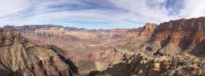
Carved by early Puebloan explorers of Grand Canyon, this long traverse of Grand Canyon from the Tanner Trail to Horseshoe Mesa and Grandview is perhaps one of the finest backpacking trips on the planet. There is a little bit of everything Grand Canyon here, as hikers will encounter outrageous views of the Great Unconformity, sandy beaches, a class 3 scramble over the famous Papago Wall, and a spectacular slot canyon carved from billion-year-old Shinumo Quartzite. This route confronts with hikers with the unimaginable scale of Grand Canyon, as it will seem as though you are climbing mountains in a canyon. Grand!
Going Guided
Hiking and exploring The Wave, or any of our public lands, is a special experience. Although it is possible to see these places yourself, hiring a guiding outfitter is a great idea. For instance, guiding services provide logistical support, and plan everything for your best possible trip. They provide a great safety net on the trail, and are trained in backcountry medicine. Above all, they provide a depth of knowledge of the region that turns a walk into a true adventure.
Canyons and Chefs provides all of the support you need, and pairs that with professional chefs and expert geologist/guides. Our meals use fresh ingredients and are inspired by local farms, culture, and cuisine. We utilize a mobile professional kitchen as a backbone for cooking over the fire. Furthermore, we provide top-of-the-line gear and passion for the places we explore. In conclusion, you can these wild places, but going with a guide can create an even more memorable experience. Don’t be shy, and call us!
Read our blog!
For adventure Chef-Driven Outdoor Experiences, see our epic tours in Grand Canyon, Utah, and Arizona!
Follow us on Facebook and Instagram
Explore Further, Be Wild, Eat Like Kings —
Canyons and Chefs
by The Goat | Aug 27, 2019 | Backpacking, Grand Canyon, Hiking, History
How long Does it Take to Walk Down the Grand Canyon
Like many of the questions about Grand Canyon, this one has several different and nuanced answers. Will you travel by foot, mule, or helicopter? How much gear might you be carrying? Are you a fit hiker, or is this your first time? Are you approaching from North Rim or South Rim? The Goat is here to break down all of these options!
Hiking
Let’s begin with the most popular, and easily the most rewarding style of travel in Grand Canyon; a good old-fashioned, one foot in front of the other journey into the depths of time and space.
Some Advice before you Begin
First and foremost, the National Park Service (and The Goat) advises that nobody, under any circumstances, should attempt the hike from rim-to-river and back in one day. Attempting to hike rim-to-river and back in a day has resulted in many deaths over the years, along with countless cases of heat exhaustion, heat stroke, and severe dehydration among other delightful afflictions. Before we get into the fun, fabulous parts of hiking in Grand Canyon, we must first be clear about this practice.
Inverted Mountains Are Sneaky
Grand Canyon Hikers must remember one mantra; going down is optional, coming up is mandatory. The NPS must execute hundreds of rescues each year on hikers that run into trouble. Grand Canyon is a hostile, dry, and unforgiving place that yields no mercy. Summertime temperatures can reach well over 100 degrees, there is little water on any trails, and even less shade.
Hiking in Grand Canyon is often referred to as “hiking a mountain in reverse”. That is, your descent comes first, while your ascent is how you must finish. This can fool hikers easily, as walking down is an easy, breezy, view-saturated adventure that can quickly get out of hand. Many hikers that find trouble simply started walking down the trail, suddenly realizing that they are five miles down having barely broken a sweat.
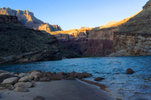
Water
Perhaps the most potentially dangerous thing about undertaking any hike in Grand Canyon is the particular lack of water. Many hikes the world over cross numerous streams, have shade, and/or easy access to clean, potable water. This is not the case in Grand Canyon, as water sources are extremely limited. Two South Rim hikes (Tanner, South Kaibab) have no accessible water source of any kind until the Colorado River.
Other South Rim trails (Hermit, Bright Angel) have access to water along the trail, but not for at least 3.5 miles. Always carry plenty of water when hiking in Grand Canyon. The Goat recommends a minimum of 3L/person, no matter the distance of the hike.
Spatial Perception
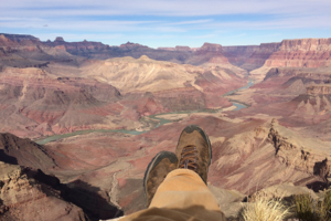
Much like the sneakiness of the inverted mountain, things in Grand Canyon tend to appear much closer than they actually are. At times it feels as though you could literally reach out and touch the Colorado River, or even just a portion of trail beneath you. Go to Desert Watchtower on the East Rim. From the Tanner Trail, you are presented with an astonishing view of the mighty Colorado, a unique rim view in Grand Canyon. Though the river is over 9 miles away by trail, an optical illusion is presented that makes the river feel close.
This is a difficult lesson for many hikers in Grand Canyon. Our destination is just right over there! It looks so close! Believe us, it is not. Between the necessarily winding trail, the relentless sun, the lack of water, and the absence of shade, something that optically appears close becomes seemingly further away in reality. Remember that the scale presented to your senses in Grand Canyon is typically unlike anything you’ve ever experience. Those of us that have spent years in this wondrous landscape are still blown away by its size and space. In Grand Canyon, perception is often NOT reality.
Let’s Start Hiking!
At last, we can actually talk about hiking! Hiking in Grand Canyon is a magical, perhaps even spiritual experience. The colors, sights, sounds, smells, and ever-changing conditions create an intensely dramatic and memorable experience on even short hikes. As you hike though 2 billion years of Earth’s history, the Canyon reveals itself step-by-step, both physically and philosophically. In terms of trails and the time it takes to reach the bottom, here are your options:
South Rim
The South Rim presents most of the park’s developed trails, has the “shortest” routes to the river at the bottom, and is by a wide margin the more popular of the two rims. There are 4 developed trails from the South Rim, and 1 trail that is undeveloped and unmaintained.
Bright Angel
The Bright Angel Trail is the most popular trail in Grand Canyon. It traces the path of the Bright Angel Fault, through Indian Gardens, across the Tonto bench, and down to the river in 9.6 miles. This highly trafficked corridor trail teems with other hikers and rangers aplenty, great for beginners introducing themselves to Grand Canyon hiking. Hikers can reach the river and Bright Angel Campground in between 4-5 hours.
South Kaibab
The South Kaibab Trail is the steeper counterpart of the Bright Angel Trail, and plunges to the river in an abrupt 6.4 miles. Holding the distinction as the only trail in the park developed completely by the NPS, it is a more direct route to the river for those looking for speed. Connecting South Kaibab to Bright Angel via the Tonto Trail is a classic backpacking trip that many first-timers find welcoming. Hiking to the river along the South Kaibab Trail typically takes between 3-4 hours.
Hermit Trail
The Hermit Trail follows a route forged by Canyon pioneer Louis Boucher, also known as “the Hermit of Grand Canyon”. Mr. Boucher led a reclusive life at the bottom of the Canyon for roughly 20 years, guiding tourists, mining, and homesteading. His pioneer route was improved by the Santa Fe Railroad company in the early 1900s, and today presents an excellent alternative to the more crowded corridor trails. The Hermit Trail descends 8.9 miles to the river, and will take the average hiker between 4-5 hours to reach the bottom.
Tanner Trail
The Tanner Trail is perhaps the most exciting and more challenging of developed routes from the South Rim. The trail presents sweeping views across eastern Grand Canyon, with views of Marble Canyon and the Vermillion Cliffs to the north. The Grand Canyon Supergroup, a suite of tilted, faulted, 1 billion year-old sedimentary rocks that symbolize the Great Unconformity are revealed in splendor here, a perspective unique to this part of the canyon. The Tanner trail is 9.3 miles long, and hikers may reach the river in 4-5 hours.
South Bass
The South Bass trail, set roughly 25 miles west of the South Rim Visitor’s Center, is easily the most rugged trail from the South Rim. Reached by a 4WD trail, the drive here takes roughly 2.5 hours. The trail itself was carved by William Wallace Bass, and early pioneer and promoter of tourism in Grand Canyon. South Rim solitude is found in droves here, wildlife abundant, and views outstanding. The trail is 12.2 miles long, and will take the average hiker 5-7 hours to reach the river.
North Rim
The less popular, more contemplative North Rim presents Grand Canyon hikers with opportunities for more challenges, more solitude, and a decidedly different perspective of Grand Canyon. Set at over 8,500 feet above sea level, North Rim is a forested wonderland of rolling meadows, wildflower, and perhaps even a glimpse of one of the iconic symbols of the west, the American Bison. Access requires longer drive times, and trails here retain a fairly rugged character. Like the South Rim, do not even dream of attempting a rim-to-river-to-rim hike in one day. North Rim trails are long, can be challenging, and are generally reserved for more-experienced Grand Canyon hikers.
Much of the Colorado River system that has carved Grand Canyon emanates from the north. Consequently, in contrast to South Rim, North Rim is “set back” from the river, following long, meandering routes coursed by ancient tributaries. South Rim’s dramatic and abrupt cliff faces and 4000-foot plunges are a product of the lack of water flowing into the river from the south, while North Rim landscapes are dominated by softer relief.
North Kaibab
Counterpart to the South Kaibab Trail, North Kaibab is North Rim’s most accessible and least rugged trail. It is the only North Rim trail maintained by the NPS. The trail is follows a 28 miles route to the river, and most hikers will find that it takes 2-3 days to reach the river. Keep in mind that this is the least-challenging trail on North Rim.
Nankoweap Route
Notice the use of the word “route”, as opposed to the use of the word “trail” in the name. This is for a reason, as Nankoweap is really not a trail in the traditional sense. It is lightly trafficked, unmaintained, and follows an ambitiously-descending ridge along the East Kaibab Monocline. Hikers descend 14.8 miles along the trail, and average hikers may reach the river in 1-2 days. Get ready. Get set. Go!
North Bass
The North Bass Trail is, of course, the North Rim counterpart to South Rim’s Bass Trail. William Wallace Bass, pioneer of Grand Canyon, carved this route as part of his efforts to promote tourism in Grand Canyon. The trail follows faults, rock falls, and sublime canyon scenery 14.5 miles to the river. Hikers may reach the river in 1-2 days. This is perhaps the quintessential trail in Grand Canyon, as it contains just about everything hiking here has to offer. Try an exciting Rim-to-Rim backpacking tour on the Bass Trail, complete with a pack rafting adventure!
Seeing Grand Canyon on Muleback
The National Park Service maintains a mule farm on both North and South Rims. Visitors to Grand Canyon may elect to have their gear carried to their campsite by pack mule, a decidedly easier alternative to carrying your own gear. Please consider your choice carefully when selecting a mule outfitter.
Several private companies have been fined and banned from Grand Canyon for animal abuse and cruelty. Check the Park Service’s website for more information about mule rides in Grand Canyon. Contact us to learn more about mule-assisted backpacking tours.
Imbibing in a mule-assisted trip to the river certainly takes a load off, however it does not save time. Hikers must still make their way on foot, or on the back of a mule whose goal is not speed. Mule trips down to the river typically take between 4-5 hours.
See Grand Canyon by Helicopter
One of the fairly new enterprises in Grand Canyon is the proliferation of helicopter tours. They are popular particularly in western Grand Canyon, where helicopters buzz through the air almost constantly. The Goat’s opinion is this — get your butt off your couch and onto your feet. Need more information? Please look elsewhere :). Helicopters create several problems in Grand Canyon. Helicopters create pollution, both noise and exhaust. They destroy any perceived wilderness experience. They damage wildlife patterns, and best of all (sarcasm) they crash! In the past 7 years, there have been 3 helicopter crashes that resulted in fatalities. The most recent of these was near Peach Springs in 2017, when 5 passengers and the pilot died. One woman was rescued, and is scarred for life both physically and mentally. Take my advice — don’t contribute to the proliferation of industrial tourism in Grand Canyon.
Fitness
Surely you’ve heard this numerous times, but please be in reasonable physical condition. Undertaking any hiking in Grand Canyon is a decidedly physical challenge, and it will increase your enjoyment as well as decrease your chances of trouble if you are in shape. For more information, see our blog post regarding training for hiking in Grand Canyon.
Guided Grand Canyon Hiking Tours
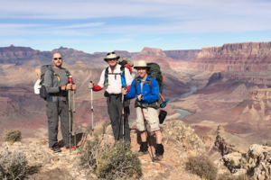
Perhaps the very best way to see and experience Grand Canyon is by hiring a professional guide service. Hiking with people who know the Grand Canyon intimately vastly improves your experience and understanding of this unreal place, and not having to deal with logistics, food, gear, and all that madness only enhances the trip.
Blue Marble Adventure GeoTourism provides everything need; geologist/guides with actual geology degrees and professional certifications, backcountry meals inspired by professional chefs, top-of-the-line gear, and outstanding customer service.
The Goat’s Final Word
There you have it, folks. You asked how long does it take walk down the Grand Canyon, and we have outlined virtually every possible eventuality! Whether by foot (awesome), by mule (still awesome), helicopter (not cool), from North or South Rim, by land or bey sea, you now have some idea of how long it takes. Happy Hiking!
Follow us on Facebook and Instagram
Contact Us for information about traveling through geologic time
by The Goat | Aug 27, 2019 | Backpacking, Grand Canyon, Hiking
How Hot Does it Get in the Grand Canyon?
With the summer months officially upon us, it has come time to discuss one of the most-asked questions this time of year: how hot does it actually get in Grand Canyon? The answer is one word, three letters: H-O-T. The Inner Gorge regularly sees temperatures hovering over 110 degrees, and the Phantom Ranch Ranger Station, a popular destination any time of the year, has recorded temperatures as high as 116 degrees. Grand Canyon is one hot spot in the summertime, my friends.
Why is it so hot?
Several reasons contribute to temperatures in the depths of Grand Canyon. They may seem fairly obvious, but our bet is that some may be surprising. Many of our guests are not accustomed to traveling in the American Southwest, and are sometimes surprised at the heat. The temperatures may be doubly surprising given that elevations at either rim are well over 7000 feet above sea level. Let’s examine the culprits.
Climate
First of all, and most simply, it’s a desert. Grand Canyon sits on the Colorado Plateau, a saucer-shaped uplift in the Earth’s crust. The Plateau is sandwiched between two mighty mountain ranges, the Rockies and Sierras, both of which impound much of the moisture in the region. The Colorado Desert, as it is known to ecologists, lies adjacent to the Sonoran Desert of Arizona and Mojave Desert of California.
Though not as arid as its cousins to the south, the Colorado Desert is a desert nonetheless. Average annual precipitation across the Plateau is just 10″ in the lowest, hottest spots, The region is studded with laccoltith (granitic dome) mountains that receive snow, but the lowlands are hot and dry places, indeed.
The Rocks
Given its desert nature, much of the Colorado Plateau is a wilderness of naked rock. Vegetation in the lower elevations is sparse, lending very little shade. The bare rocks “breathe” heat, inhaling the solar radiation, then exhaling back out into the atmosphere. The darker and more dense the rock, the more inhaling and exhaling take place.
The rocks of Grand Canyon’s Inner Gorge, known as the Vishnu Metamorphic Complex, are prime candidates for this breathing action. Their color (very dark, essentially black in most places) and density (metamorphic rocks are extremely dense) make them enormously susceptible to heat absorption. Given their location in the depths of Grand Canyon, it is no wonder why the inner canyon can feel like a blast furnace in the hottest months.
Even the lighter-colored, less dense sedimentary rocks found in Grand Canyon such as sandstone, shale, and limestone, are very inefficient cooling centers. No matter where they are in the canyon, the rocks cannot escape the sun, and hikers in Grand Canyon cannot escape the rocks (yay!).
In essence, Grand Canyon behaves like a giant, incredibly scenic parking lot. The same action that occurs in the vast expanses of concrete jungles known as cities, also occurs here in Grand Canyon and across the naked rock wilderness of the Colorado Plateau.
Elevation Changes
Grand Canyon is a massive, inverted mountain. The summit of this mountain, the Colorado River, lies at roughly 2000 feet elevation. The base, respectively North and South Rims, are at impressive elevations of 7500 and 8500 feet. As you may imagine, this creates significant differences in temperature. The rule of thumb climbing mountains in in the upward direction is 5 degrees for every thousand feet. This same rule of thumb applies to inverted mountains.
A nice summer day on the North Rim might be 80 degrees. This same day temperatures on the South Rim may be a warm, but still relatively comfortable 85+ degrees Six thousand feet below at Phantom Ranch it will be a balmy 110 degrees. Temperatures in the sun may exceed 130 degrees.
The forested rims, particularly the lush North Rim, are in climate zones more similar to places like Yellowstone, Yosemite, and Rocky Mountain National Park. In contrast, the Inner Gorge lies in a climate zone similar to that of Saguaro and Joshua Tree National Parks which are located in the Sonoran and Mojave Deserts, respectively.
Is there any way to beat the heat?
Staying in the cool pine forests near the Grand Canyon’s North and South Rims is the best bet to beat the heat in the summer. South Rim regularly sees temperatures in the 90s, but shade is easy to find. Cool breezes often blow through the stands of ponderosa pine, making a picnic overlooking the canyon very pleasant.
The North Rim is cooler, typically seeing high temperatures in the low-to-mid 80’s. Stands of aspen forest tremble in the breeze, and at 8500 feet nights get quite cool. A trip to North Rim is a great way to spend a summer day. Summertime stars at either rim are a sight to behold.
But I still want to hike….
Hiking in Grand Canyon in the summertime, as you may gather, can be a interesting proposition. The Goat’s advice is to get out early. Starting a hike before dawn is a summer rite-of-passage in Grand Canyon. Avoid hiking during the hottest times of the day (10AM-4PM). If you are out on the trail during those times, it is a good idea to seek shade where available. Drink plenty of water (3-4L/person), and eat salty snacks that help your body to retain moisture. Nuts, Jerky, and cheese make a fantastic meal on the trail, but avoid food high in sugar.
Is it a good idea (or even fun) to go backpacking in the summer?
If you are planning a backpacking trip below the rim during the summer, know what you are in for and prepare for it. Following the general hiking guidelines outlined earlier is a great start. Plan your trip so that you will be near water, if possible. Many hikes from the North Rim have water along the trail, and the Colorado River makes a wonderful and very welcome swimming hole.
Packing correctly is quite helpful as well. A wide-brimmed hat is key, along with sunglasses and clothing material that wicks moisture. Synthetic garments work well, and avoid wearing anything that absorbs moisture such as denim or cotton.
What is the best time of year to hike in Grand Canyon?
If you can swing it, Grand Canyon hiking is best enjoyed during the cooler months. October to April are the best times, with November to March being particularly spectacular. Although it may be chilly on the rim, hiking in the canyon during these months presents daytime temperatures in the 50s and 60s, absolutely perfect for hiking.
Be advised that North Rim is open from May 15 – October 15. In the off-season there are no services available, and access is quite limited. In order to access North Rim during the winter, hikers must approach the rim on foot, in snowshoes, or on cross country skies.
Despite summer being warmer, there is no such thing as a bad time to visit Grand Canyon. Simply hiking along the rim to take in the astounding views is a great summertime activity, but hiking below the rim can be highly enjoyable too. Following our hiking guidelines will ensure that your backpacking trip or day hike is a safe and fun experience that yields stories and memories to last a lifetime.
Going Guided
Exploring Grand Canyon with a guide service is hands-down the best way to enjoy the canyon. This is true any time of the year, but is especially true when the temperature starts to rise. Blue Marble Adventure GeoTourism’s guides are certified in CPR and backcountry medicine in addition to being degreed geologists. This depth of medical knowledge is the key to keeping our guests safe on the trail, particularly when the conditions are not ideal. Hit us up for more information, or to join an epic backpacking or basecamp hiking tour.
Hiring an outfitter has several benefits. Namely, we worry about all the other stuff while you enjoy your adventure! Food, navigation, top-of-the-line gear, and deep knowledge of the landscape is the coup de gras.
The Goat’s Final Word
Grand Canyon presents the intrepid adventurer extraordinary experiences with unique challenges. Even without the heat, hiking in Grand Canyon can be demanding and requires preparation paired with realistic goals. Summer heat is certainly among the challenges one will find here, but it can be managed fairly easily by hiking smart.
In fact, the heat offers hikers the opportunity to really slow down and enjoy the vistas unraveling before their eyes. Hiking by moonlight is an extraordinary experience that not only beats the heat, but presents an altogether different perspective on this wondrous place. Trust me, wandering through a moonlight-bathed gorge while a Great Horned Owl hoots from the cliffs above is a sublime experience.
Slow down, find some shade, drink some water, and chill. Post up under a sprawling cottonwood tree. Have a well-deserved splash in the river or under a waterfall. Take cues from Grand Canyon wildlife. Do you see them going hard in the heat? No? Then you shouldn’t either. Above all, don’t force anything. If you feel hot, slow down. Don’t be afraid to take care of yourself, your body will thank you.
Contact us for information about Grand Canyon hiking, or step into a geologic time machine on one of our epic Grand Canyon hiking tours
Follow Blue Marble Guides on Facebook and Instagram
by The Goat | Aug 27, 2019 | Grand Canyon, Permits
How Much Does it Cost to get into Grand Canyon?
What would you pay for a million dollar view into 2 billion years of Earth’s history? While we say this is priceless, there is a price when entering Grand Canyon, and all National Parks here in the USA and around the world. In fact, depending on what you want to do, there may be other fees to explore the park in addition entry fee itself. There are permit fees for overnight hiking, camping and designated use area fees, lodging, and if you’re the gift shop type (who among us can resist?), there can be almost limitless optional fees. Never fear, The Goat is here to break it down for you, whatever adventure you may crave in Grand Canyon National Park.
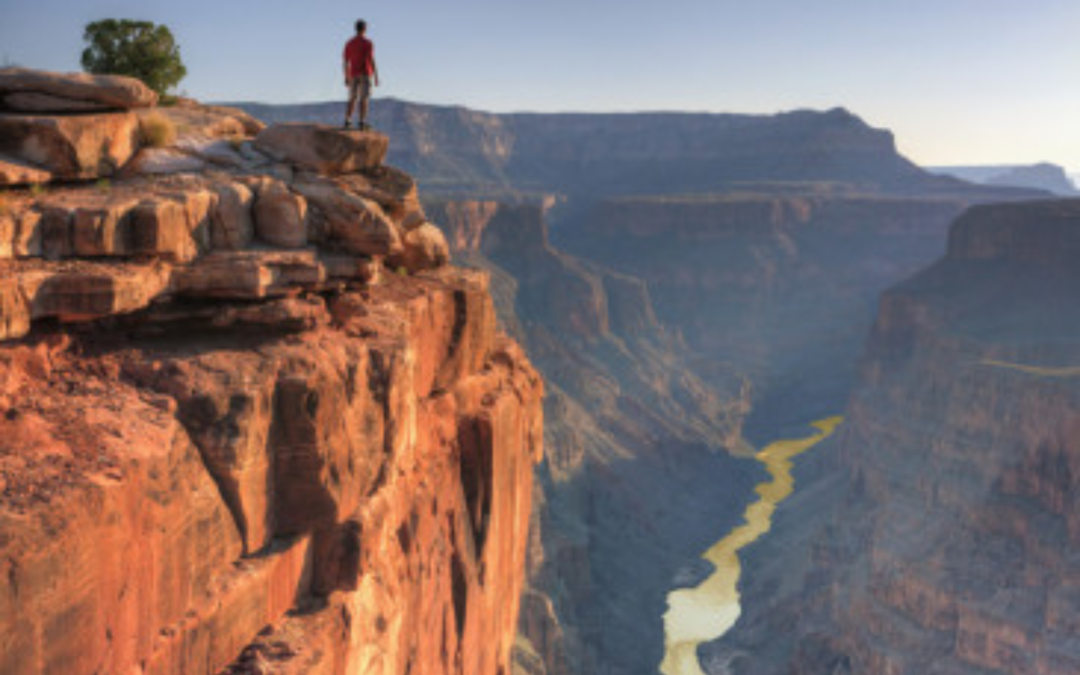
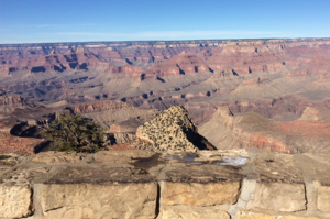
Looking out across the Tanner Trail in Grand Canyon
Simple Entry:
This is the most straightforward, and it is paid upon entry to Grand Canyon. Instead of individual fees, the fee is per vehicle for passenger cars. Fees vary depending upon the type of vehicle you drive, and your vehicle can include up to the legal number of people that can fit in your vehicle.
Grand Canyon National Park Vehicle Permit- $35.00 (U.S. Dollars)
Admits one single, private, non-commercial vehicle and all its passengers. Organized groups are not eligible for the vehicle permit.
Grand Canyon National Park Motorcycle Permit- $25.00 (U.S. Dollars)
Admits one single, private, non-commercial motorcycle and its passenger(s).
Grand Canyon National Park Individual Permit – $15.00/person (U.S. Dollars)
Admits one individual when entering by foot, bicycle, park shuttle bus, Grand Canyon Railway and private rafting trip. Individuals 15 years old and younger are admitted free of charge.
Backcountry Permits:
These fees are charged for any kind of overnight expedition below the rim. This includes backpacking, rafting, or any kind of activity that requires an overnight stay below either North or South Rim in Grand Canyon National Park.
Backcountry overnight permits are $10 per permit plus $8 per person or stock animal per night camped below the rim and $8 per group per night camped above the rim.
*Be advised that backcountry permits can be hard to come by in busy season, and really all times of year, especially for corridor trails such as Bright Angel and South Kaibab into Phantom Ranch. Make your reservations as early as possible, or call us for more information on a guided tour
Camping:
Camping in the developed campgrounds of Grand Canyon National Park provides easy access to the canyon during sunrise and sunset, two times that any photo enthusiast will want to observe. Be sure to make reservations well (months) in advance, as spots book very quickly. Do not expect to roll into the park, regardless of the time of year, and get a campsite without a reservation. The North Rim Campground is open from May 15 to October 31, and camping can be had at-large and for free in the Coconino National Forest (South Rim) and Kaibab National Forest (North Rim) if you get shut out of the park.
South Rim Campgrounds:
Mather Campground: $22/night, reservations required
Desert View Campground: $22/night, first come-first served
North Rim Campgrounds:
North Rim Campground: $22/night, reservations required
Contact Grand Canyon National Park
Sunrise on the Colorado River, Grand Canyon National Park
Annual Passes
Annual passes to Grand Canyon are the way to go if you plan to be here more than a couple of times in a year. There are several passes to choose from, and some are awarded free to those who qualify such as military and senior citizens.
National Parks Annual Pass
This pass allows for unlimited access to every National Park and National Monument in the National Park system. It does not cover other fees such as camping, nor does it grant access to State Parks. This is easily the best value for people that want to explore several (more than 3) National Parks within the year. The pass grants one year of access from the date it was purchased, and costs $80.
Military Pass
This pass is available to currently-serving members of any military branch. Simply present your military ID at any federal recreation site, and you will be granted free entrance. You may also get a hard copy of the pass itself. Thank you for your service!
Senior Pass
The Senior Pass is available to any US citizen over the age of 62. You must present proof of age and residency. This is typically as simple as showing a current drivers license. If you do not have a driver’s license, here is a list of acceptable documentation. The cost for this pass is $80 lifetime, or $20 annually.
4th-Grade Pass
This program began just a few years ago, and is a really great initiative by the NPS. Any child in 4th grade may be granted a free pass during their entire 4th-grade school year (September-August). This is a great way to get kids excited about America’s Best Idea, the National Parks! Visit the Every Kid Outdoors website for more information about this pass.
Access Pass
The Access Pass is available FREE to any US citizen or permanent resident with permanent disabilities. Applicants must provide documentation on their residency and medical conditions to qualify. Read this article for more information about the Access Pass.
Volunteer Pass
250 hours of volunteer service will earn you a free lifetime pass to the National Parks. Find out more about how to volunteer here.
Going Guided
Exploring and hiking in Grand Canyon is more than worth the cost of admission. Simply seeing the canyon up close is an experience that most cherish for their entire lives. Hiring a guide outfitter service dramatically enhances your experience in these glorious wild lands. Outfitters handle logistics that could otherwise bog down a trip, provide safety and security in the wild, and have a depth of knowledge about the region that truly brings it to life.
Blue Marble Adventure GeoTourism takes it to the next level, offering a glimpse into deep time with our geologist/guides. Tours function as time machines, whisking guests back in time through the lens of the dramatic rocks.
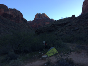
Happy guests on a Blue Marble Grand Canyon backpacking tour
The Goat’s Final Word
Grand Canyon is a stupendous hole in the ground. In this hole you can find wonder, awe, spirit, and soul. Come here; the cost matters not. However, if general information is required that is certainly sensible. The cost of entry to Grand Canyon is $35/week for passenger vehicles, which is how most enter the park.
There are different fees for different activities within Grand Canyon, such as overnight use and camping. There is a myriad of annual passes available as well that can provide tremendous value for those that wish to visit multiple times a year, or to visit different parks besides Grand Canyon. See you on the trail!
Read our blog, The Call of the Goat.
To experience the southwest in a geologic time machine check out our tours in Grand Canyon, Utah, and Arizona.
Follow us on Facebook and Instagram.
Explore Further, Be Wild, See Through Time — Blue Marble Adventure GeoTourism
by The Goat | Aug 27, 2019 | Grand Canyon, Hiking
Why did Grand Canyon become a National Park?
The answer to this question seems obvious. Simply put, it is the Grandest Canyon on the planet. Scenery aside, Grand Canyon is a treasure trove of resources that scream for preservation. To truly answer the question though, we must delve into why any National Park exists. It’s not just the scenery that makes Grand Canyon famous, but the pioneers that preserved it. The story of Grand Canyon’s journey to National Park status is as deep and wide as the canyon itself. Henceforth, come as The Goat tells the tale of the how the National Parks, and Grand Canyon itself, came to be.
Why are there ANY National Parks?
A National Park is an area that has been set aside for preservation and public use by an act of the President or Congress. Most importantly, it is closed to industry and private development. However, the story of the National Parks begins, as many stories in the development of the Western United States. Pioneers, prospectors, and the railroad were the driving force.
The purchase of land by the US Government in the early 1800’s opened the land. In these wide-open spaces, places were discovered unlike any on Earth. Soaring mountains, deep canyons, active volcanoes, and extraordinary landscapes were the norm. The discovery of gold in California sparked a massive westward expansion in 1849, and flooded the wild lands with pioneers and opportunists. Many of those that didn’t strike it rich realized the potential for preservation of these beautiful places.
Political Movement and Conservation
In the 1870’s, a political movement known as “democratic liberalism” had washed over the nation. Americans were concerned with the perceived ravages of unchecked capitalism, and Congress responded. The Congress enacted the Forest Service Act, one of many new laws passed aimed at social reform. The new law allowed the Federal Government to set aside areas like Yellowstone, Yosemite, and Sequoia National Forest for protection.
Yellowstone became the first National Park in 1872, and the party had just begun. Using the Forest Service Act, the Yellowstone National Park Act was cemented into law in March of that year, and kicked off a generation of conservation that created many of our most famous National Parks.
The First National Parks
Yellowstone was, of course, the first National Park created in 1872. However, many other parks came before Grand Canyon. Sequoia was set aside for protection in 1890, along with Yosemite. Grand Canyon National Park was created in 1919, but by then, Rocky Mountain, Crater Lake, and Hawaii Volcanoes among others had already been established.
The Antiquities Act
In 1906, Congress created the Antiquities Act. The act gave the President power to establish National Monuments, by using land already owned by the Federal Government. It paved the way for the creation of the National Park Service in 1916, and the NPS now manages 61 National Parks, and many more National Monuments.
Grand Canyon Becomes a National Park
The cultural history of Grand Canyon dates back several millennia, but the first Europeans to arrive in the Grand Canyon region came after the Mexican-American War of the 1840’s. Trade and transportation routes opened up in the American Southwest and began to approach the North and South Rims of Grand Canyon.
The story of Grand Canyon becoming a National Park begins, as many stories in the settlement and development of the Western United States, with pioneers, prospectors, and the railroad. Grand Canyon was an unknown wilderness for the first five million years of its existence, but that was about to change.
Early Pioneers and Exploration
Early Pioneers in the area included Bill Bass and Ralph Cameron. Louis Boucher, better known as “The Hermit”, built a wonderful trail into the canyon’s depths. John Wesley Powell, “The Father of the American Southwest”, was the first to navigate the Colorado River from Lee’s Ferry to Pearce Ferry in 1869. His book, The Exploration of the Colorado River and its Canyons, documents the journey.
Powell’s voyage was important in mapping Grand Canyon. It was was the key to unlocking the unknown. There was little known about the inner canyon before. Powell took 11 men on the expedition, and 8 finished the journey. One man became ill, and another injured himself. Two men gave up, and climbed out of the canyon near Toroweap. They were never seen again, and it is unknown what happened to them.
Powell was the head of the US Geological Survey at the time. His expedition opened the canyon for more intensive geologic research, and scientists from around the world came to study the canyon. The rocks in Grand Canyon hold many secrets. Two billion years of Earth’s history is contained in its walls. Above all, Grand Canyon is a window into time.
Mining and The Railroad Come to Grand Canyon
The Union and Pacific Railroad arrived in the 1870’s, and along with the Santa Fe Railroad began to provide transportation to and from Grand Canyon for tourism and industry. Several mining claims were established in the canyon, most notably the Last Chance mine below Horseshoe Mesa. Last Chance was one of the only mines that was profitable. The profits, however, were short-lived.
Most prospectors in Grand Canyon quickly realized that they could make far more money with tourism, and improved routes down into the canyon. Mules and horses carried tourists and their trappings down into the canyon, where a camp awaited. After that, tourism grew quickly, and soon the railroad companies became interested.
The first train to arrive at Grand Canyon’s South Rim pulled up in 1901. El Tovar Hotel was completed in 1904, and was immediately heralded as the finest accommodation in the west. The railroad stop literally paved the way for the development and growth of the burgeoning park, and people flocked to take in the views.
Grand Canyon Becomes Protected Land
First, Grand Canyon was protected under the Forest Act in 1882, to the chagrin of many would-be industrialists. Then, President Theodore Roosevelt used the Antiquities Act to establish Grand Canyon National Monument in 1908. The newly created power protected the canyon from any and all private claims. Finally, Senator Henry Ashurst of Arizona introduced the bill that officially made the Grand Canyon a National Park in 1919. It is now one of the most popular places on Earth.
Grand Canyon has seen tens of millions of visitors since its designation. In 2018, visitation hit an all-time high at over 6.4 million, and it is the 8th-most visited Park in the system. National Parks such as Golden Gate Bridge and the Lincoln Memorial are also designated National Parks, and places such as these the most total visitation. After that, Grand Canyon sits behind only Great Smoky Mountains in terms of the natural National Parks.
Going Guided
Hiking and exploring Grand Canyon, or any of the National Parks, is a special experience. Although it is possible to see these places yourself, hiring a guide is a great idea. For instance, guiding services provide logistical support, and plan everything for your best possible trip. They provide a great safety net on the trail, and are trained in backcountry medicine. Above all, they provide a depth of knowledge of the region that turns a walk into a true adventure.
Blue Marble Adventure GeoTourism provides all of the support you need, and pairs that with expert geologist/guides. Our backcountry meals use fresh ingredients, and are planned by a professional chef. Furthermore, we provide top-of-the-line gear and passion for the places we explore. In conclusion, you can visit National Parks, but going with a guide can create and even more memorable experience. Don’t be shy, and call us!
The Goat’s Final Word
As you can see, the real answer of how Grand Canyon became a National Park is not so obvious. The question why is an obvious answer, but how is the real answer. The scenery and beauty at Grand Canyon are magnificent. In other words, the clear need to preserve this special place is made obvious the moment you approach the rim. However, it took gumption and years of political action that brought us the National Parks. Therefore, visit the National Parks. They are magical places. Marvel in the surroundings, and appreciate how they came to be.
Why did Grand Canyon become a National Park? The answer is simple. How though? Fortitude. Commitment. Perseverance. Dedication to a cause. The actions of a relentless band of rebels. The same actions and fortitude that carved the entire National Park system. In conclusion, action.
Read our blog!
For adventure hiking vacations in a geologic time machine, see our epic tours in Grand Canyon, Utah, and Arizona!
For geological musings read The Goat’s geology blog.
Follow us on Facebook and Instagram
Explore Further, Be Wild, See Through Time — Blue Marble Adventure GeoTourism