by The Goat | Mar 12, 2020 | Geology, History
Here I am, 30km below the Earth’s surface. Patiently waiting, my kayak bobs up and down in a pool of molten magma the size of the state of Maine. I am anticipating the ride of my life, and have been waiting for nearly 600,000 years for the perfect wave. Underneath the place in which we have come to know as Yellowstone National Park, potentially the most pristine and breathtaking place on the face of the planet, lies a boiling pot that at some point in the geologically-near future will need to release its enormous energy. It is that release for which I am waiting, and the ebb and flow of building pressure is maddeningly rhythmic, enough to lull a thrill-seeker to sleep; but I know I must keep my vigilance, for when it comes it will be rapid and without warning. From my vantage point, I am aware of my relative position rising nearer and nearer to the surface, pushing up the land into nearly indiscernible domes on the surface. I rock back and forth in preparation for that moment.
I know that on the surface mud pots have begun to broil and geysers are spouting at a rate that is uncharacteristic, yet entrancing. Animals have scattered to the high grounds, able to perceive the slightest change in the environment. Birds have flown, bears and bison have ascended the hillsides, and the wolves are howling, calling to each other that something is amiss. But the people remain, still unaware of the impending geological cataclysm and distracted by the intense outer beauty. I, however, am keenly aware of the raging torrent inside.
The magma surrounding me is a deep orange, molten at nearly 1200°C and highly silicic (composed of minerals with silicon and oxygen). Above my head I can see the physical boundary between the earth’s mantle, a ductile more flexible layer of molten rock, and the crust, the more brittle outer layer that we call home. In this chamber I find the same peace that I find in the middle of the ocean. Oddly quiet yet deafening, oddly calm yet brimming with energy that I could not begin to comprehend; serenely bobbing up and down with the waves waiting, watching, anticipating that perfect moment that will take me from stoic onlooker to adrenaline-infused surfer. I dip my paddle in again as I feel static electricity envelop the chamber, itself anticipating a release heretofore unseen by the human eye. My moment is here.
Rising quickly, I hear the intense crashing and cracking of rocks as the magma and I ascend through the crust, melting and pulverizing everything in our path. We are moving at a rate faster than a bullet fired from an AK-47, nearly twice the speed of sound. Although we will slow as we breach the surface, the releasing pressure is already throwing rocks into the air at nearly 20300 m/s, enough to send them 5km into the air and land somewhere in the middle of North Dakota. This is one of the rocks I hope to catch, then ride the ash cloud around the Earth in the upper stratosphere. I steel my resolve as the chaos intensifies around me, bracing my boat for our exit. At this point the landscape that was once known as the World’s First National Park is unrecognizable, decimated in a hurricane of fiery explosions and thundering earthquakes.
Watching from afar one may think they are witnessing an atomic bomb explosion, and they would be correct save for the fact that the energy released by this eruption would be on the order of 100,000,000 atomic bombs being detonated at once. Beneath the surface I am having the time of my life bouncing from one magma wave to the other, dodging eddies and avoiding holes, all while keeping my eyes upstream. We will reach the surface soon and I will be shot into the air riding a wave of kinetic energy created by the force of the driving magma rising and filling space once occupied by oxygen and other gases.
I see the light as the pressure blows out a hole in front of me, billowing forth ash and rock as we emerge. I’ve left the magma wave behind, but I’m not out of the proverbial woods yet, so I thrust forth with my paddle and ride the ash wave up nearly 13km into the atmosphere, balancing ever so delicately on the debris cloud. From my perch I watch as I cross states, then countries, then continents in a global tour de force. I’ve had my fun, so I roll my hull, point my nose down waiting to pull my parachute until I emerge from the thick clouds of noxious fumes. I land gently in what was once Flagstaff, Arizona, now buried under 5m of ash and dust, get out of my boat and take off my gas mask. I suppose I won’t be hitching a ride back to the put-in this time.
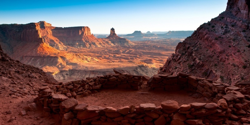
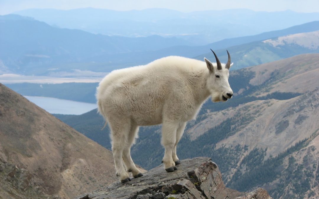
Photo Courtesy of The Goat, Bumpass Hell, Lassen Volcanic NP, CA
May The Goat be with with
by The Goat | Aug 27, 2019 | Backpacking, Grand Canyon, Hiking, History
How long Does it Take to Walk Down the Grand Canyon
Like many of the questions about Grand Canyon, this one has several different and nuanced answers. Will you travel by foot, mule, or helicopter? How much gear might you be carrying? Are you a fit hiker, or is this your first time? Are you approaching from North Rim or South Rim? The Goat is here to break down all of these options!
Hiking
Let’s begin with the most popular, and easily the most rewarding style of travel in Grand Canyon; a good old-fashioned, one foot in front of the other journey into the depths of time and space.
Some Advice before you Begin
First and foremost, the National Park Service (and The Goat) advises that nobody, under any circumstances, should attempt the hike from rim-to-river and back in one day. Attempting to hike rim-to-river and back in a day has resulted in many deaths over the years, along with countless cases of heat exhaustion, heat stroke, and severe dehydration among other delightful afflictions. Before we get into the fun, fabulous parts of hiking in Grand Canyon, we must first be clear about this practice.
Inverted Mountains Are Sneaky
Grand Canyon Hikers must remember one mantra; going down is optional, coming up is mandatory. The NPS must execute hundreds of rescues each year on hikers that run into trouble. Grand Canyon is a hostile, dry, and unforgiving place that yields no mercy. Summertime temperatures can reach well over 100 degrees, there is little water on any trails, and even less shade.
Hiking in Grand Canyon is often referred to as “hiking a mountain in reverse”. That is, your descent comes first, while your ascent is how you must finish. This can fool hikers easily, as walking down is an easy, breezy, view-saturated adventure that can quickly get out of hand. Many hikers that find trouble simply started walking down the trail, suddenly realizing that they are five miles down having barely broken a sweat.
Water
Perhaps the most potentially dangerous thing about undertaking any hike in Grand Canyon is the particular lack of water. Many hikes the world over cross numerous streams, have shade, and/or easy access to clean, potable water. This is not the case in Grand Canyon, as water sources are extremely limited. Two South Rim hikes (Tanner, South Kaibab) have no accessible water source of any kind until the Colorado River.
Other South Rim trails (Hermit, Bright Angel) have access to water along the trail, but not for at least 3.5 miles. Always carry plenty of water when hiking in Grand Canyon. The Goat recommends a minimum of 3L/person, no matter the distance of the hike.
Spatial Perception
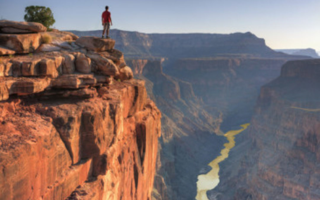
Much like the sneakiness of the inverted mountain, things in Grand Canyon tend to appear much closer than they actually are. At times it feels as though you could literally reach out and touch the Colorado River, or even just a portion of trail beneath you. Go to Desert Watchtower on the East Rim. From the Tanner Trail, you are presented with an astonishing view of the mighty Colorado, a unique rim view in Grand Canyon. Though the river is over 9 miles away by trail, an optical illusion is presented that makes the river feel close.
This is a difficult lesson for many hikers in Grand Canyon. Our destination is just right over there! It looks so close! Believe us, it is not. Between the necessarily winding trail, the relentless sun, the lack of water, and the absence of shade, something that optically appears close becomes seemingly further away in reality. Remember that the scale presented to your senses in Grand Canyon is typically unlike anything you’ve ever experience. Those of us that have spent years in this wondrous landscape are still blown away by its size and space. In Grand Canyon, perception is often NOT reality.
Let’s Start Hiking!
At last, we can actually talk about hiking! Hiking in Grand Canyon is a magical, perhaps even spiritual experience. The colors, sights, sounds, smells, and ever-changing conditions create an intensely dramatic and memorable experience on even short hikes. As you hike though 2 billion years of Earth’s history, the Canyon reveals itself step-by-step, both physically and philosophically. In terms of trails and the time it takes to reach the bottom, here are your options:
South Rim
The South Rim presents most of the park’s developed trails, has the “shortest” routes to the river at the bottom, and is by a wide margin the more popular of the two rims. There are 4 developed trails from the South Rim, and 1 trail that is undeveloped and unmaintained.
Bright Angel
The Bright Angel Trail is the most popular trail in Grand Canyon. It traces the path of the Bright Angel Fault, through Indian Gardens, across the Tonto bench, and down to the river in 9.6 miles. This highly trafficked corridor trail teems with other hikers and rangers aplenty, great for beginners introducing themselves to Grand Canyon hiking. Hikers can reach the river and Bright Angel Campground in between 4-5 hours.
South Kaibab
The South Kaibab Trail is the steeper counterpart of the Bright Angel Trail, and plunges to the river in an abrupt 6.4 miles. Holding the distinction as the only trail in the park developed completely by the NPS, it is a more direct route to the river for those looking for speed. Connecting South Kaibab to Bright Angel via the Tonto Trail is a classic backpacking trip that many first-timers find welcoming. Hiking to the river along the South Kaibab Trail typically takes between 3-4 hours.
Hermit Trail
The Hermit Trail follows a route forged by Canyon pioneer Louis Boucher, also known as “the Hermit of Grand Canyon”. Mr. Boucher led a reclusive life at the bottom of the Canyon for roughly 20 years, guiding tourists, mining, and homesteading. His pioneer route was improved by the Santa Fe Railroad company in the early 1900s, and today presents an excellent alternative to the more crowded corridor trails. The Hermit Trail descends 8.9 miles to the river, and will take the average hiker between 4-5 hours to reach the bottom.
Tanner Trail
The Tanner Trail is perhaps the most exciting and more challenging of developed routes from the South Rim. The trail presents sweeping views across eastern Grand Canyon, with views of Marble Canyon and the Vermillion Cliffs to the north. The Grand Canyon Supergroup, a suite of tilted, faulted, 1 billion year-old sedimentary rocks that symbolize the Great Unconformity are revealed in splendor here, a perspective unique to this part of the canyon. The Tanner trail is 9.3 miles long, and hikers may reach the river in 4-5 hours.
South Bass
The South Bass trail, set roughly 25 miles west of the South Rim Visitor’s Center, is easily the most rugged trail from the South Rim. Reached by a 4WD trail, the drive here takes roughly 2.5 hours. The trail itself was carved by William Wallace Bass, and early pioneer and promoter of tourism in Grand Canyon. South Rim solitude is found in droves here, wildlife abundant, and views outstanding. The trail is 12.2 miles long, and will take the average hiker 5-7 hours to reach the river.
North Rim
The less popular, more contemplative North Rim presents Grand Canyon hikers with opportunities for more challenges, more solitude, and a decidedly different perspective of Grand Canyon. Set at over 8,500 feet above sea level, North Rim is a forested wonderland of rolling meadows, wildflower, and perhaps even a glimpse of one of the iconic symbols of the west, the American Bison. Access requires longer drive times, and trails here retain a fairly rugged character. Like the South Rim, do not even dream of attempting a rim-to-river-to-rim hike in one day. North Rim trails are long, can be challenging, and are generally reserved for more-experienced Grand Canyon hikers.
Much of the Colorado River system that has carved Grand Canyon emanates from the north. Consequently, in contrast to South Rim, North Rim is “set back” from the river, following long, meandering routes coursed by ancient tributaries. South Rim’s dramatic and abrupt cliff faces and 4000-foot plunges are a product of the lack of water flowing into the river from the south, while North Rim landscapes are dominated by softer relief.
North Kaibab
Counterpart to the South Kaibab Trail, North Kaibab is North Rim’s most accessible and least rugged trail. It is the only North Rim trail maintained by the NPS. The trail is follows a 28 miles route to the river, and most hikers will find that it takes 2-3 days to reach the river. Keep in mind that this is the least-challenging trail on North Rim.
Nankoweap Route
Notice the use of the word “route”, as opposed to the use of the word “trail” in the name. This is for a reason, as Nankoweap is really not a trail in the traditional sense. It is lightly trafficked, unmaintained, and follows an ambitiously-descending ridge along the East Kaibab Monocline. Hikers descend 14.8 miles along the trail, and average hikers may reach the river in 1-2 days. Get ready. Get set. Go!
North Bass
The North Bass Trail is, of course, the North Rim counterpart to South Rim’s Bass Trail. William Wallace Bass, pioneer of Grand Canyon, carved this route as part of his efforts to promote tourism in Grand Canyon. The trail follows faults, rock falls, and sublime canyon scenery 14.5 miles to the river. Hikers may reach the river in 1-2 days. This is perhaps the quintessential trail in Grand Canyon, as it contains just about everything hiking here has to offer. Try an exciting Rim-to-Rim backpacking tour on the Bass Trail, complete with a pack rafting adventure!
Seeing Grand Canyon on Muleback
The National Park Service maintains a mule farm on both North and South Rims. Visitors to Grand Canyon may elect to have their gear carried to their campsite by pack mule, a decidedly easier alternative to carrying your own gear. Please consider your choice carefully when selecting a mule outfitter.
Several private companies have been fined and banned from Grand Canyon for animal abuse and cruelty. Check the Park Service’s website for more information about mule rides in Grand Canyon. Contact us to learn more about mule-assisted backpacking tours.
Imbibing in a mule-assisted trip to the river certainly takes a load off, however it does not save time. Hikers must still make their way on foot, or on the back of a mule whose goal is not speed. Mule trips down to the river typically take between 4-5 hours.
See Grand Canyon by Helicopter
One of the fairly new enterprises in Grand Canyon is the proliferation of helicopter tours. They are popular particularly in western Grand Canyon, where helicopters buzz through the air almost constantly. The Goat’s opinion is this — get your butt off your couch and onto your feet. Need more information? Please look elsewhere :). Helicopters create several problems in Grand Canyon. Helicopters create pollution, both noise and exhaust. They destroy any perceived wilderness experience. They damage wildlife patterns, and best of all (sarcasm) they crash! In the past 7 years, there have been 3 helicopter crashes that resulted in fatalities. The most recent of these was near Peach Springs in 2017, when 5 passengers and the pilot died. One woman was rescued, and is scarred for life both physically and mentally. Take my advice — don’t contribute to the proliferation of industrial tourism in Grand Canyon.
Fitness
Surely you’ve heard this numerous times, but please be in reasonable physical condition. Undertaking any hiking in Grand Canyon is a decidedly physical challenge, and it will increase your enjoyment as well as decrease your chances of trouble if you are in shape. For more information, see our blog post regarding training for hiking in Grand Canyon.
Guided Grand Canyon Hiking Tours
Perhaps the very best way to see and experience Grand Canyon is by hiring a professional guide service. Hiking with people who know the Grand Canyon intimately vastly improves your experience and understanding of this unreal place, and not having to deal with logistics, food, gear, and all that madness only enhances the trip.
Blue Marble Adventure GeoTourism provides everything need; geologist/guides with actual geology degrees and professional certifications, backcountry meals inspired by professional chefs, top-of-the-line gear, and outstanding customer service.
The Goat’s Final Word
There you have it, folks. You asked how long does it take walk down the Grand Canyon, and we have outlined virtually every possible eventuality! Whether by foot (awesome), by mule (still awesome), helicopter (not cool), from North or South Rim, by land or bey sea, you now have some idea of how long it takes. Happy Hiking!
Follow us on Facebook and Instagram
Contact Us for information about traveling through geologic time
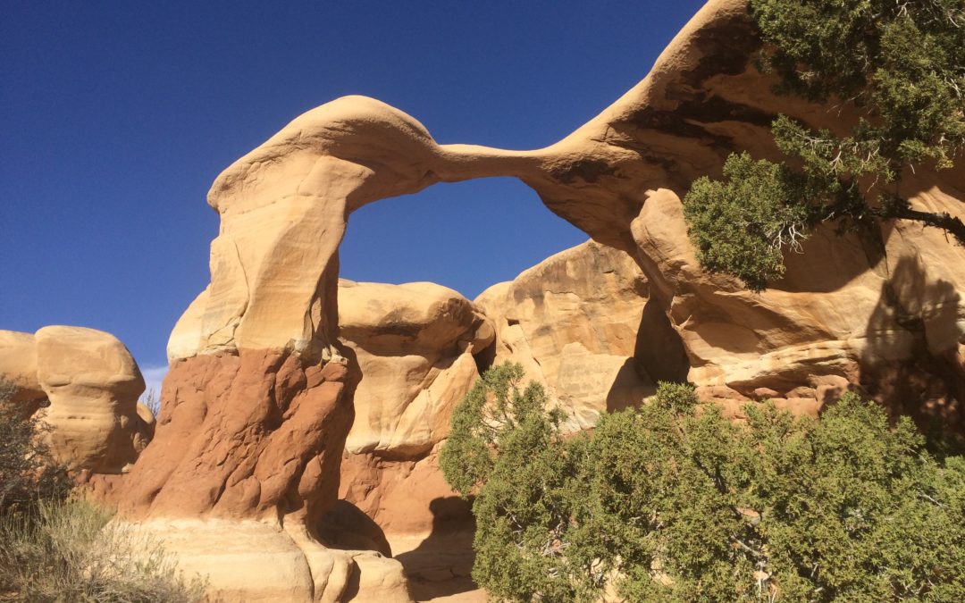
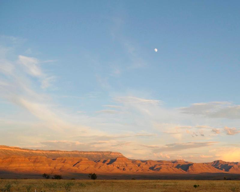
by The Goat | Aug 27, 2019 | Geology, Grand Staircase-Escalante, History, Utah Canyon Country, Vermillion Cliffs
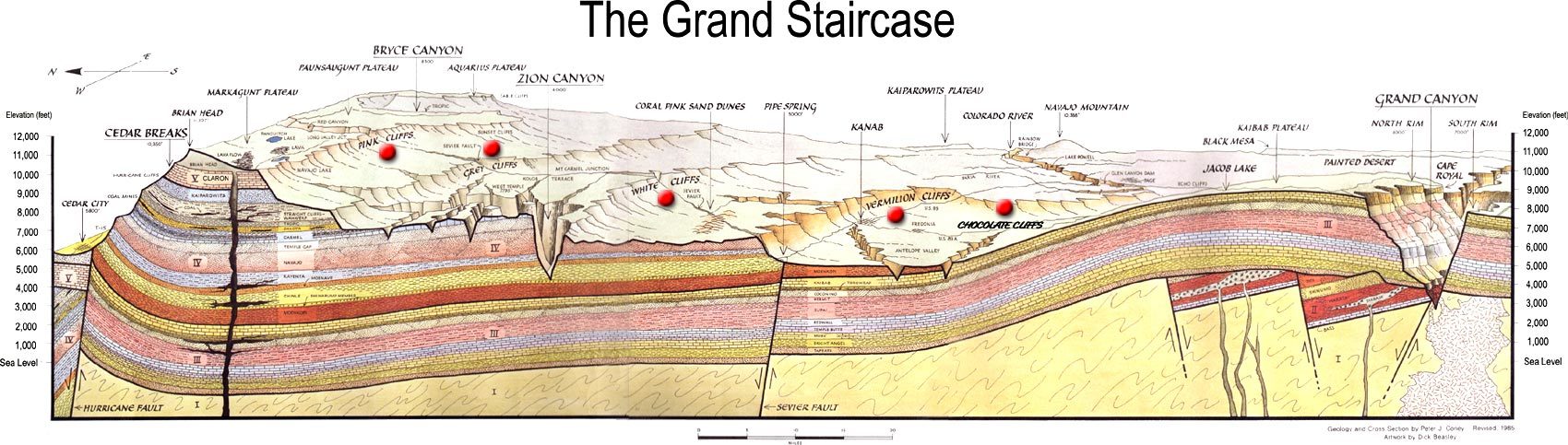
How was the Grand Staircase formed?
Why is the Grand Staircase called the Grand Staircase? Because it sounds cool? Well, of course because it sounds cool, but the name actually represents a very unique and important geological phenomenon that has been built over hundreds of millions of years. Starting from the North Rim of the Grand Canyon to the hoodoo wonderland that is Bryce Canyon National Park, the Grand Staircase represents progressively younger and higher cliffs that quite literally form a staircase, as though a giant was looking for an easy way to step up to the Sierra Nevada Mountains. There are five stairs in this grandest of staircases, each a different color, a different piece of rock, and a different age from Permian to Cretaceous, a span of over 200 million years.
Step Zero: Kaibab Limestone, North Rim Grand Canyon National Park
Before you being to climb any staircase, you must first stand below it and contemplate your climb. This is step zero. The best part about this step is that there it also serves as a foyer, with stairs above and below. The stairs below? 2 billion years of Earth’s history and 5000 vertical feet down to the Colorado River and its Grand Canyon. The top step of this staircase is the North Rim of the Grand Canyon and the Kaibab Limestone, a Permian formation packed with marine fossils that serves as the hard, protective layer of the Kaibab Plateau and the soft sandstones and shales that make up the red and orange walls you will see when hiking in Grand Canyon
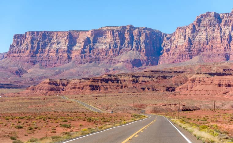
Step One: The Chocolate Cliffs: Moenave and Chinle Formations
The first official step in the Grand Staircase is the Chocolate Cliffs, located near the town of Fredonia, AZ and seen prominently on US hwy 89 near the Arizona/Utah Border. The Chocolate Cliffs can also be seen below Glen Canyon Dam. Aptly named, these velvet brown cliffs of the Moenave Formation, a variably sandy and silty sandstone/shale that represents a proximal marine fluvial (river) system of early Jurassic age, are part of the greater Glen Canyon Group that includes all the Jurassic-aged units of the Grand Staircase (Wingate, Moenave, Kayenta, Navajo). The Chocolate Cliffs are home to thousands of dinosaur fossil fragments, though no full specimens have been recovered.
Step Two: The Vermillion Cliffs: Kayenta Formation and Navajo Sandstone, Vermillion Cliffs National Monument
The Vermillion Cliffs, perhaps more famous geologically for their National Monument that contains such features as “The Wave“, White Pocket, and Buckskin Gulch, are the second step in the layercake of geologic time that forms the Grand Staircase. Laid down during the mid Jurassic, Vermillion is composed of two distinct rock units that are married to one another across the Colorado Plateau. The Kayenta Formation, which is sandwiched between the older Wingate and younger Navajo Sandstones, is a terrifically diverse and interesting unit that represents a wetter transition period with a howling and vast desert on each chronological side.
A veritable melange of lithology, Kayenta has just about everything from thin lenses of limestone and muddy shales to cross-bedded sandstones similar to its stratigraphic neighbors. It records almost seasonal changes with its mud cracks, as well as large scale climatic changes indicated by sand dunes, river beds, and even the occasional shallow lake bed. Kayenta and Navajo are almost always found together, and oftentimes form dramatic cliffs and canyons together as seen in the Vermillion Cliffs and Zion National Park.
Step Three: The White Cliffs: Navajo Sandstone, Zion National Park
The third step in the Grand Staircase are perhaps some of the most most famous and photographed cliffs in the world, creating Zion National Park in southwest Utah. Soaring red and white Navajo Sandstone, formed by a massive windblown desert in the middle Jurassic, have made Zion National Park one of the most sought-after destinations in the Utah, the American Southwest, and even the world as people travel from thousands of miles and from every corner of the globe to behold the epic grandeur showcased by these rocks.
Step 4: The Gray Cliffs/Straight Cliffs, Straight Cliffs Formation/Mancos Shale, Grand Staircase National Monument
Though often overlooked for its wildly famous famous neighbors, the fourth step Gray Cliffs are nothing if not spectacular. Though not as celebrated as the White and Pink Cliffs contained within the boundaries of Bryce and Zion Canyons and their National Parks, the Gray Cliffs contains some of the most wild, scenic, unspoiled, and lightly explored wilderness in North America. Think that sounds ridiculous? Consider this: the Kaiparowits Plateau, wherein the Gray Cliffs are most prominent, receives less visitors in one year than Zion does in one day, and that’s just the beginning. The Gray Cliffs and the canyons below them contain some of the most complete and celebrated archaeological finds in the United States. Want to see a T-Rex? Want to walk in Apatosuar footprints? The Gray Cliffs house all these wonders and more in their Cretaceous-era shales.
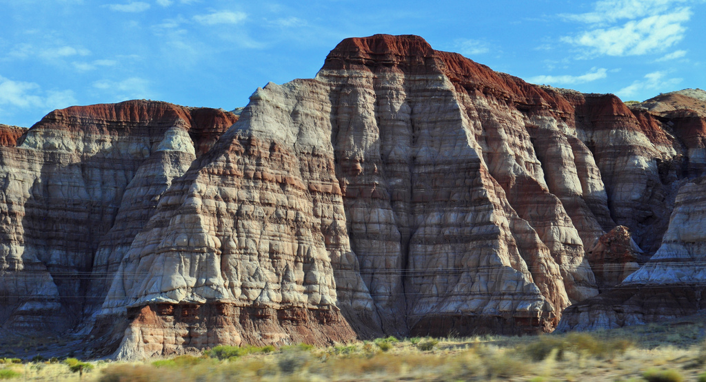
Step 5: The Pink Cliffs, Claron Formation, Bryce Canyon National Park
Our climb ends in some of the most famous scenery in the entire world, the pink and orange hoodoos of the Claron Formation and Bryce Canyon National Park. Remnants of shallow, salty inland lakes of the late Cretaceous, the Pink Cliffs have eroded into outrageously spectacular natural amphitheaters, mesas, and wild canyons. Cedar Breaks National Monument also displays the Pinks and receives far fewer visitors.
Visitors to the entire Grand Staircase area, from its namesake National Monument to the soaring cliffs of its three National Parks, will be treated to some of the most special, most spectacular, and most geologically important scenery in the entire world. There is no better way to explore the Kaiparowits Plateau, The Grand Canyon, or the rest of the Grand Staircase than with our geologist/guides, who will take care of your every need while giving you an in-depth glimpse into the geologic secrets hidden in this outstanding place.
Going Guided
Hiking and exploring Grand Staircase-Escalante, or any of the National Parks, is a special experience. Although it is possible to see these places yourself, hiring a guide is a great idea. For instance, guiding services provide logistical support, and plan everything for your best possible trip. They provide a great safety net on the trail, and are trained in backcountry medicine. Above all, they provide a depth of knowledge of the region that turns a walk into a true adventure.
Blue Marble Adventure GeoTourism provides all of the support you need, and pairs that with expert geologist/guides. Our backcountry meals use fresh ingredients, and are planned by a professional chef. Furthermore, we provide top-of-the-line gear and passion for the places we explore. In conclusion, you can visit National Parks, but going with a guide can create and even more memorable experience. Don’t be shy, and call us!
Read our blog!
For adventure hiking vacations in a geologic time machine, see our epic tours in Grand Canyon, Utah, and Arizona!
For geological musings read The Goat’s geology blog.
Follow us on Facebookand Instagram
Explore Further, Be Wild, See Through Time — Blue Marble Adventure GeoTourism
by The Goat | Aug 27, 2019 | Arches, Bryce Canyon, Canyonlands, History, National Parks, Utah Canyon Country, Zion
What are the 5 National Parks in Utah?
Breathe in, breathe out. Survey the scene. Take it all in. This is the most outrageous scenery anywhere in the world, and you are right in the middle of it. Utah’s Canyon Country is a geological fantasy, and an adventure hikers dream. In this wild land there are five National Parks, each of them holding distinction as some of the most iconic on the planet. Zion, Bryce, Capitol Reef, Arches, and Canyonlands National Parks hold some of the most world famous scenery, whimsical geology, and thrilling adventure that people from all over the world flock to, and The Goat is here to give you a first-hand glimpse of what to expect when spelunking Utah’s Canyon Country.
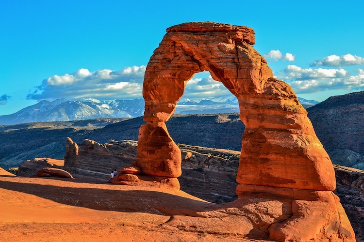
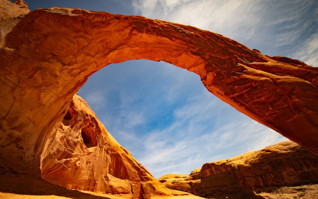
Arches National Park, Northeast Utah near Moab
Arches National Park is perhaps the most famous place in the world. Although that is an incredibly bold statement, there is nothing that represents the Colorado Plateau, the Southwest, and indeed, The United States, quite like an image from Arches. Delicate Arch, pictured above, is without a doubt the most famous natural arch in the world, and is one of the most famous and photographed destinations in the southwest. Quick, think of an image that represents America. We dare you to conjure an image, or series of images, that does not include these iconic features and their namesake National Park.
Established in 1929 as a National Monument by Herbert Hoover then upgraded to a National Park by Richard Nixon in 1969, Arches National Park is home to the largest and densest concentration of sedimentary arches in the world. The literally thousands of arches are among several geologic features that are unique and specific to Arches National Park, and it is markedly different from its neighbor Canyonlands National Park just to the southwest. Arches is set atop a massive salt deposit laid down by an ancient sea roughly 300 million years ago, and this is the special ingredient that has allowed for the fabulous features for which it is most famous.
Set in Utah’s high desert climate, weather in Arches is punctuated by hot summers, mild winters, and seasonal monsoons that can dump most of its 10 inches of yearly precipitation in just a few events. The weather is also one of the root causes for the park’s unique geology, as the unpredictable nature of precipitation, freezing, lake of competent soils, and other factors contribute daily to shape this wondrous piece of the Colorado Plateau.
Check out our Guided Geology Tours of Arches National Park
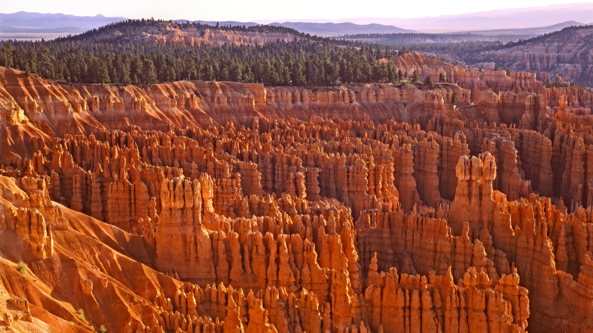
Bryce Canyon National Park, Southwest Utah near St. George
Fun Fact #1 about Bryce Canyon: It’s not a canyon (bet you didn’t see that coming). Geologically speaking, Bryce Canyon and Bryce Canyon National Park is a natural amphitheater, carved out by millions of years of the erosion of the soft lacustrine (lake) sediments. The most famous feature of the park, its “hoodoos”, are carved out of the Claron Formation, otherwise known as the beautiful pink and orange sandy limestone that caps the entire park. Want to make a few new friends? Hug a hoodoo!
Southwestern Utah, wherein Bryce Canyon National Park is located, is a fundamentally unique and spectacular geologic marvel. Here you will stand in awe as you see the underpinnings of the meetings of two geologic provinces and the forces that shape them both. The Colorado Plateau and the Basin and Range provinces come together in this general region, making Utah’s High Plateau Country what it is; high plateaus that are former mountains that have been acted upon by millions of years of erosion by wind and water.
Faults to the west and east, remnants of the forces that built the Rocky Mountains, have thrust southwestern Utah skyward creating unique topography that is of nearly ridiculous proportions. Bryce Canyon sits at an average elevation of over 8,000 feet, which is quite astonishing considering that it is over 1,000 feet higher than its neighbor Zion National Park. When you think of Bryce Canyon, do you think of elevations higher than average elevations in the Appalachian Mountains? Most don’t, so you’re not alone!
Summer is a great time to visit Bryce Canyon National Park, although that is when the park sees most of its nearly 2.5 million yearly visitors. Winter brings snow and cooler temperatures, though it can lend fantastic solitude to the masterful scenery. Spring and fall can bring unpredictable weather events including snow and rain, but don’t let that stop you, the shoulder seasons are likely the ideal time to visit, as you will avoid winter chill and summer crowds, a rare duel threat.
For more information about Bryce Canyon National Park, give us a call or reserve a spot on one of our fantastic guided Utah geology hiking tours!
Canyonlands National Park, Northeast Utah near Moab
The name of this spectacular National Park says it all; it is truly a land of canyons. Set aside as a National Monument in 1964, Canyonlands National Park contains some of the most awe-inspiring and remote Colorado Plateau scenery that one can find. Telling a geologic story nearly 350 million years old, Canyonlands retains all the features that make it a master class in Colorado Plateau geology and all of Utah’s Mighty 5 National Parks. Here you will find numerous sandstone arches, hoodoos, remote slot canyons, towering cliffs and mesas, faults, folds, salt domes, meteorite impacts, and a collection of some of the most important rock layers of the Paradox Basin, a fundamentally important piece of the geologic puzzle on the Colorado Plateau.
More remote and less-visited than its across-the-highway neighbor Arches National Park, Canyonlands is a place where you feel truly connected to nature, the past, present, and even the future; it’s a place where one can truly ponder the beauty, grace, complexity and its diametric simplicity of the Colorado Plateau in all of its unabashed glory. It holds the confluence of perhaps the West’s two most important rivers; the Colorado and the Green, each of which, along with their tributaries has intricately carved this vast land of seemingly endless gashes in the Earth, each more spectacular and foreboding than the last. Time here has painted, carved, woven, and stitched together the very fabric of what makes Utah and the southwest such an alluring place, and Canyonlands National Park is an absolute forget-about-it must for any outdoor adventurer.
Capitol Reef National Park, Central Utah near Boulder
Perhaps the most underrated National Park in the entire system, and certainly in Utah, is Capitol Reef National Park. Capitol Reef is akin to the forgotten middle child who is class valedictorian, goes to an Ivy League school, becomes a cutting-edge neurosurgeon, and nobody notices. Anyone who knows this middle child would tell you of its brilliance, its beauty, its allure, and its potential. However, not enough people have paid attention because all of its other siblings happen to be smart, beautiful, famous, and in-demand as well.
Born into National Park designation in 1970, Capitol Reef National Park is a veritable outdoor geology laboratory. The wilderness protects a 100-mile long monocline known as The Waterpocket Fold, so names due to the many erosional pockets which house water after rain events. The structure is a towering reminder of the tectonic forces that built the Rocky Moutains, and is one of the most well-exposed, spectacular, largest, and well-preserved (not eroded) such structures on Earth. Along its rugged spine are towering cliffs and mesas that take the form of domes that are reminiscent of capitol buildings found in Washington DC among other big cities, giving their moniker to this wonderful place. The reef portion of the park’s name comes from the foreboding cliffs that seem to guard its secrets, as reefs are commonly known as barriers to travel.
Capitol Reef has many advantages that its sibling parks lack; the best of all being solitude and proximity to large metropolitan areas. Capitol Reef National Park is, quite literally, in the middle of nowhere. Whereas Zion and Bryce are but 2-3 hours from Las Vegas and large highways, and Arches/Canyonlands are just outside of the world-renowned tourist mecca of Moab, Capitol Reef’s largest, nearest city is Boulder; population: 3,500.
No major highways allow easy access, and just getting to Capitol Reef is half the fun, as an approach from any direction takes you into the heart of Utah’s Canyon Country. In addition, it shares its southern border with Grand-Staircase Escalante National Monument, making access from that direction even more adventurous. Some of the most unspoiled wilderness, star-gazing, hiking, and outdoor recreation opportunities are contained within this utterly spectacular and outstanding slice of outdoor heaven. Consider yourself warned.
For more information about Capitol Reef National Park, give us a call or reserve a spot on one of our fantastic guided Utah geology hiking tours!
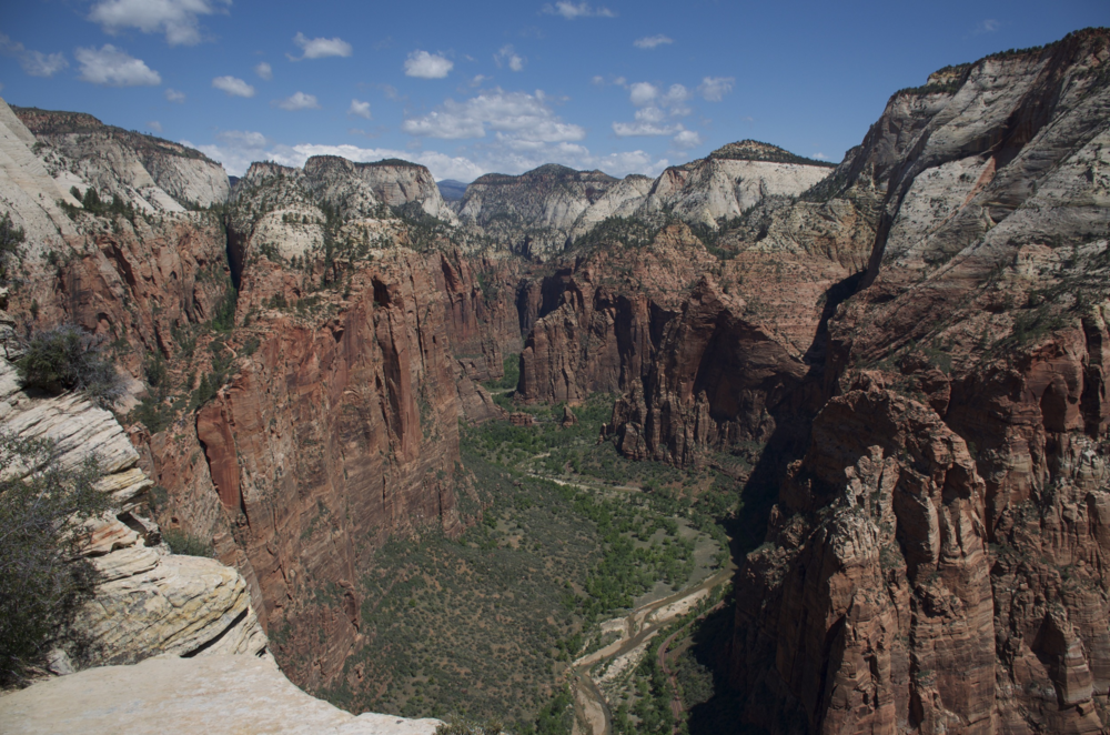
Zion National Park, Southwest Utah near St. George
Considered by many to be one of the premier National Parks not just in the United States but in the world, Zion National Park ranks as the 6th-most visited National Park in the system. Within its borders are contained some of the most iconic and famous trails and landmarks in the southwest, including Angel’s Landing, The Subway, and The Watchtower to name a few. Despite its visitation numbers, the crowds typically flock to the most well-known parts of the park, and there is plenty of solitude to be found in Zion’s remote and beautiful backcountry.
Located south of Bryce Canyon in Utah’s High Plateau Country, Zion is a wonderful melange of geologic layercake that makes the Colorado Plateau famous. At almost 7,000 feet average elevation, Zion is a land of deeply-eroded canyons, towering cliffs, and is often referred to as “Yosemite Dressed in Red” by it many adoring fans. The Virgin River, which is ultimately the forming body in Lake Mead east of Las Vegas, is also the primary erosional force at work in Zion National Park, and it along with is tributaries have cut into the sunset-red rocks to sculpt Zion’s outrageous and almost daunting scenery.
When to Visit
Summer serves as the park’s busy visitation season with consistent temperatures, stable weather, and ample vacation time for families. However, Zion can be enjoyed year-round, and the hearty outdoor adventure traveler will enjoy the relative solitude offered in the cooler months between October and May.
With so many great adventures to be had, choosing the right one for you can be the hardest part! Give us a call for information about any of these wonderful places, or reserve a spot on one of our fabulous tours and let our expert geologist/guides take you on an epic journey!
Going Guided
Hiking and exploring Utah and its National Parks, is a special experience. Although it is possible to see these places yourself, hiring a guide is a great idea. For instance, guiding services provide logistical support, and plan everything for your best possible trip. They provide a great safety net on the trail, and are trained in backcountry medicine. Above all, they provide a depth of knowledge of the region that turns a walk into a true adventure.
Blue Marble Adventure GeoTourism provides all of the support you need, and pairs that with expert geologist/guides. Our backcountry meals use fresh ingredients, and are planned by a professional chef. Furthermore, we provide top-of-the-line gear and passion for the places we explore. In conclusion, you can visit National Parks, but going with a guide can create and even more memorable experience. Don’t be shy, and call us!
Read our blog!
For adventure hiking vacations in a geologic time machine, see our epic tours in Grand Canyon, Utah, and Arizona!
For geological musings read The Goat’s geology blog.
Follow us on Facebookand Instagram
Explore Further, Be Wild, See Through Time — Blue Marble Adventure GeoTourism
by The Goat | Aug 27, 2019 | History
Dinosaurs, Soaring Forests, and Giant Rivers
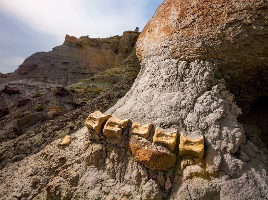
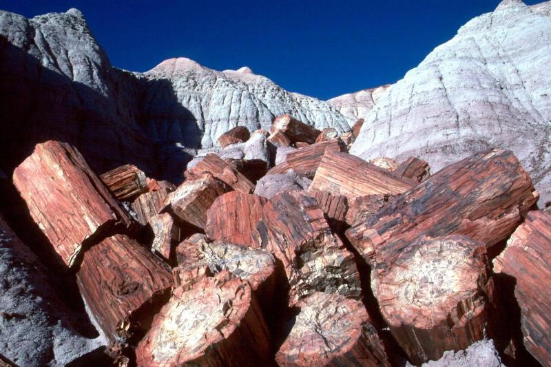
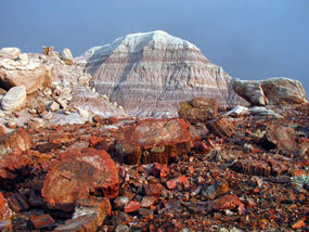
The Painted Desert is a beautiful and mysterious place. Perhaps its crown jewel is the Petrified Forest National Park, where one may encounter the largest known concentration of petrified wood on the planet, a pretty special distinction. From small shards to large trunks that are several feet in diameter, this natural phenomena dominates the stark, hauntingly beautiful landscape in northeastern Arizona.
The most fun part about being a geologist, or learning about geology, is the creativity and imagination in picturing how a landscape like the Petrified Forest came to be. Why is it here? The story told by the rocks and fossils in this wondrous place is one that winds through the sands of time, beginning nearly 225 million years ago in an era known as the Triassic……
The clock keeps on ticking…
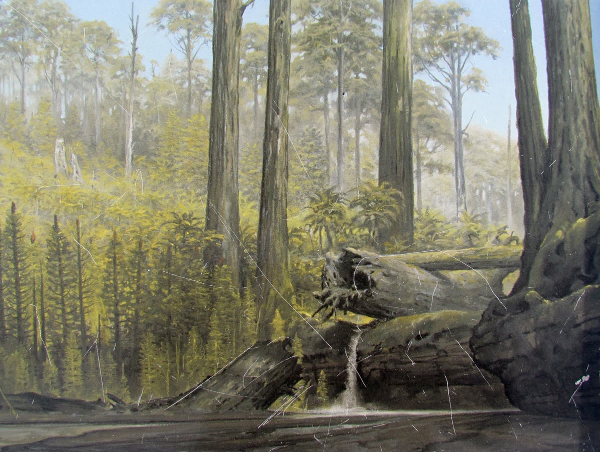
As the years fly by, transporting us to this very place, we find ourselves standing in a towering deciduous forest. These trees, some perhaps 100m tall, dominate the skyline and provide a lush canopy of greenery for the local flora and fauna. We are close to the equator, inland on the supercontinent known as Pangea, formed when all the continents were sutured together by plate tectonics.
Artist’s rendering of a Late Triassic scence (courtesy geolhistory.com)
A giant dragonfly, one roughly the size of an adult males’ hand, swoops by, landing nearby on a fern in the swampy landscape. The vegetation is dense, the air is humid, and the smell in the air is a pungent mix of decaying organic matter and still water. We are in a sub-tropical jungle, similar to one you might find in modern day Central America, and it is quite hot. As we stomp though the brush swinging our machetes, we come to a clearing where a wide, shallow, lazy river is coursing its way through the forest, bound on each side by floodplains.
Wild Dinosaurs
Following the river we find tracks. What are they? Large Phytosaurs are fishing and sunning themselves on the bank of this warm river, while the other titan of the Triassic, Rauisuchian, steers clear. Many other smaller dinosaur-like reptiles and crocodilian vertebrates roam around the brushy banks and Pterosaurs circle in the air, looking for fish and small mammals.
The Phytosaur, top predator of the Triassic
The scene is serene, peaceful. A warm, wet wind blows through the river valley, rustling fern leaves and wafting tree seeds. Though you may not want to go, time steps forward. Over the next 150 million years, this scene is buried by larger rivers, deserts, and lakes. Trees fall and muds and sands carried by the ever-coursing rivers of change bury the trees and dinosaurs, entombing them to one day rise again. Pangea rifts apart near the end of the Cretaceous and massive volcanic outputs combine with extra-terrestrial impacts to wipe the planet clean, giving rise the mammals that heretofore existed only underground.
The Supercontinent Pangea. The PFNP was located near the southwestern edge of the North American continent
The Mountains….
Then, as the Rocky Mountains are built to the northeast, the land is thrust upward, exposing it to the surficial winds and waters that carve the most epic of landscapes. The Petrified Forest member of the widespread Chinle Formation, the colorful and unique formation that creates the brush stroke appearance of the Painted Desert, peeks its head out from its long slumber under the layers of sediment that buried it long ago. The trees have undergone a fossilization process known as silicification, wherein silica (SiO2) replaces organic material over long periods of time, while the rest of the landscape has undergone a process called diagenisis, or the combination of processes that renders sediment into rock.
The modern-day Petrified Forest near Blue Mesa
As modern life took hold over the thousands of years of human evolution and exploration, this area was noted as special and unique, and preserved for the generations when it was designated as a National Monument in 1906, then as a National Park in 1962. Today it stands as one of the most fascinating and unique places on the face of the Earth.
Going Guided
Hiking and exploring any of the National Parks, is a special experience. Although it is possible to see these places yourself, hiring a guide is a great idea. For instance, guiding services provide logistical support, and plan everything for your best possible trip. They provide a great safety net on the trail, and are trained in backcountry medicine. Above all, they provide a depth of knowledge of the region that turns a walk into a true adventure.
Blue Marble Adventure GeoTourism provides all of the support you need, and pairs that with expert geologist/guides. Our backcountry meals use fresh ingredients, and are planned by a professional chef. Furthermore, we provide top-of-the-line gear and passion for the places we explore. In conclusion, you can visit National Parks, but going with a guide can create and even more memorable experience. Don’t be shy, and call us!
Read our blog!
For adventure hiking vacations in a geologic time machine, see our epic tours in Grand Canyon, Utah, and Arizona!
For geological musings read The Goat’s geology blog.
Follow us on Facebookand Instagram
Explore Further, Be Wild, See Through Time — Blue Marble Adventure GeoTourism
by The Goat | Aug 27, 2019 | Geology, History
The most pertinent question one may find themselves asking when reading this blog is “who exactly is The Goat”? Is he an actual goat? A mascot of some sort? Some ridiculous nonsense dreamed up by somebody who thinks they are clever? A metaphor perhaps? The answer is yes; yes, my friends. The Goat is all of these things, except for a real goat I suppose.
The Goat is truly a metaphor. He is adventure, he is the unknown, he is the calling into the mountains, the deserts, the wilderness, the world. He is the small voice in your head that tells you to get off the couch and do something wild, something free, something you have never done before. The Goat implores you to push your boundaries and to expand your horizons. He is, in all reality, your sense of wonder and true adventurous nature.
His blog, The Call of The Goat, will represent all things adventure, geology, travel, food, unbridled nature, and the call of the wild itself, which is in and of itself the true Call of The Goat: to be wild, free, unencumbered by the daily grind and seeking only to learn, teach, feel and be in the wild. He is an animal of the world, and transcends the world through science, adventure, knowledge, and general goatiness.
Be one with The Goat as he travels, thinks, lives, ponders, informs, and jumps around on rocks; you will live as he lives, does as he does, and goat as he goats. Here is how you can get your goat…….
- Read this blog and like it (both mentally and physically with on social media).The Blue Marble Adventure GeoTourism Blog is dedicated simply to various topics on geology adventure travel, trail guides, answering questions about various destinations, and delves into the sights and sounds of his beloved American Desert.
- Listen to his Podcast: The Call of The Goat RockTalks as he discusses with guests and people of interest various topics on geology, travel, gear reviews, destination countdown lists, and all things outdoors. You may upload from this blog.
- Visit his personal blog, also known as The Call of The Goat. In his personal blog, The Goat waxes poetic on various issues including, of course, geology and science, climate change, public lands, the geologic history of our beloved American Southwest, and other topics of interest. The blog also includes popular (and unpopular) book reviews, helpful hints to overcome various geologic challenges faced by the student of geology, and personal musings on adventuring in the American Desert.
If that still does not answer your questions on “who is the goat?”, well then, my friends, perhaps you should find the goat within yourself.