by The Goat | Mar 26, 2020 | Backpacking, Grand Canyon, Hiking, National Parks, Rim-to-Rim Grand Canyon
What are the Best Backpacking Trips in Grand Canyon?
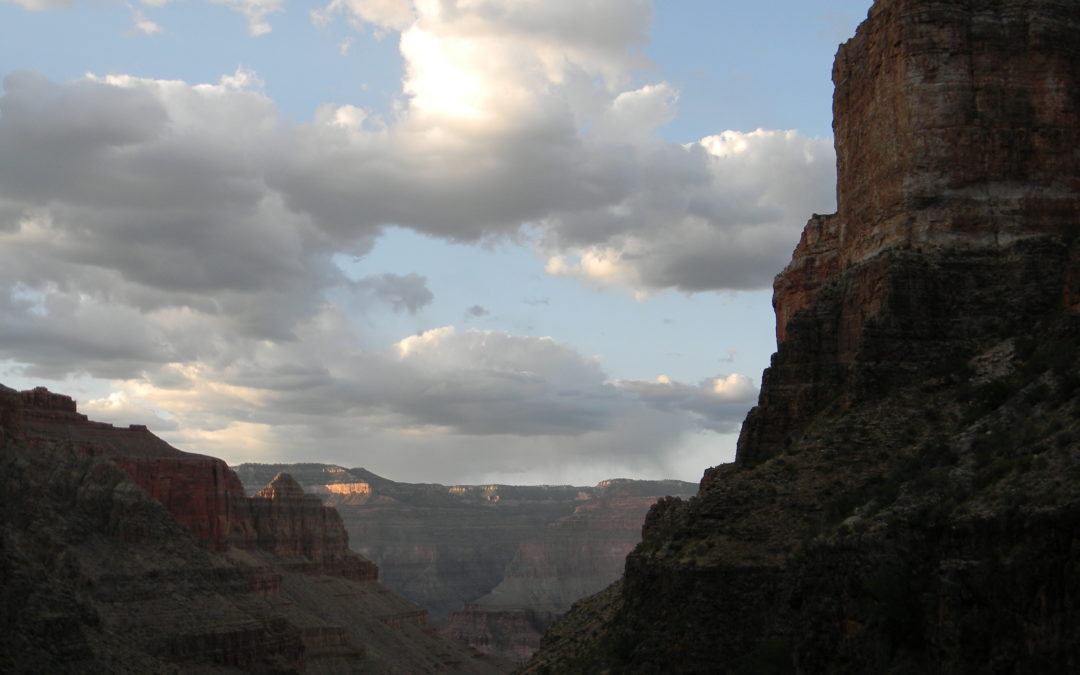
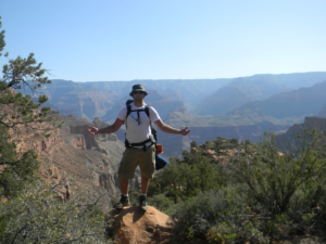
Grand Canyon National Park can be a nearly overwhelming place. What do I do? Where should I go? Even for seasoned backpackers, the choices can be endless and exhausting. The Goat has compiled a list especially for you, outlining backpacking trips in Grand Canyon for all skill and experience levels. Enjoy!
5. The Hermit Loop
Time: 3 days, 2 nights
Distance: 18 miles
Difficulty: Undergraduate+ (Check out our difficulty ratings)
The Hermit Loop is a truly classic Grand Canyon backpacking trip that can be easily accomplished over a long weekend. It is a great hike for those who are looking to take their first backpacking foray into the big ditch, and truly hits all the highlights. Sweeping vistas, interesting side trips, and excellent canyon history await on a trail forged originally by the “hermit of the Grand Canyon”, Mr. Louis Boucher. The route was later improved by the Santa Fe Railroad Line in an attempt to bring mining, then tourism, into the area.
4. Tuckup Canyon via the Stairway to Heaven
Time: 7 days, 6 nights
Distance: 45 miles
Difficulty: PhD+ (check our difficulty ratings)
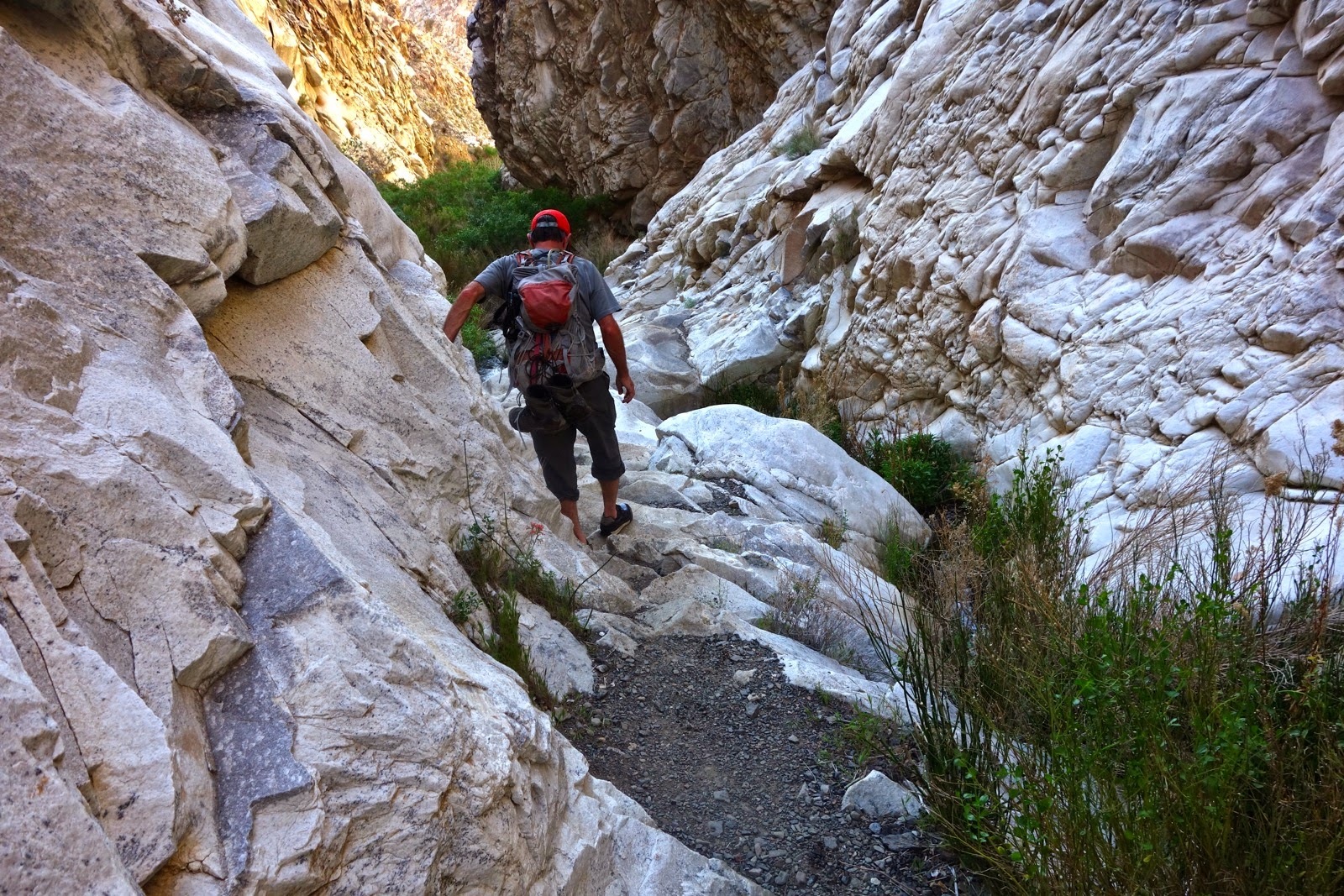
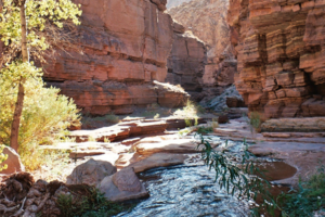
Get your defibrillator, this one is not for the faint of heart. Located in one of the most remote parts of Grand Canyon, this long, challenging loop is meant for experienced cannoneers only. This route takes ambitious hikers down Tuckup Canyon, past Shaman’s Gallery (recognized as one of the most spectacular rock art etchings in the American Southwest), through a traverse along the mighty Colorado River, and then up Stairway Canyon. Along the way, there are exciting climbing, route-finding, and scrambling challenges, and . Strap in!
3. Thunder River to Deer Creek
Time: 4 days, 3 nights
Distance: 28 miles
Difficulty: Graduate+ (check our difficulty ratings)
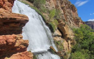
The Thunder River to Deer Creek Loop is perhaps the North Rim’s most fabulous backpacking trip. Multiple water sources, outstanding scenery, and a truly thunderous river. Geologically speaking, Thunder River is one of the most unique features in Grand Canyon. It begins as an underground river (aquifer) up on the Kaibab Plateau. It flows along various fault lines and crustal weaknesses until it breaks loose at the contact of the permeable Esplanade Group (mostly shales) and the impermeable Redwall Limestone, quite literally thundering onto the rocks below.
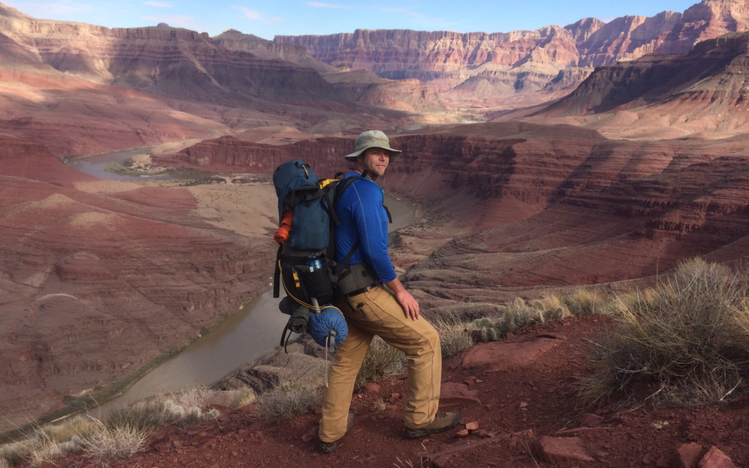
2. Rim-to-Rim via Phantom Ranch
Time: 3 days, 2 nights
Distance: 19 miles
Difficulty: Graduate (check our difficulty ratings)
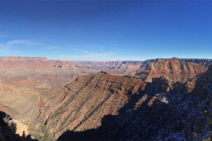
This is the true Grand Canyon classic backpacking trip. Starting at the North Rim, your descent begins on the North Kaibab Trail as it winds it way down to the Colorado River. Along the way hikers are treated to unspoiled views, soaring eagles, and a well-developed trail. Thru-hikers may camp at Bright Angel Campground, or stay in the lodge at the famed Phantom Ranch. From here hikers may choose to ascend either the South Kaibab Trail (shorter, steeper) or the Bright Angel Trail (more miles) and stay the second night on the Esplanade. After cresting on the South Rim, be sure to gaze upon your North Rim starting point. This is one of the most popular trips in Grand Canyon, so be sure to make your reservations early!
1. The Escalante Route
Time: 5 days, 4 nights
Distance: 35 miles
Difficulty: PhD (check our difficulty ratings)
Carved by early Puebloan explorers of Grand Canyon, this long traverse of Grand Canyon from the Tanner Trail to Horseshoe Mesa and Grandview is perhaps one of the finest backpacking trips on the planet. There is a little bit of everything Grand Canyon here, as hikers will encounter outrageous views of the Great Unconformity, sandy beaches, a class 3 scramble over the famous Papago Wall, and a spectacular slot canyon carved from billion-year-old Shinumo Quartzite. This route confronts with hikers with the unimaginable scale of Grand Canyon, as it will seem as though you are climbing mountains in a canyon. Grand!
Going Guided
Hiking and exploring The Wave, or any of our public lands, is a special experience. Although it is possible to see these places yourself, hiring a guiding outfitter is a great idea. For instance, guiding services provide logistical support, and plan everything for your best possible trip. They provide a great safety net on the trail, and are trained in backcountry medicine. Above all, they provide a depth of knowledge of the region that turns a walk into a true adventure.
Canyons and Chefs provides all of the support you need, and pairs that with professional chefs and expert geologist/guides. Our meals use fresh ingredients and are inspired by local farms, culture, and cuisine. We utilize a mobile professional kitchen as a backbone for cooking over the fire. Furthermore, we provide top-of-the-line gear and passion for the places we explore. In conclusion, you can these wild places, but going with a guide can create an even more memorable experience. Don’t be shy, and call us!
Read our blog!
For adventure Chef-Driven Outdoor Experiences, see our epic tours in Grand Canyon, Utah, and Arizona!
Follow us on Facebook and Instagram
Explore Further, Be Wild, Eat Like Kings —
Canyons and Chefs
by The Goat | Mar 12, 2020 | Backpacking, Death Valley, Geology, Hiking, National Parks
Death Valley: 10 Cool Facts at 134 Degrees
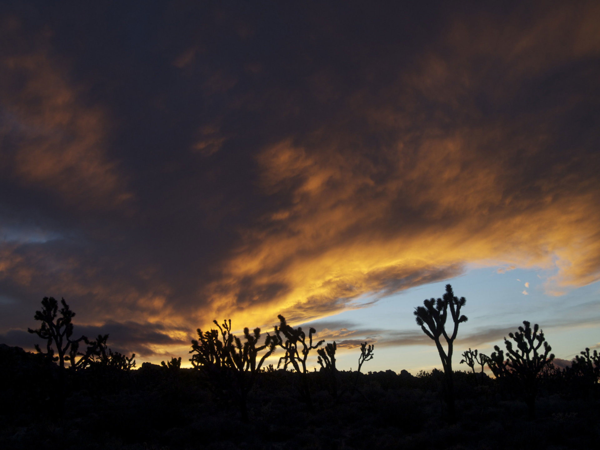
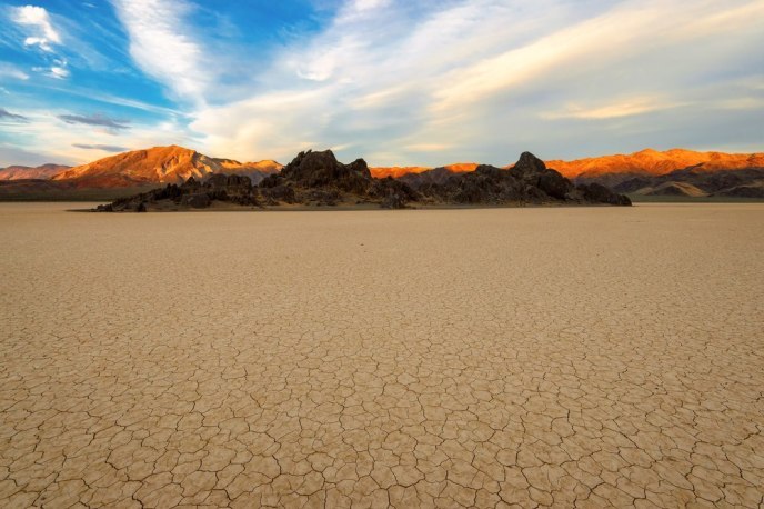
There is a place so vast, so beautiful, so unique, and so special that it nearly defies comprehension. This is Death Valley. Located in the howling wilds of the Mojave Desert along the border of California and Nevada, Death Valley is at the same time magnificent and overwhelming in sheer size, beauty, and adventure opportunity. In our opinion, it is world-famous for all the wrong reasons. When most think of Death Valley, they think of it being the place where the hottest temperature on Earth was recorded; 134 degrees Fahrenheit to be exact on July 10, 1913. Even the name itself conjures up images of things literally bursting into flames; a place that is at the least not enjoyable, and at the worst, the terrestrial version of The Inferno.
While Death Valley itself does hold that distinction, the surrounding areas are quite pleasant during the summer months, and see up to feet of snow in the winter. The Goat aims to shed some new light on this wondrous, mysterious, gorgeous, and astonishing area, and he has put together his very best “Did You Know?” list about Death Valley!
1. Did you know that the vertical distance between the lowest and highest points in Death Valley is over 11,000 feet?
Telescope Peak, the highest peak in the Panamint Mountains that tower over Death Valley, is 11,049 feet above sea level. Its lofty peak is less than 15 miles away from the lowest point in North America, Badwater Basin at 282 feet below sea level. This nearly incomprehensible juxtaposition is a feat that is only accomplished by the complex tectonics and unique geology that govern Death Valley’s highs and lows.
2. Did you know that Death Valley should really be called “Life Valley?”
Death Valley National Park is home to numerous lizard and reptile species, bighorn sheep, antelope, snakes, Gila monsters, mountain lions, coyotes, foxes, several species of owl, rodents, and hundreds of plant and tree species including cottonwood, oak, Joshua trees, and various pines, as well as many species of cactus. The perception that it is a barren, lifeless desert could not be further from reality, as it houses one of the greatest biologically diverse ecosystems in the world.
3. Did you know that you can play golf then soak in hot springs in Death Valley?
You and the Devil. Furnace Creek Golf Club boasts a full 18-hole course that challenges golfers of all levels, and the Devil’s Golf Course is one of the most excellent salt flats in the world. Visitors to Death Valley can easily see both in a day, so get ready to dance with the Devil! After dancing, feel free to soak luxuriously in Furnace Creek Hot Springs, the park’s developed and fantastically rejuvenating hot natural hot spring.
4. Did you know that Death Valley is the largest National Park in the contiguous 48?
At 3.4 million acres, it dwarfs many of our National Parks including Grand Canyon, Yosemite, and even Yellowstone in sheer size. In fact, Grand Canyon and Yellowstone together would fit inside Death Valley!
5. Did you know that one of Earth’s rarest species exists in Death Valley?
The Devil’s Hole Pupfish, one of the most rare and beautiful species of fish in the world, exists in Death Valley and only Death Valley. In fact, the park is home to several species that are not just indigenous, but exist here almost exclusively.
6. Did you know that Mt. Whitney is in the next mountain range over?
Mt. Whitney, the highest peak in the contiguous 48 states at 14,465 feet above sea level, lies in the Sierra Nevada just west of Death Valley. This means that the highest and lowest points in the lower 48 are less than 100 miles apart!
7. Did you know that in 1929, not a single drop of rain fell in Death Valley?
Yep, not one. Death Valley is the driest place in North America, averaging less than 5 inches of rain per year. The howling deserts of places like Arizona and even the Sahara Desert of Africa average more, making Death Valley one of the driest places on the globe.
8. Did you know that Death Valley is home to some of the best-preserved human history sites in the Unites States?
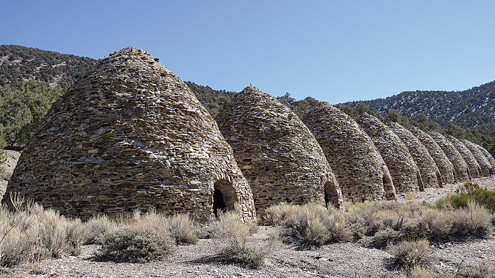
Both modern and ancient history are on fabulous display here in Death Valley. Archaeological evidence dates back to over 9,000 years ago, as petroglyphs and various Puebloan artifacts can be found all over the park. In addition, the Timbisha Shoshone Native American Tribe has called Death Valley home for over 1,000 years. There is colorful mining and European history here as well, as Death Valley got its name from frustrated and thirsty prospectors in 1848. There are numerous well-preserved mining claims and historical artifacts, and even a wickedly cool ghost town! (Check out our Surprise Canyon Backpacking Tour)
9. Did you know Death Valley is a favorite for Hollywood movie sets?
Dozens of scenes from Star Wars have been filmed in Death Valley, including Artist’s Palette (the Sandcrawler scene from Star Wars Episode IV: A New Hope), Golden Canyon (Jawa scenes from Star Wars Episode IV: A New Hope) and Mesquite Flat Sand Dunes (Droid scenes from Star Wars Episode IV: A New Hope). Also, cult classic film Tremors was filmed in the Owens Valley just one range over, and many of the shots in this excellent movie gaze onto the west side of the Panamint Mountains. Check out The Goat’s Geology Blogto learn more about Tremors and other great geology movies!
10. Did you know that Death Valley has some of the most outrageous geology in the world?
The geologic display in Death Valley is nothing short of astonishing. Home to three major faults, Death Valley is a wild melange of nearly-billion year-old sediments (very rare), contorted metamorphics, twisted volcanics, and more mineralization and hydrothermal staining than you could shake a geologic hammer at. A quintessential example of the extensional tectonics that have created the Basin and Range Province, Death Valley is not to be missed by the geologist child in all of us.
Bonus: Did you know that Death Valley can be a great place in all seasons (even summer)?
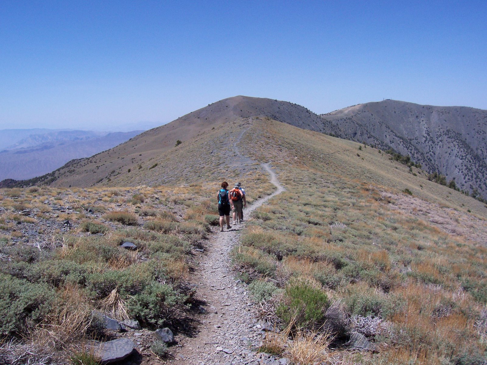
You read that right; all seasons, even summer. Crazy? Ridiculous? Suicidal? Nope, just the truth. The Panamint Mountains, which reach to over 11,000 feet, stay cool even as the summer heat blisters the valley below. This is a perfect time to summit many of Death Valley’s most lofty peaks, including Telescope Peak, it’s highest point.
Blue Marble Adventure GeoTourism is ecstatic to be rolling out our guided Death Valley hiking tours! Let our geologist/guides show you the wonder and whimsy of one of the most fantastically outrageous places on the face of the Earth. You’ll be glad you got past the name and into the wild!
May The Goat be always with you
by The Goat | Aug 27, 2019 | Arches, Bryce Canyon, Canyonlands, History, National Parks, Utah Canyon Country, Zion
What are the 5 National Parks in Utah?
Breathe in, breathe out. Survey the scene. Take it all in. This is the most outrageous scenery anywhere in the world, and you are right in the middle of it. Utah’s Canyon Country is a geological fantasy, and an adventure hikers dream. In this wild land there are five National Parks, each of them holding distinction as some of the most iconic on the planet. Zion, Bryce, Capitol Reef, Arches, and Canyonlands National Parks hold some of the most world famous scenery, whimsical geology, and thrilling adventure that people from all over the world flock to, and The Goat is here to give you a first-hand glimpse of what to expect when spelunking Utah’s Canyon Country.
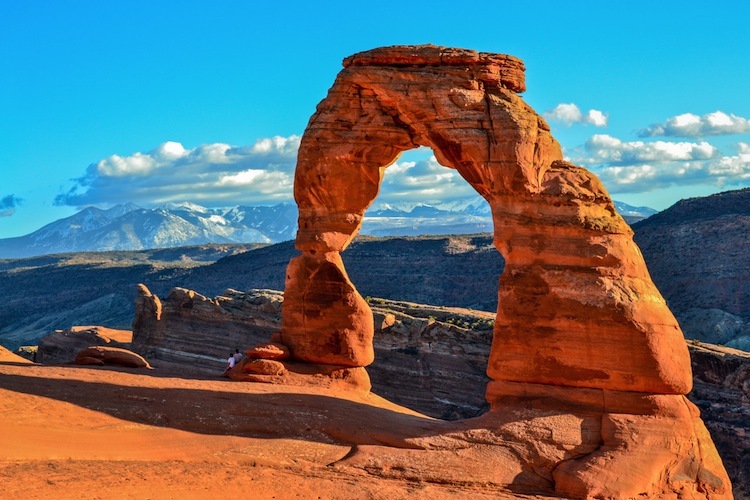
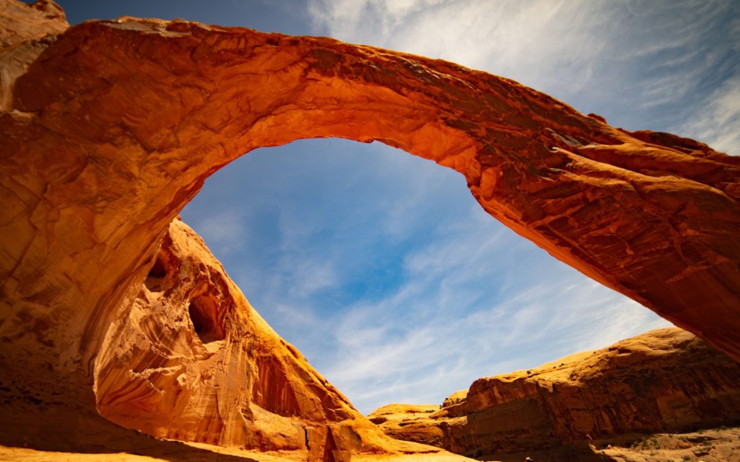
Arches National Park, Northeast Utah near Moab
Arches National Park is perhaps the most famous place in the world. Although that is an incredibly bold statement, there is nothing that represents the Colorado Plateau, the Southwest, and indeed, The United States, quite like an image from Arches. Delicate Arch, pictured above, is without a doubt the most famous natural arch in the world, and is one of the most famous and photographed destinations in the southwest. Quick, think of an image that represents America. We dare you to conjure an image, or series of images, that does not include these iconic features and their namesake National Park.
Established in 1929 as a National Monument by Herbert Hoover then upgraded to a National Park by Richard Nixon in 1969, Arches National Park is home to the largest and densest concentration of sedimentary arches in the world. The literally thousands of arches are among several geologic features that are unique and specific to Arches National Park, and it is markedly different from its neighbor Canyonlands National Park just to the southwest. Arches is set atop a massive salt deposit laid down by an ancient sea roughly 300 million years ago, and this is the special ingredient that has allowed for the fabulous features for which it is most famous.
Set in Utah’s high desert climate, weather in Arches is punctuated by hot summers, mild winters, and seasonal monsoons that can dump most of its 10 inches of yearly precipitation in just a few events. The weather is also one of the root causes for the park’s unique geology, as the unpredictable nature of precipitation, freezing, lake of competent soils, and other factors contribute daily to shape this wondrous piece of the Colorado Plateau.
Check out our Guided Geology Tours of Arches National Park
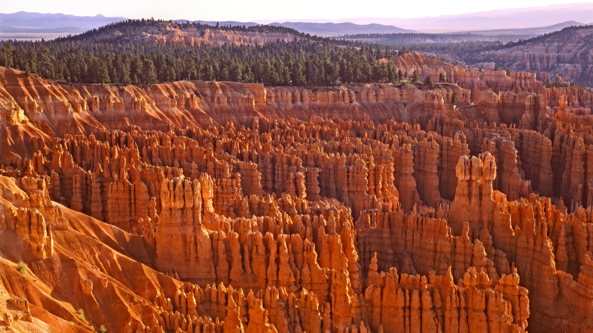
Bryce Canyon National Park, Southwest Utah near St. George
Fun Fact #1 about Bryce Canyon: It’s not a canyon (bet you didn’t see that coming). Geologically speaking, Bryce Canyon and Bryce Canyon National Park is a natural amphitheater, carved out by millions of years of the erosion of the soft lacustrine (lake) sediments. The most famous feature of the park, its “hoodoos”, are carved out of the Claron Formation, otherwise known as the beautiful pink and orange sandy limestone that caps the entire park. Want to make a few new friends? Hug a hoodoo!
Southwestern Utah, wherein Bryce Canyon National Park is located, is a fundamentally unique and spectacular geologic marvel. Here you will stand in awe as you see the underpinnings of the meetings of two geologic provinces and the forces that shape them both. The Colorado Plateau and the Basin and Range provinces come together in this general region, making Utah’s High Plateau Country what it is; high plateaus that are former mountains that have been acted upon by millions of years of erosion by wind and water.
Faults to the west and east, remnants of the forces that built the Rocky Mountains, have thrust southwestern Utah skyward creating unique topography that is of nearly ridiculous proportions. Bryce Canyon sits at an average elevation of over 8,000 feet, which is quite astonishing considering that it is over 1,000 feet higher than its neighbor Zion National Park. When you think of Bryce Canyon, do you think of elevations higher than average elevations in the Appalachian Mountains? Most don’t, so you’re not alone!
Summer is a great time to visit Bryce Canyon National Park, although that is when the park sees most of its nearly 2.5 million yearly visitors. Winter brings snow and cooler temperatures, though it can lend fantastic solitude to the masterful scenery. Spring and fall can bring unpredictable weather events including snow and rain, but don’t let that stop you, the shoulder seasons are likely the ideal time to visit, as you will avoid winter chill and summer crowds, a rare duel threat.
For more information about Bryce Canyon National Park, give us a call or reserve a spot on one of our fantastic guided Utah geology hiking tours!
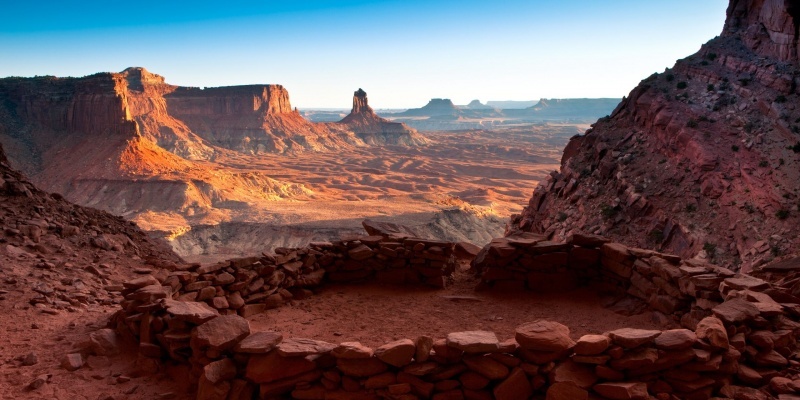
Canyonlands National Park, Northeast Utah near Moab
The name of this spectacular National Park says it all; it is truly a land of canyons. Set aside as a National Monument in 1964, Canyonlands National Park contains some of the most awe-inspiring and remote Colorado Plateau scenery that one can find. Telling a geologic story nearly 350 million years old, Canyonlands retains all the features that make it a master class in Colorado Plateau geology and all of Utah’s Mighty 5 National Parks. Here you will find numerous sandstone arches, hoodoos, remote slot canyons, towering cliffs and mesas, faults, folds, salt domes, meteorite impacts, and a collection of some of the most important rock layers of the Paradox Basin, a fundamentally important piece of the geologic puzzle on the Colorado Plateau.
More remote and less-visited than its across-the-highway neighbor Arches National Park, Canyonlands is a place where you feel truly connected to nature, the past, present, and even the future; it’s a place where one can truly ponder the beauty, grace, complexity and its diametric simplicity of the Colorado Plateau in all of its unabashed glory. It holds the confluence of perhaps the West’s two most important rivers; the Colorado and the Green, each of which, along with their tributaries has intricately carved this vast land of seemingly endless gashes in the Earth, each more spectacular and foreboding than the last. Time here has painted, carved, woven, and stitched together the very fabric of what makes Utah and the southwest such an alluring place, and Canyonlands National Park is an absolute forget-about-it must for any outdoor adventurer.
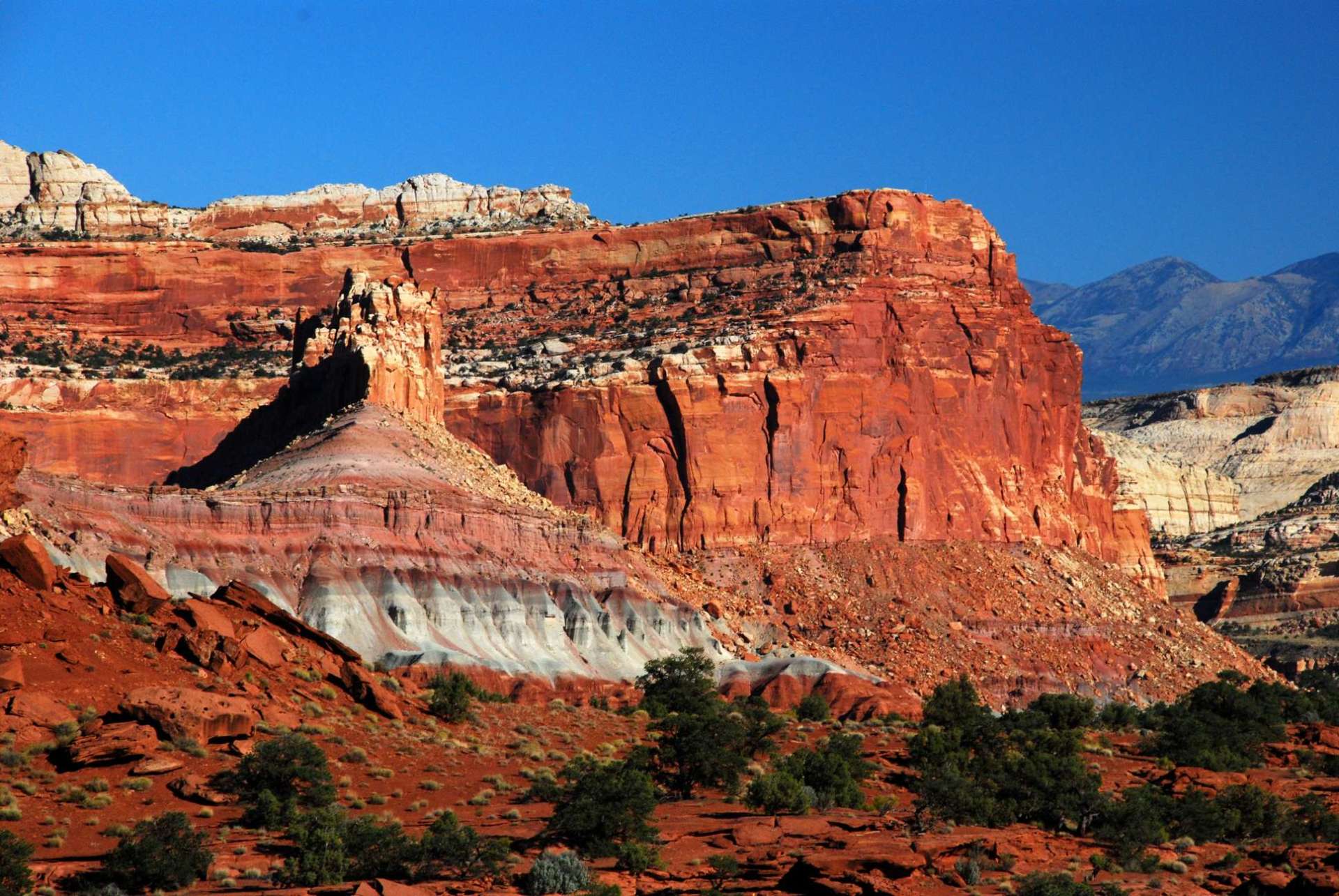
Capitol Reef National Park, Central Utah near Boulder
Perhaps the most underrated National Park in the entire system, and certainly in Utah, is Capitol Reef National Park. Capitol Reef is akin to the forgotten middle child who is class valedictorian, goes to an Ivy League school, becomes a cutting-edge neurosurgeon, and nobody notices. Anyone who knows this middle child would tell you of its brilliance, its beauty, its allure, and its potential. However, not enough people have paid attention because all of its other siblings happen to be smart, beautiful, famous, and in-demand as well.
Born into National Park designation in 1970, Capitol Reef National Park is a veritable outdoor geology laboratory. The wilderness protects a 100-mile long monocline known as The Waterpocket Fold, so names due to the many erosional pockets which house water after rain events. The structure is a towering reminder of the tectonic forces that built the Rocky Moutains, and is one of the most well-exposed, spectacular, largest, and well-preserved (not eroded) such structures on Earth. Along its rugged spine are towering cliffs and mesas that take the form of domes that are reminiscent of capitol buildings found in Washington DC among other big cities, giving their moniker to this wonderful place. The reef portion of the park’s name comes from the foreboding cliffs that seem to guard its secrets, as reefs are commonly known as barriers to travel.
Capitol Reef has many advantages that its sibling parks lack; the best of all being solitude and proximity to large metropolitan areas. Capitol Reef National Park is, quite literally, in the middle of nowhere. Whereas Zion and Bryce are but 2-3 hours from Las Vegas and large highways, and Arches/Canyonlands are just outside of the world-renowned tourist mecca of Moab, Capitol Reef’s largest, nearest city is Boulder; population: 3,500.
No major highways allow easy access, and just getting to Capitol Reef is half the fun, as an approach from any direction takes you into the heart of Utah’s Canyon Country. In addition, it shares its southern border with Grand-Staircase Escalante National Monument, making access from that direction even more adventurous. Some of the most unspoiled wilderness, star-gazing, hiking, and outdoor recreation opportunities are contained within this utterly spectacular and outstanding slice of outdoor heaven. Consider yourself warned.
For more information about Capitol Reef National Park, give us a call or reserve a spot on one of our fantastic guided Utah geology hiking tours!
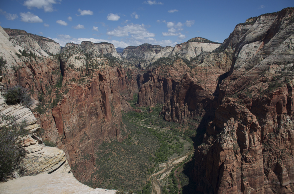
Zion National Park, Southwest Utah near St. George
Considered by many to be one of the premier National Parks not just in the United States but in the world, Zion National Park ranks as the 6th-most visited National Park in the system. Within its borders are contained some of the most iconic and famous trails and landmarks in the southwest, including Angel’s Landing, The Subway, and The Watchtower to name a few. Despite its visitation numbers, the crowds typically flock to the most well-known parts of the park, and there is plenty of solitude to be found in Zion’s remote and beautiful backcountry.
Located south of Bryce Canyon in Utah’s High Plateau Country, Zion is a wonderful melange of geologic layercake that makes the Colorado Plateau famous. At almost 7,000 feet average elevation, Zion is a land of deeply-eroded canyons, towering cliffs, and is often referred to as “Yosemite Dressed in Red” by it many adoring fans. The Virgin River, which is ultimately the forming body in Lake Mead east of Las Vegas, is also the primary erosional force at work in Zion National Park, and it along with is tributaries have cut into the sunset-red rocks to sculpt Zion’s outrageous and almost daunting scenery.
When to Visit
Summer serves as the park’s busy visitation season with consistent temperatures, stable weather, and ample vacation time for families. However, Zion can be enjoyed year-round, and the hearty outdoor adventure traveler will enjoy the relative solitude offered in the cooler months between October and May.
With so many great adventures to be had, choosing the right one for you can be the hardest part! Give us a call for information about any of these wonderful places, or reserve a spot on one of our fabulous tours and let our expert geologist/guides take you on an epic journey!
Going Guided
Hiking and exploring Utah and its National Parks, is a special experience. Although it is possible to see these places yourself, hiring a guide is a great idea. For instance, guiding services provide logistical support, and plan everything for your best possible trip. They provide a great safety net on the trail, and are trained in backcountry medicine. Above all, they provide a depth of knowledge of the region that turns a walk into a true adventure.
Blue Marble Adventure GeoTourism provides all of the support you need, and pairs that with expert geologist/guides. Our backcountry meals use fresh ingredients, and are planned by a professional chef. Furthermore, we provide top-of-the-line gear and passion for the places we explore. In conclusion, you can visit National Parks, but going with a guide can create and even more memorable experience. Don’t be shy, and call us!
Read our blog!
For adventure hiking vacations in a geologic time machine, see our epic tours in Grand Canyon, Utah, and Arizona!
For geological musings read The Goat’s geology blog.
Follow us on Facebookand Instagram
Explore Further, Be Wild, See Through Time — Blue Marble Adventure GeoTourism
by The Goat | Aug 27, 2019 | Backpacking, Grand Canyon, Hiking, National Parks
What are the Best Backpacking Trips in Grand Canyon?
Grand Canyon National Park can be a nearly overwhelming place. What do I do? Where should I go? Even for seasoned backpackers, the choices can be endless and exhausting. The Goat has compiled a list especially for you, outlining backpacking trips in Grand Canyon for all skill and experience levels. Enjoy!
5. The Hermit Loop
Time: 3 days, 2 nights
Distance: 18 miles
Difficulty: Undergraduate+
The Hermit Loop is a truly classic Grand Canyon backpacking trip that can be easily accomplished over a long weekend. It is a great hike for those who are looking to take their first backpacking foray into the big ditch, and truly hits all the highlights. Sweeping vistas, interesting side trips, and excellent canyon history await on a trail forged originally by the “hermit of the Grand Canyon”, Mr. Louis Boucher. The route was later improved by the Santa Fe Railroad Line in an attempt to bring mining, then tourism, into the area.
4. Tuckup Canyon via the Stairway to Heaven
Time: 7 days, 6 nights
Distance: 45 miles
Get your defibrillator, this one is not for the faint of heart. Located in one of the most remote parts of Grand Canyon, this long, challenging loop is meant for experienced cannoneers only. This route takes ambitious hikers down Tuckup Canyon, past Shaman’s Gallery (recognized as one of the most spectacular rock art etchings in the American Southwest), through a traverse along the mighty Colorado River, and then up Stairway Canyon. Along the way, there are exciting climbing, route-finding, and scrambling challenges, and . Strap in!
3. Thunder River to Deer Creek
Time: 4 days, 3 nights
Distance: 28 miles
The Thunder River to Deer Creek Loop is perhaps the North Rim’s most fabulous backpacking trip. Multiple water sources, outstanding scenery, and a truly thunderous river. Geologically speaking, Thunder River is one of the most unique features in Grand Canyon. It begins as an underground river (aquifer) up on the Kaibab Plateau. It flows along various fault lines and crustal weaknesses until it breaks loose at the contact of the permeable Esplanade Group (mostly shales) and the impermeable Redwall Limestone, quite literally thundering onto the rocks below.
2. Rim-to-Rim via Phantom Ranch
Time: 4 days, 3 nights
Distance: 19 miles
This is the true Grand Canyon classic backpacking trip. Starting at the North Rim, your descent begins on the North Kaibab Trail as it winds it way down to the Colorado River. Along the way hikers are treated to unspoiled views, soaring eagles, and a well-developed trail. Thru-hikers may camp at Bright Angel Campground, or stay in the lodge at the famed Phantom Ranch. From here hikers may choose to ascend either the South Kaibab Trail (shorter, steeper) or the Bright Angel Trail (more miles) and stay the second night on the Esplanade. After cresting on the South Rim, be sure to gaze upon your North Rim starting point. This is one of the most popular trips in Grand Canyon, so be sure to make your reservations early! For those who want an alternate, consider the Rim-to-River and Back hike.
1. The Escalante Route
Time: 5 days, 4 nights
Distance: 35 miles
Carved by early Puebloan explorers of Grand Canyon, this long traverse of Grand Canyon from the Tanner Trail to Horseshoe Mesa and Grandview is perhaps one of the finest backpacking trips on the planet. There is a little bit of everything Grand Canyon here, as hikers will encounter outrageous views of the Great Unconformity, sandy beaches, a class 3 scramble over the famous Papago Wall, and a spectacular slot canyon carved from billion-year-old Shinumo Quartzite. This route confronts with hikers with the unimaginable scale of Grand Canyon, as it will seem as though you are climbing mountains in a canyon. Grand!
Going Guided
Hiking and exploring Grand Canyon, or any of the National Parks, is a special experience. Although it is possible to see these places yourself, hiring a guide is a great idea. For instance, guiding services provide logistical support, and plan everything for your best possible trip. They provide a great safety net on the trail, and are trained in backcountry medicine. Above all, they provide a depth of knowledge of the region that turns a walk into a true adventure.
Blue Marble Adventure GeoTourism provides all of the support you need, and pairs that with expert geologist/guides. Our backcountry meals use fresh ingredients, and are planned by a professional chef. Furthermore, we provide top-of-the-line gear and passion for the places we explore. In conclusion, you can visit National Parks, but going with a guide can create and even more memorable experience. Don’t be shy, and call us!
Read our blog!
For adventure hiking vacations in a geologic time machine, see our epic tours in Grand Canyon, Utah, and Arizona!
For geological musings read The Goat’s geology blog.
Follow us on Facebookand Instagram
Explore Further, Be Wild, See Through Time — Blue Marble Adventure GeoTourism