by The Goat | Aug 27, 2019 | Arches, Bryce Canyon, Canyonlands, History, National Parks, Utah Canyon Country, Zion
What are the 5 National Parks in Utah?
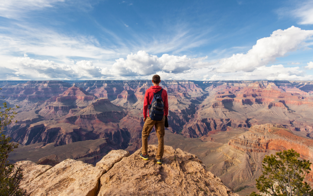
Breathe in, breathe out. Survey the scene. Take it all in. This is the most outrageous scenery anywhere in the world, and you are right in the middle of it. Utah’s Canyon Country is a geological fantasy, and an adventure hikers dream. In this wild land there are five National Parks, each of them holding distinction as some of the most iconic on the planet. Zion, Bryce, Capitol Reef, Arches, and Canyonlands National Parks hold some of the most world famous scenery, whimsical geology, and thrilling adventure that people from all over the world flock to, and The Goat is here to give you a first-hand glimpse of what to expect when spelunking Utah’s Canyon Country.
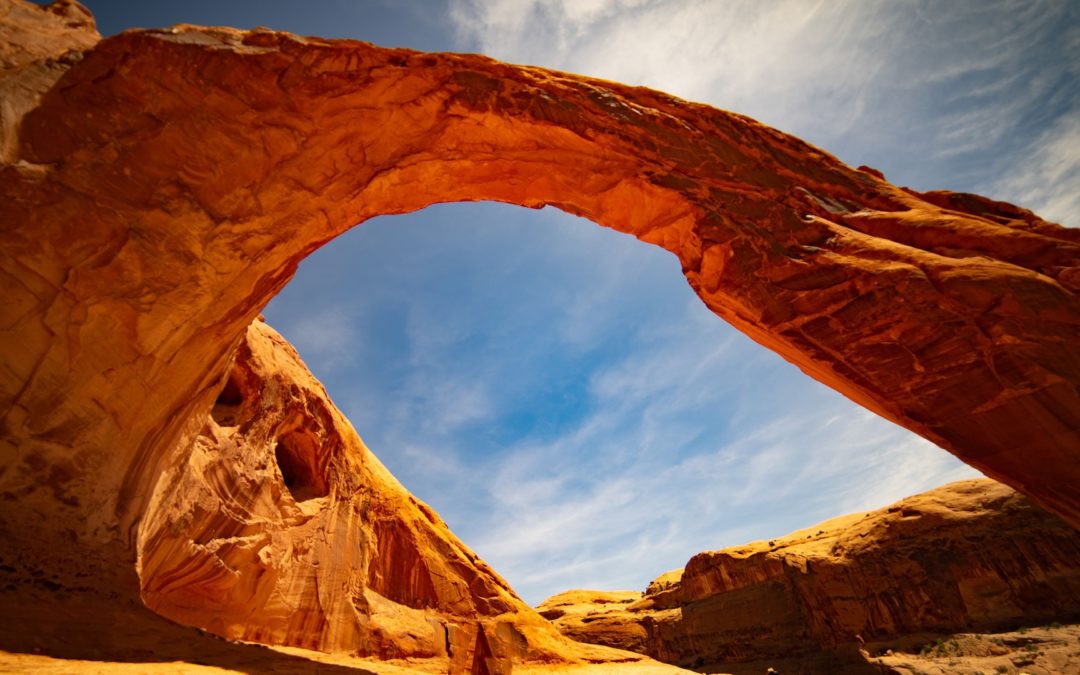
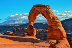
Arches National Park, Northeast Utah near Moab
Arches National Park is perhaps the most famous place in the world. Although that is an incredibly bold statement, there is nothing that represents the Colorado Plateau, the Southwest, and indeed, The United States, quite like an image from Arches. Delicate Arch, pictured above, is without a doubt the most famous natural arch in the world, and is one of the most famous and photographed destinations in the southwest. Quick, think of an image that represents America. We dare you to conjure an image, or series of images, that does not include these iconic features and their namesake National Park.
Established in 1929 as a National Monument by Herbert Hoover then upgraded to a National Park by Richard Nixon in 1969, Arches National Park is home to the largest and densest concentration of sedimentary arches in the world. The literally thousands of arches are among several geologic features that are unique and specific to Arches National Park, and it is markedly different from its neighbor Canyonlands National Park just to the southwest. Arches is set atop a massive salt deposit laid down by an ancient sea roughly 300 million years ago, and this is the special ingredient that has allowed for the fabulous features for which it is most famous.
Set in Utah’s high desert climate, weather in Arches is punctuated by hot summers, mild winters, and seasonal monsoons that can dump most of its 10 inches of yearly precipitation in just a few events. The weather is also one of the root causes for the park’s unique geology, as the unpredictable nature of precipitation, freezing, lake of competent soils, and other factors contribute daily to shape this wondrous piece of the Colorado Plateau.
Check out our Guided Geology Tours of Arches National Park
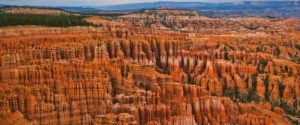
Bryce Canyon National Park, Southwest Utah near St. George
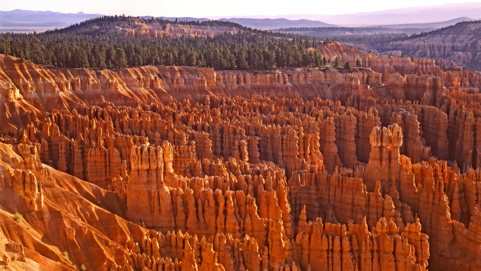
Fun Fact #1 about Bryce Canyon: It’s not a canyon (bet you didn’t see that coming). Geologically speaking, Bryce Canyon and Bryce Canyon National Park is a natural amphitheater, carved out by millions of years of the erosion of the soft lacustrine (lake) sediments. The most famous feature of the park, its “hoodoos”, are carved out of the Claron Formation, otherwise known as the beautiful pink and orange sandy limestone that caps the entire park. Want to make a few new friends? Hug a hoodoo!
Southwestern Utah, wherein Bryce Canyon National Park is located, is a fundamentally unique and spectacular geologic marvel. Here you will stand in awe as you see the underpinnings of the meetings of two geologic provinces and the forces that shape them both. The Colorado Plateau and the Basin and Range provinces come together in this general region, making Utah’s High Plateau Country what it is; high plateaus that are former mountains that have been acted upon by millions of years of erosion by wind and water.
Faults to the west and east, remnants of the forces that built the Rocky Mountains, have thrust southwestern Utah skyward creating unique topography that is of nearly ridiculous proportions. Bryce Canyon sits at an average elevation of over 8,000 feet, which is quite astonishing considering that it is over 1,000 feet higher than its neighbor Zion National Park. When you think of Bryce Canyon, do you think of elevations higher than average elevations in the Appalachian Mountains? Most don’t, so you’re not alone!
Summer is a great time to visit Bryce Canyon National Park, although that is when the park sees most of its nearly 2.5 million yearly visitors. Winter brings snow and cooler temperatures, though it can lend fantastic solitude to the masterful scenery. Spring and fall can bring unpredictable weather events including snow and rain, but don’t let that stop you, the shoulder seasons are likely the ideal time to visit, as you will avoid winter chill and summer crowds, a rare duel threat.
For more information about Bryce Canyon National Park, give us a call or reserve a spot on one of our fantastic guided Utah geology hiking tours!
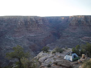
Canyonlands National Park, Northeast Utah near Moab
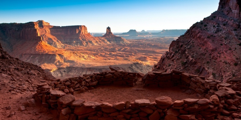
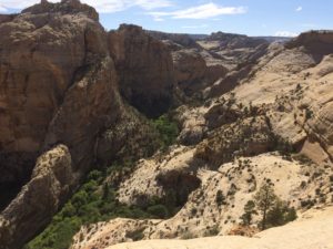
The name of this spectacular National Park says it all; it is truly a land of canyons. Set aside as a National Monument in 1964, Canyonlands National Park contains some of the most awe-inspiring and remote Colorado Plateau scenery that one can find. Telling a geologic story nearly 350 million years old, Canyonlands retains all the features that make it a master class in Colorado Plateau geology and all of Utah’s Mighty 5 National Parks. Here you will find numerous sandstone arches, hoodoos, remote slot canyons, towering cliffs and mesas, faults, folds, salt domes, meteorite impacts, and a collection of some of the most important rock layers of the Paradox Basin, a fundamentally important piece of the geologic puzzle on the Colorado Plateau.
More remote and less-visited than its across-the-highway neighbor Arches National Park, Canyonlands is a place where you feel truly connected to nature, the past, present, and even the future; it’s a place where one can truly ponder the beauty, grace, complexity and its diametric simplicity of the Colorado Plateau in all of its unabashed glory. It holds the confluence of perhaps the West’s two most important rivers; the Colorado and the Green, each of which, along with their tributaries has intricately carved this vast land of seemingly endless gashes in the Earth, each more spectacular and foreboding than the last. Time here has painted, carved, woven, and stitched together the very fabric of what makes Utah and the southwest such an alluring place, and Canyonlands National Park is an absolute forget-about-it must for any outdoor adventurer.
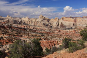
Capitol Reef National Park, Central Utah near Boulder
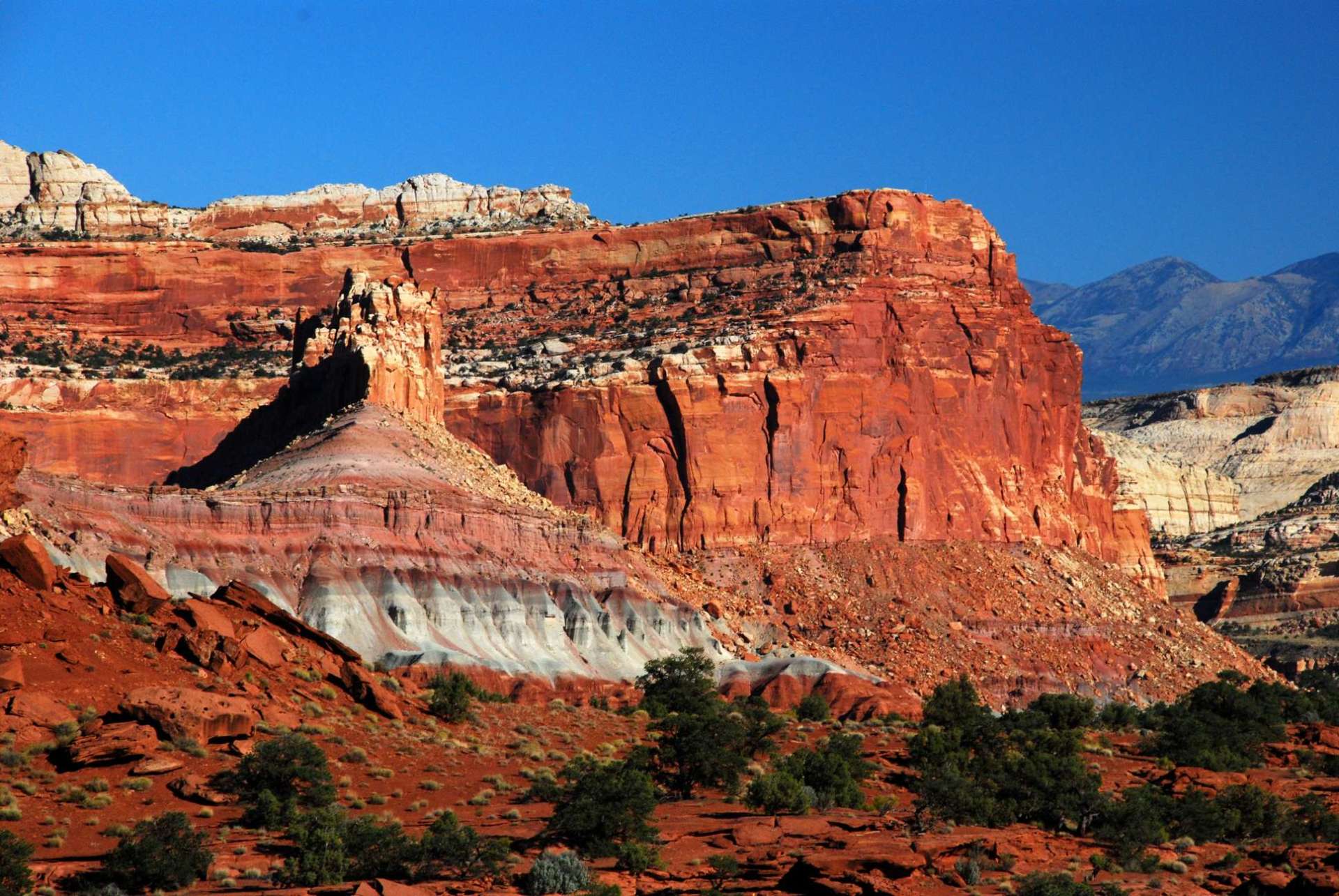
Perhaps the most underrated National Park in the entire system, and certainly in Utah, is Capitol Reef National Park. Capitol Reef is akin to the forgotten middle child who is class valedictorian, goes to an Ivy League school, becomes a cutting-edge neurosurgeon, and nobody notices. Anyone who knows this middle child would tell you of its brilliance, its beauty, its allure, and its potential. However, not enough people have paid attention because all of its other siblings happen to be smart, beautiful, famous, and in-demand as well.
Born into National Park designation in 1970, Capitol Reef National Park is a veritable outdoor geology laboratory. The wilderness protects a 100-mile long monocline known as The Waterpocket Fold, so names due to the many erosional pockets which house water after rain events. The structure is a towering reminder of the tectonic forces that built the Rocky Moutains, and is one of the most well-exposed, spectacular, largest, and well-preserved (not eroded) such structures on Earth. Along its rugged spine are towering cliffs and mesas that take the form of domes that are reminiscent of capitol buildings found in Washington DC among other big cities, giving their moniker to this wonderful place. The reef portion of the park’s name comes from the foreboding cliffs that seem to guard its secrets, as reefs are commonly known as barriers to travel.
Capitol Reef has many advantages that its sibling parks lack; the best of all being solitude and proximity to large metropolitan areas. Capitol Reef National Park is, quite literally, in the middle of nowhere. Whereas Zion and Bryce are but 2-3 hours from Las Vegas and large highways, and Arches/Canyonlands are just outside of the world-renowned tourist mecca of Moab, Capitol Reef’s largest, nearest city is Boulder; population: 3,500.
No major highways allow easy access, and just getting to Capitol Reef is half the fun, as an approach from any direction takes you into the heart of Utah’s Canyon Country. In addition, it shares its southern border with Grand-Staircase Escalante National Monument, making access from that direction even more adventurous. Some of the most unspoiled wilderness, star-gazing, hiking, and outdoor recreation opportunities are contained within this utterly spectacular and outstanding slice of outdoor heaven. Consider yourself warned.
For more information about Capitol Reef National Park, give us a call or reserve a spot on one of our fantastic guided Utah geology hiking tours!
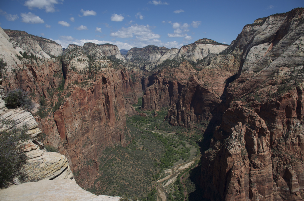
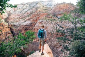
Zion National Park, Southwest Utah near St. George
Considered by many to be one of the premier National Parks not just in the United States but in the world, Zion National Park ranks as the 6th-most visited National Park in the system. Within its borders are contained some of the most iconic and famous trails and landmarks in the southwest, including Angel’s Landing, The Subway, and The Watchtower to name a few. Despite its visitation numbers, the crowds typically flock to the most well-known parts of the park, and there is plenty of solitude to be found in Zion’s remote and beautiful backcountry.
Located south of Bryce Canyon in Utah’s High Plateau Country, Zion is a wonderful melange of geologic layercake that makes the Colorado Plateau famous. At almost 7,000 feet average elevation, Zion is a land of deeply-eroded canyons, towering cliffs, and is often referred to as “Yosemite Dressed in Red” by it many adoring fans. The Virgin River, which is ultimately the forming body in Lake Mead east of Las Vegas, is also the primary erosional force at work in Zion National Park, and it along with is tributaries have cut into the sunset-red rocks to sculpt Zion’s outrageous and almost daunting scenery.
When to Visit
Summer serves as the park’s busy visitation season with consistent temperatures, stable weather, and ample vacation time for families. However, Zion can be enjoyed year-round, and the hearty outdoor adventure traveler will enjoy the relative solitude offered in the cooler months between October and May.
With so many great adventures to be had, choosing the right one for you can be the hardest part! Give us a call for information about any of these wonderful places, or reserve a spot on one of our fabulous tours and let our expert geologist/guides take you on an epic journey!
Going Guided
Hiking and exploring Utah and its National Parks, is a special experience. Although it is possible to see these places yourself, hiring a guide is a great idea. For instance, guiding services provide logistical support, and plan everything for your best possible trip. They provide a great safety net on the trail, and are trained in backcountry medicine. Above all, they provide a depth of knowledge of the region that turns a walk into a true adventure.
Blue Marble Adventure GeoTourism provides all of the support you need, and pairs that with expert geologist/guides. Our backcountry meals use fresh ingredients, and are planned by a professional chef. Furthermore, we provide top-of-the-line gear and passion for the places we explore. In conclusion, you can visit National Parks, but going with a guide can create and even more memorable experience. Don’t be shy, and call us!
Read our blog!
For adventure hiking vacations in a geologic time machine, see our epic tours in Grand Canyon, Utah, and Arizona!
For geological musings read The Goat’s geology blog.
Follow us on Facebookand Instagram
Explore Further, Be Wild, See Through Time — Blue Marble Adventure GeoTourism
by The Goat | Aug 27, 2019 | Arches, Backpacking, Bears Ears, Canyonlands, Geology, Grand Canyon, Grand Staircase-Escalante, Hiking, The Wave, Utah Canyon Country, Vermillion Cliffs
The Bucket List Countdown
Everyone has a list. A daily list, a chore list, a grocery list, an assignment list, a to do list, a list of…..? None of these lists are fun, nor do they really do anything to further joy and appreciation of the beauty of the natural world. This is where the bucket list comes in. A life to do list, a list of things that if we accomplished them we would pass into time and space as happy souls; souls that knew there was nothing more that they needed to accomplish. That, my friends, is the only to-do list that you should really pay any mind.
What we have here is the Top 10 places to see in the American Southwest before time and space claims you for their own. These 10 locations not only encompass everything that makes the Southwest special, but are places that fill us with wonder, joy, mystery, energy, beauty, and a sense of being that can only be achieved by realizing just how special a place our Earth is.
The foundational specialty of the top 10 is the mind-bending geologic scales that they present to us. This is not a comprehensive list but rather one compiled of The Goat’s personal tastes and experiences. Come along on a journey through time!
10. Glen Canyon National Recreation Area, Arizona
Glen Canyon National Recreation Area provides almost limitless opportunities to hike, backpack, boat, swim, and recreate (hence the name). Though much of its splendor has been covered by the waters of Lake Powell behind Glen Canyon Dam, the area remains a splendrous wonderland of rock and scenery. Coursing from the seasonally-populated town of Hite in the north to Glen Canyon Dam itself, GCNRA traverses a stark and beautiful land along the former path of the Colorado River.
Among these fabulous places are Coyote Gulch, Choprock and Neon Canyons, and West Canyon among others. These canyons in particular still display the outrageous scenery and fairy tale-esque environments that Glen Canyon held before being impounded by the “beavers”.
Slickrock country abounds here, with canyons carved into orange and red-hued Navajo Sandstone and the aptly-named Glen Canyon Group. The rocks here are of Jurassic age, and record tidal mud flats and incredibly vast wind-blown desert sand dunes, which is thought to be the largest desert in recorded geologic history.
The Goat’s advice: get off the lake and into the canyons if you truly want to see this fantastic place. The Canyons of the Escalante, part of the northwesterly arm that extends from the Colorado, holds many remnants of the entombed wonderland. However, many features (such as the famous Rainbow Bridge) can be reached by boat which is a fun way to see this stark rock paradise set against the blue waters of Lake Powell.
Main Attractions:
Deep, sinewy slickrock canyons replete with arches, natural bridges, waterfalls, ancient ruins, and Lake Powell.
How to Get There:
For the easiest lake access, head to the town of Page, Arizona and one of the many marinas. From nearly anywhere else along its boundaries in southern Utah, GCNRA can be accessed by foot via countless canyons.
Optimal Seasons:
Hiking in Glen Canyon is best enjoyed from March to June, and late September to November. Lake Powell is a wonderful summertime destination.
9. Bryce Canyon National Park
Set in south-central Utah, Bryce Canyon contains deeply carved amphitheaters and ubiquitous hoodoos draped in orange. Erosional remainders of ancient freshwater lakes, these hoodoos create a fairyland of rocks that is extraordinarily unique. Many of the hoodoos sit in deep basins that appear almost like large theaters, beckoning to audiences to watch their show.
Bryce Canyon checks in as one of the smaller National Parks at just over 50,000 acres, but contained within it is jaw-dropping scenery that will surprise and delight. Before you leave, you may feel as though you have 100,000 new hoodoo friends, as each one of them seems to take on a certain unique persona.
This area was covered by large, freshwater lakes in the Pleistocene between 8-10 million years ago. Regional tectonic uplift and and erosion by dripping water, wind, and time has sculpted this outstanding landscape.
Main Attractions:
A veritable forest of the geologic oddity known as the hoodoo. The hoodoos here are erosional remains of once-cohesive blocks of sandy limestone that have been carved slowly by the forces of geologic time. Other features, such as spires and buttes, tower above the trails that snake their way through the golden-tinted hoodoos into secret grottos and cavernous alcoves. Truly stupendous!
How to Get There:
Take Utah Highway 12, a National Scenic Byway, south from Escalante, or north from Panguitch, Utah. The nearest major airport is in St. George, Utah, about 4 hours from the park.
Optimal Season:
The best season in Bryce Canyon is late spring to early fall, but winter brings snow and chilly weather.
8. Bears Ears National Monument, Utah
In the southeast corner of the state lies one of our newest National Monuments, Bears Ears. Conferred by President Barack Obama in December of 2016, the designation of Bears Ears has been a source of controversy and conflict. This controversy boiled into a nearly 85% reduction of the monument in 2017 by the current White House occupant, Donald Trump. The reduction is being litigated in Federal Court, and a final decision on the boundaries of Bears Ears awaits a judges gavel.
Bears Ears, named for twin buttes that stand sentinel over the 1.6-million acre Monument, is an absolute treasure trove of cultural, geologic, and ecological resources. Though its claim to fame are the thousands of ruins and relics left behind by generations of Anasazi Puebloans, the landscape itself is incredibly diverse and nearly unrivaled in its scenic value.
Bears Ears contains three distinct provinces: the lowlands of the Valley of the Gods, Cedar Mesa and its gashing Grand Gulch, and the Fable Plateau home of spectacular Dark Canyon and the famous Bears Ears. A short climb up the Bears Ears reveals sprawling views across much of the Grand Staircase to the southwest, north to the Canyonlands and the Orange Cliffs.
Valley of the Gods and San Juan River Country
Sitting at the base of Cedar Mesa and the historic Moki Dugway is the Valley of the Gods. Sometimes referred to as “Little Monument Valley”, Valley of the Gods is filled with large buttes and mesas sculpted into shapes that truly resemble sitting deities watching over their domain. Slightly to the southwest flows the San Juan River on its way to meet the Colorado River, goosenecking through the Monument Upwarp. The Upwarp is a massive wrinkle in Earth’s crust, remnant structure of the forces that built the Rocky Mountains. The core of this structure has been eroded and dissected, leaving the landscape beheld today.
Cedar Mesa
Up the Moki Dugway, a twisting, narrow “highway” climbing the sheer sandstone cliffs, sits Cedar Mesa. This is the most popular place in the Bears Ears, with many miles of well-trod trails into Grand Gulch, its canyon. Contained within Grand Gulch is the hundreds, if not thousands or ruin sites left by its former denizens, the Anasazi. The tribes abandoned the area under mysterious circumstances, leaving behind structures, petroglyphs, and pottery; many of these relics are in excellent condition.
The Fable Plateau
The final northernmost slice of Bears Ears is the Fable Plateau, a soaring mesa topping out at nearly 9000 feet. The mesa is carpeted with forests of aspens, fir trees, and wildflowers in the summer. Hidden in the back of beyond, a stunning landscape awaits.
Dark Canyon, perhaps America’s last wilderness frontier, is a little-explored and deep defile rivaling Grand Canyon in its scale and beauty. Sheer red and orange walls dive precipitously to its depths, where the narrows rarely see full sun; thus Dark Canyon. Revealed in this utterly surreal canyon is 100 million years of Earth’s history, recording sand-blown deserts to large rivers, and ancient seas that teemed with life. Set directly east of Canyonlands National Park, Dark Canyon is a hidden gem that rivals the most popular National Parks for scenery, and far surpasses them for wilderness solitude.
Main Attractions:
Bears Ears boasts looming buttes in the Valley of the Gods, ancient ruins in Grand Gulch, and wild, wooly, spectacular scenery in Dark Canyon. All of this can be see unencumbered and without a soul in sight.
How to Get There:
The small towns of Bluff and Blanding in Utah provide good jump-off points to the Fable Plateau and Cedar Mesa via Highway 95 west. valley of the Gods is best accessed by heading south from 95 down the Moki Dugway. The nearest airports are Grand Junction, Colorado or Flagstaff, Arizona.
Optimal Season:
Bears Ears can be enjoyed any time of year, but spring and fall are best. Summers are hot, but tolerable. Winters can bring snow to the Fable area, but is generally tolerable.
7. Waterpocket Fold, Capitol Reef National Park, Utah
The Colorado Plateau is a geologist’s paradise for several reasons. It is the preeminent showcase of relatively undisturbed sedimentary strata on the globe. Bound by mountains on all sides, including the mighty Rockies, The Plateau has somewhat mysteriously remained largely intact and undeformed since at least the Triassic, or roughly 250 million years. However, there are deformation structures within the province. The largest, most spectacular of these is a monocline known as The Waterpocket Fold in Capitol Reef National Park of Utah.
The Waterpocket Fold is a 100-mile long upwarp in the Earth’s crust, remnants of the powerful geologic forces that built the Rocky Mountains. These tectonic forces, known as the Laramide Orogeny, resulted in numerous monoclines, or single-flexure folds, across The Plateau. The Waterpocket Fold is by far the most impressive. To see this fold is to truly behold the power of Earth’s processes; those that can thrust mountains thousands of feet into the sky, and those that can bend hard rocks like silly putty.
The names of this surprising feature come from two histories:
The fold gets its name from the countless divots on its domed head that collect water after rain; thus water pockets. It is also called “Capitol Reef”: “Capitol” from the Navajo Sandstone domes resembling government buildings in Washington DC, and “Reef” from its standing as an incredibly formidable barrier to travel similar to coral reefs impeding boat travel in the ocean.
Main Attractions:
The Waterpocket Fold is the particular feature of interest in, or better yet is, the Capitol Reef. Within its impenetrable cliffs are arches, natural bridges, creeks with waterfalls, ruins, petroglyphs, deep canyons, and outstanding natural scenery. The fold gets its name from the countless divots on its domed head that collect water after rain; thus water pockets.
How to Get There:
Capitol Reef National Park is near the town of Fremont in central Utah. Highway 24 runs directly through the park.
Optimal Season:
Spring and fall are best, but Capitol Reef is nice any time of year. Summers are warm, but tolerable. Winter can bring snow and cold, although this brings intense beauty,
6. Zion National Park, Utah
How does one describe perhaps the most dramatic cliff and canyon topography on the planet? Try this: it’s like walking into the most dramatic cliff and canyon topography on the planet. The walls of Zion Canyon stretch up nearly 2000 feet over its floor. With its main access being from the bottom-up, very unique in the world of canyons, Zion presents an astonishing perspective that truly makes one feel minute. Zion owes its drama to (what else), its geology and the incredibly specific sequence of events that occurred.
What happened here?
Zion sits on the southwest margin of the Colorado Plateau Province, directly at its border with the Basin and Range Province. The Basin and Range is a vast area of the southwest from essentially Las Vegas down to Phoenix and out west to Los Angeles that has been subjected to extensional tectonics. That is, the crust is literally pulling itself apart like silly putty. Zion’s location is the reason for its existence. With the Basin and Range faulting and pulling downwards to the southwest, the Virgin River has been forced to flow out and down at a high rate while the margins of the Plateau “bounce” back up in buoyant resistance to the gravitational pull of the Basin and Range.
This dual-headed action has resulted in the extraordinary and incredibly dramatic landscape, and is also the reason that access is from the bottom instead of the top, like most canyons. Zion is an incredibly special place that presents a spectacle nearly unmatched on the planet. Why is it only #6 on this list, you ask? Crowds, plain and simple. Summer is when the throngs of people descend like locusts, when it’s over 100 degrees most days. Despite being one of the smaller National Parks, it receives roughly the same visitation as much larger parks like Grand Canyon, Yellowstone, and Yosemite. Ever tried to jam yourself into the crawlspace of your attic in the summer? Welcome to Zion! If you would truly like to enjoy this place fully, visit in the off-seasons such as spring or fall. Winter, when the cliffs are covered in snow, is particularly special.
Main Attractions:
Zion Canyon is the main attraction here, with massive, soaring walls of red-orange sandstone glowering down at the valleys below. “Yosemite Dressed in Red” also boasts arches, mesas, buttes, exhilarating cliff hiking, and in the northern Kolob Canyon part of the park, less crowds.
How to Get There:
Zion can be accessed easily from Las Vegas via I-15, which is partly why it’s so popular. The towns of Rockdale and Springdale are quaint, if not touristy, little towns right at the mouth of the canyon.
Optimal Season:
Summers are hot and crowded. Winter can be snowy and chilly, but drives away the crowds and drapes the red walls in crisp white. Spring and fall are the best seasons.
5. Arches National Park, Utah
Made famous in Edward Abbey’s classic Desert Solitaire, the Arches is an intensely special and truly one-of-a-kind place. Home to the largest concentration of natural rock arches in the world, Arches National Park is a stunning and mind-bending. Over 2000 arches have been discovered here, and more wait in the wilderness. The iconic symbol of Utah, if not the entire canyon country, is Delicate Arch. Presiding over a large amphitheater and framing the La Sal mountains to the east, Delicate Arch is truly magnificent.
Like most of the places on this list, Arches is the result of a very specific set of geologic events. First (and most importantly) vast deposits of salt were laid down as ancient seas filled and evaporated in ceaseless cycles of oscillating climate. Salt behaves strangely, not like other rocks as you might imagine. It “flows” when subjected to pressure, and deforms very easily. This deformation combined with upward flow has resulted in the incredibly and precisely sculpted arches, which would not exist without it.
Main Attraction:
Simply put: the Arches. Arches National Park also contains other incredibly unique salt deformation structures such as domes, strike valleys, grabens, and undrinkable saline springs.
How to Get There:
The Arches are easily accessed from the town of Moab, Utah. Moab has an airport and many amenities like hotels, restaurants, and shops.
Optimal Season:
Avoid the summers, as it is interminably hot and crowded. Winter can be chilly, but Delicate Arch draped in snow is a sight to behold. Spring and fall are the best seasons.
4. Grand Staircase-Escalante National Monument, Utah and Arizona
A rose by any name is still a rose. Nowhere is this saying more true than at The Staircase, or The Escalante if you prefer. The scale and twisted geology of this place is almost overwhelming at times, and its remoteness only adds to its splendor. Despite having 1.3 millions acres contained within the monument, it only houses 15-20 developed trails. making backcountry travel and navigation skills a must to see much of the area. The Staircase is about as wild as it gets in the Lower 48.
Wild sandstone hoodoos, mesas, and almost hauntingly twisted sedimentary formations greet visitors at every turn. The sediments in the Grand Staircase, named for its star-step like appearance from afar, record geologic history from the Permian to the late Cretaceous, or about 175 million years.
Recently this monument has come under attack from the Trump “administration”. Like Bears Ears, the Grand Staircase has seen a reduction in its size by over 50%. Surprising to nobody, mining companies have moved in to claim areas once made off-limits by the monument. Contact us to find out how you can help this special place be saved.
Main Attractions:
The Grand Staircase has it all. Here, explorers can find the heart of canyon country. From deeply-incised canyons to 10000 foot mountains, there is something for every adventure appetite here. Several new species of dinosaurs have been discovered here, as well as 650 species of bees, some endemic to GSENM.
How to Get There:
There are several points of access into the Grand Staircase. The town of Kanab, UT is the largest and provides the most amenities. The towns of Escalante and Boulder are classic canyon country towns. Page, AZ also offers good access.
Optimal Seasons:
There is a place for every season in the Grand Staircase, although summers are pretty warm. However, summer can be fabulous in the watery canyons, and cooling off under a showering spring is an excellent activity. Spring and fall are the best times to visit, and winter should probably be avoided.
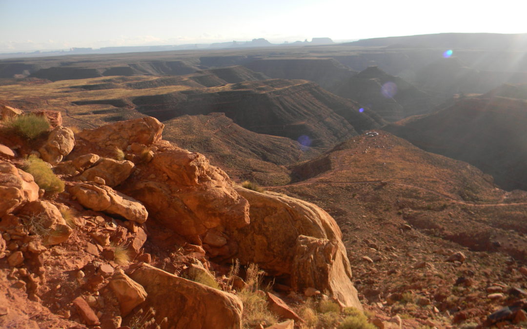
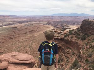
3. Canyonlands National Park, Utah
This is where the canyon country puts on its grandest display. Canyonlands National Park can be described in one sentence: this place is nuts! From the Island in the Sky to The Needles to The Maze, Canyonlands forcefully makes a case for the most spectacular scenery on the planet.
This massive park, one of the largest in the National Park system, is divided into three distinct provinces. We’ll begin there.
Island in the Sky
This district is wonderful for first-time visitors to the park. It provides expansive views to the other two, more remote districts and contains many easily-explored and very famous features. Mesa Arch and Upheaval Dome are wonderful features to explore. Grandview Point elicits outstanding, sweeping views from atop vertical cliffs plunging 1000 feet straight down.
The Needles
The Needles District explores carefully-sculpted geologic features known as hoodoos. Cut into multi-hued Permian-aged (280Ma) rock, this district retains the distinct look of a giant pincushion. Hikers can approach the Colorado River from here via a few different, rugged trails.
The Maze
Perhaps the most remote place in the lower 48, The Maze is precisely what it sounds like. A dizzying network of canyons and rock, The Maze is reserved for the most adventurous canyon country explorers. Not to be missed here is the Chocolate Drops, the Alligators Teeth, and the Land of the Standing Rocks.
Main Attractions:
There are too many to list here. Canyonlands is impossible to experience in a day or two, especially with the incredible variation between the districts. The Maze is easily the least popular, and Island in the Sky the most popular. If you have one day, do overlooks at Island in the Sky. Upheaval Dome is also not to be missed.
The Needles contains outrageous arches and rock formations, though most are accessed by relatively long (4+ mile one-way) trails.
The Maze is the absolute definition of wilderness and requires commitment just to get there. Enjoy!
How to Get There:
The easiest access into Canyonlands is from Moab, UT. Moab provides access to Island in the Sky and the Needles. If you want to access The Maze, be prepared to drive for at least 3-4 hours over 4WD roads.
Optimal Season:
Spring and fall are the best seasons to visit the Canyonlands (noticing a pattern?). Island in the Sky can be a fine summer destination, but the Needles and Maze should be approached carefully. Winter can be a dramatically-fabulous time to visit, but stay out of the water.
2. Vermillion Cliffs National Monument, Arizona
Home to perhaps the most famous geologic formation in the world, Vermillion Cliffs is one of the most sought after destinations in the southwest. Known for its difficult access, remote location, and stunning geology, this is one place that cannot be missed.
Look at your screensaver right now. Pick up a postcard. There’s a good chance the picture on it is from the Vermillion Cliffs. The Wave, the most famous, graces much of the marketing material for the American Southwest.
How Was the Wave Formed?
Although it is named “The Wave”, water has little to do with this feature. It is carved in the Jurassic Navajo Sandstone, interpreted as a massive, Sahara-like desert. Wind, time, and small amounts of seaonally-flowing water has sculpted The Wave to its current beauty. Permits to see this feature can be hard to come by, but it is certainly worth the wait. Read our blog covering how to get permits to see this feature.
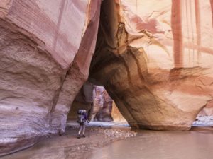
There are several other destinations here, however, including the longest, deepest slot canyon in the United States (Buckskin Gulch), the outstanding White Pocket, and Paria Canyon.
Main Attractions:
Nakedly exposed geology is on tap here, and The Wave itself, along with the mind-bending formations found all across this outstanding wilderness, are musts for anyone interested in beauty.
How to Get There:
Best access is from the towns of Page, AZ or Kanab, UT, but all access requires 4WD and knowledge of how to use it.
Optimal Season:
Spring and fall are the best times of the year to visit (once again). Summers are very hot, but if a permit to The Wave is involved the date on your permit is the optimal season. Winters are chilly and can bring snow, but also create rare and fantastic photo opportunities.
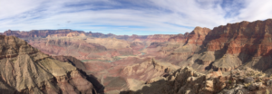
1. Grand Canyon National Park, Arizona
Truly the Grandaddy of them all, The Grand Canyon does and will always reign supreme as the jewel of the American Southwest. Overwhelming in its grandeur, humbling in its splendor, inspiring in its presence, this canyon is absolutely nothing short of grand.
There is very little to say about The Grand that has not been said in hyperbole for over 100 years. Teddy Roosevelt immediately designated it for protection shortly after his visit in 1904, and people have been coming in droves to gaze upon one of the official natural wonders of the world. Nearly 6 million people per year Grand Canyon, but it is not hard to find solitude on the trails and away from the busy parts of the park.
As one walks down the trails here, keep in mind that for each step is worth nearly 100,000 years. The rocks at the rim are roughly 260 million years old, and the rocks at the Colorado River in the inner gorge are roughly 1.9 billion years old. That means with 16,000 steps, you will have traveled 1.6 billion years back in time when you reach the river. Not bad for a day.
There is a lifetime’s worth of hikes, backpacking trips, and even scenic drives that await for the novice to the seasoned traveler. This is most certainly THE bucket list item.
Main Attraction:
A giant freaking hole in the ground, but a ridiculously beautiful hole.
How to Get Here:
Access South Rim from Flagstaff or Tusayan, AZ, and access to North Rim is best from Kanab, UT or Jacob Lake, AZ.
Optimal Seasons:
Seasons vary depending on activity and location. Late spring to early fall are optimal times on both rims, but fall to spring is best for being in the Inner Gorge.
Going Guided
Oftentimes the best way to experience these nearly overwhelming places is on a guided tour. Guides provide several things: safety, security, logistics, transportation, food, water, and a depth of knowledge gained over years of experience in these wild lands.
Many of the places listed here require keen navigation skills, lack water, and can present difficult challenges with climate, wildlife, exposure to heights, and elevation changes. Hiring a guide can eliminate all of those potential issues, and allow guests to simply enjoy their surroundings. Blue Marble Adventure GeoTourism provides outstanding service, top-of-the-line-gear, professional geologist/guides, and handles all logistics. Guarantee your best trip ever! Go Guided!
The Goat’s Final Word
There it is, the best geologic adventures in the West. The naked rock wildernesses of the Colorado Plateau provide limitless and life-changing experiences. These 10 locations are not only the best adventures in the southwest, they represent some of the best adventure and scenery in the world.
The bottom line: immediately drop that foolish chore list you are holding and start dreaming beyond your gutters. The greater world waits for you, but don’t wait for it.
Like our blog? Check out one of our guided tours through geologic time to Grand Canyon, Utah Canyon Country, and Arizona Red Rock Country.
Explore Further, Be Wild, See Through Time — Blue Marble Adventure GeoTourism