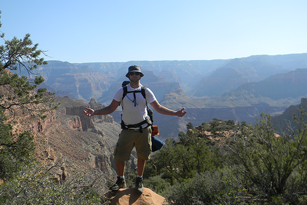
by The Goat | Aug 27, 2019 | Backpacking, Hiking
Blue Marble’s Fitness Crash Course Part 1: Setting Goals and Committing
For tasty recipes to fuel your training visit The Goat’s blog.
Getting in shape is not easy. It takes commitment, focus, and above all, a goal. When was the last time you just started exercising for no particular reason? Did you follow through with the plan? Likely not. You are not alone my friends. Training with no goal is like going to school without the prospect of graduating. Where does it start? Where does it end? How do you motivate yourself everyday without some kind of light at the end of the tunnel?
Whether it’s finishing an Ironman Triathlon or simply making it up the hill down the street, a goal set and achieved not only gives a sense of personal pride when it’s accomplished, but also gives you something very specific to work toward, which helps dial in your training regimen.
So, before you do anything else, figure out what it is you want to accomplish. Hike rim to rim at the Grand Canyon? Summit a 14,000ft peak? Do a multi-mile dayhike in Sedona? All of these are excellent goals, and all of them require different fitness levels and training regimens. In Part 1 of this series, we will discuss setting a goal and laying the groundwork that will launch you into feeling good, and above all feeling like you can actually get where you want to go.
The number one reason that people burn out in the early stages of any fitness program is that they start off balls-to-the-wall. Going to the gym and maxing out for two hours on day one accomplishes nothing but soreness, fatigue, and even injury. These consequences are not only detrimental to your body, but your emotional and mental investment in your plan will deteriorate quickly and you will fail. Start with much less than you think you can handle in the first two weeks, and move forward from there. You will gain confidence, avoid injury, and lay the groundwork for the next few months of real training.
In addition, your diet plays an important role in your workout regimen and overall health. It is extremely important to fill your calorie quota and, above all, stay hydrated. Eating multiple small meals per day packed with lean meat protein, nuts, greens, and fruits will keep your body fueled and ramp up your metabolism, which will burn that pesky fat and quickly help you to get in top condition (And don’t forget to reward yourself with something (a cookie, piece of cake, etc.) daily, you earned it!). Unfortunately, this is where many more health plans fail: people equate diet and exercise with starving themselves and maxing out their exercise. Once more, this is not only counterproductive, but dangerous and not recommended for maximum Goatiness. See our diet blog post for great recipes, and diet tips.
Below you will find the framework for a daily workout over two weeks that will set the foundation of training for your ultimate goal. Our program will seek to strengthen your core, lower body, and cardiovascular fitness, and generally work every muscle group without inducing fatigue. This program assumes that you are person in average physical condition (not significantly overweight or injured, do not have health problems, or have participated in a workout program recently). Please consult a physician before starting any workout program, and do not continue and exercise if you begin to feel pain or prolonged faintness.
*Abdominal Program: 10 situps, 10 crunches, 10 leg lifts, 20 bicycles
Week 1:
Day 1: 1 min. jumprope, 5 pull-ups, 15 pushups, 1x abdominal program*, 10 minute run at a casual pace (1 min. run, 1 min, walk, repeat)
Day 2: 1 min. jumprope, 1x abdominal program, 20 calf raises, 20 squats (no weights), 30 sec. plank 10 minute run (1 min. run, 1 min, walk, repeat)
Day 3: 1 min. jumprope, Swim 200m freestyle (50m, rest for 1 min) OR Bike for 30 mins straight on gentle topography at a casual pace
Day 4: 1 min. jumprope, 5 pull-ups, 20 pushups, 1x abdominal, 10 minute run (1 min. run, 1 min, walk, repeat for 10 mins)
Day 5: 1 min. jumprope, 10 lateral shuffles….
10 burpees….
10 lunges….
……30 sec. plank, 5 minute run (1.5 min run, 1 min walk, repeat)
Day 6: 1 min. jumprope, 1x abdominal….
20 calf raises….
20 squats (no weights)…..
…..Swim 200m freestyle (50m, rest for 1 min) OR Bike for 30 mins straight on gentle topography at a casual pace
Day 7: The Goat’s 20 min. Yoga (Check it out on Blue MarbleTV)
In week 2, we will take what we accomplished in week 1 and bring it up another notch. Important in week two is staying focused and pushing through the “week 2 blues”. This is when many workout plans lose their momentum, as people start to lose their week 1 fire and start to let other things get in the way. This is part of the reason to start slow and let it grow, rather than coming out guns blazing in week 1; so that when week two rolls around, you will want more, and not be willing to skip a day. Keep at it Goats!
Week 2:
Day 1: 1 min. jumprope, 2x (5 pull-ups, 15 pushups, 1x abdominal program*), 10 minute run (2 min run, 1 min walk, repeat)
Day 2: 1 min. jumprope, 2x (1x abdominal program, 20 calf raises, 20 squats (no weights), 1 min. plank, 10 minute run (2 min run, 1 min walk, repeat)
Day 3: 1 min. jumprope, Swim 300m freestyle (50m, rest for 1 min) OR Bike for 45 mins. straight on gentle topography at a casual pace
Day 4: 1 min. jumprope, 2x (5 pull-ups, 15 pushups, 1x abdominal), 10 minute run (2 min run, 1 min walk, repeat)
Day 5: 1 min. jumprope, 15 lateral shuffles, 15 burpees, 15 knee-ups, 1 min. plank, 7 minute run, (1.5 min run, 1 min walk, repeat)
Day 6: 1 min. jumprope, 2x (1x abdominal, 20 calf raises, 20 squats (no weights)), Swim 200m freestyle (50m, rest for 1 min) OR Bike for 30 mins straight on gentle topography at a casual pace
Day 7 : The Goat’s 20 min. Yoga (Check it out on Blue MarbleTV)
So there it is my friends; two weeks for the rest of your life. With this foundation, which was relatively easily achieved, you can now start really training for your goal. With a positive mental attitude, some intestinal fortitude, and flowing endorphins, you will be on top of that mountain in no time. See you There!
Stay tuned as we lay out training regimens for backpacking/dayhiking, canyoneering/climbing/scrambling, as well as Grand Canyon/Plateau Country Backpacking, and Mountain Backpacking
Going Guided
Hiking and exploring American Southwest is a special experience. Although it is possible to see these places yourself, hiring a guide is a great idea. For instance, guiding services provide logistical support, and plan everything for your best possible trip. They provide a great safety net on the trail, and are trained in backcountry medicine. Above all, they provide a depth of knowledge of the region that turns a walk into a true adventure.
Blue Marble Adventure GeoTourism provides all of the support you need, and pairs that with expert geologist/guides. Our backcountry meals use fresh ingredients, and are planned by a professional chef. Furthermore, we provide top-of-the-line gear and passion for the places we explore. In conclusion, you can visit National Parks, but going with a guide can create and even more memorable experience. Don’t be shy, and call us!
Read our blog!
For adventure hiking vacations in a geologic time machine, see our epic tours in Grand Canyon, Utah, and Arizona!
For geological musings read The Goat’s geology blog.
Follow us on Facebookand Instagram
Explore Further, Be Wild, See Through Time — Blue Marble Adventure GeoTourism
by The Goat | Aug 27, 2019 | Arches, Backpacking, Bears Ears, Canyonlands, Geology, Grand Canyon, Grand Staircase-Escalante, Hiking, The Wave, Utah Canyon Country, Vermillion Cliffs
The Bucket List Countdown
Everyone has a list. A daily list, a chore list, a grocery list, an assignment list, a to do list, a list of…..? None of these lists are fun, nor do they really do anything to further joy and appreciation of the beauty of the natural world. This is where the bucket list comes in. A life to do list, a list of things that if we accomplished them we would pass into time and space as happy souls; souls that knew there was nothing more that they needed to accomplish. That, my friends, is the only to-do list that you should really pay any mind.
What we have here is the Top 10 places to see in the American Southwest before time and space claims you for their own. These 10 locations not only encompass everything that makes the Southwest special, but are places that fill us with wonder, joy, mystery, energy, beauty, and a sense of being that can only be achieved by realizing just how special a place our Earth is.
The foundational specialty of the top 10 is the mind-bending geologic scales that they present to us. This is not a comprehensive list but rather one compiled of The Goat’s personal tastes and experiences. Come along on a journey through time!
10. Glen Canyon National Recreation Area, Arizona
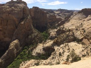
Glen Canyon National Recreation Area provides almost limitless opportunities to hike, backpack, boat, swim, and recreate (hence the name). Though much of its splendor has been covered by the waters of Lake Powell behind Glen Canyon Dam, the area remains a splendrous wonderland of rock and scenery. Coursing from the seasonally-populated town of Hite in the north to Glen Canyon Dam itself, GCNRA traverses a stark and beautiful land along the former path of the Colorado River.
Among these fabulous places are Coyote Gulch, Choprock and Neon Canyons, and West Canyon among others. These canyons in particular still display the outrageous scenery and fairy tale-esque environments that Glen Canyon held before being impounded by the “beavers”.
Slickrock country abounds here, with canyons carved into orange and red-hued Navajo Sandstone and the aptly-named Glen Canyon Group. The rocks here are of Jurassic age, and record tidal mud flats and incredibly vast wind-blown desert sand dunes, which is thought to be the largest desert in recorded geologic history.
The Goat’s advice: get off the lake and into the canyons if you truly want to see this fantastic place. The Canyons of the Escalante, part of the northwesterly arm that extends from the Colorado, holds many remnants of the entombed wonderland. However, many features (such as the famous Rainbow Bridge) can be reached by boat which is a fun way to see this stark rock paradise set against the blue waters of Lake Powell.
Main Attractions:
Deep, sinewy slickrock canyons replete with arches, natural bridges, waterfalls, ancient ruins, and Lake Powell.
How to Get There:
For the easiest lake access, head to the town of Page, Arizona and one of the many marinas. From nearly anywhere else along its boundaries in southern Utah, GCNRA can be accessed by foot via countless canyons.
Optimal Seasons:
Hiking in Glen Canyon is best enjoyed from March to June, and late September to November. Lake Powell is a wonderful summertime destination.
9. Bryce Canyon National Park
Set in south-central Utah, Bryce Canyon contains deeply carved amphitheaters and ubiquitous hoodoos draped in orange. Erosional remainders of ancient freshwater lakes, these hoodoos create a fairyland of rocks that is extraordinarily unique. Many of the hoodoos sit in deep basins that appear almost like large theaters, beckoning to audiences to watch their show.
Bryce Canyon checks in as one of the smaller National Parks at just over 50,000 acres, but contained within it is jaw-dropping scenery that will surprise and delight. Before you leave, you may feel as though you have 100,000 new hoodoo friends, as each one of them seems to take on a certain unique persona.
This area was covered by large, freshwater lakes in the Pleistocene between 8-10 million years ago. Regional tectonic uplift and and erosion by dripping water, wind, and time has sculpted this outstanding landscape.
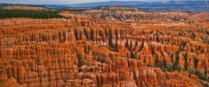
Main Attractions:
A veritable forest of the geologic oddity known as the hoodoo. The hoodoos here are erosional remains of once-cohesive blocks of sandy limestone that have been carved slowly by the forces of geologic time. Other features, such as spires and buttes, tower above the trails that snake their way through the golden-tinted hoodoos into secret grottos and cavernous alcoves. Truly stupendous!
How to Get There:
Take Utah Highway 12, a National Scenic Byway, south from Escalante, or north from Panguitch, Utah. The nearest major airport is in St. George, Utah, about 4 hours from the park.
Optimal Season:
The best season in Bryce Canyon is late spring to early fall, but winter brings snow and chilly weather.
8. Bears Ears National Monument, Utah
In the southeast corner of the state lies one of our newest National Monuments, Bears Ears. Conferred by President Barack Obama in December of 2016, the designation of Bears Ears has been a source of controversy and conflict. This controversy boiled into a nearly 85% reduction of the monument in 2017 by the current White House occupant, Donald Trump. The reduction is being litigated in Federal Court, and a final decision on the boundaries of Bears Ears awaits a judges gavel.
Bears Ears, named for twin buttes that stand sentinel over the 1.6-million acre Monument, is an absolute treasure trove of cultural, geologic, and ecological resources. Though its claim to fame are the thousands of ruins and relics left behind by generations of Anasazi Puebloans, the landscape itself is incredibly diverse and nearly unrivaled in its scenic value.
Bears Ears contains three distinct provinces: the lowlands of the Valley of the Gods, Cedar Mesa and its gashing Grand Gulch, and the Fable Plateau home of spectacular Dark Canyon and the famous Bears Ears. A short climb up the Bears Ears reveals sprawling views across much of the Grand Staircase to the southwest, north to the Canyonlands and the Orange Cliffs.
Valley of the Gods and San Juan River Country
Sitting at the base of Cedar Mesa and the historic Moki Dugway is the Valley of the Gods. Sometimes referred to as “Little Monument Valley”, Valley of the Gods is filled with large buttes and mesas sculpted into shapes that truly resemble sitting deities watching over their domain. Slightly to the southwest flows the San Juan River on its way to meet the Colorado River, goosenecking through the Monument Upwarp. The Upwarp is a massive wrinkle in Earth’s crust, remnant structure of the forces that built the Rocky Mountains. The core of this structure has been eroded and dissected, leaving the landscape beheld today.
Cedar Mesa
Up the Moki Dugway, a twisting, narrow “highway” climbing the sheer sandstone cliffs, sits Cedar Mesa. This is the most popular place in the Bears Ears, with many miles of well-trod trails into Grand Gulch, its canyon. Contained within Grand Gulch is the hundreds, if not thousands or ruin sites left by its former denizens, the Anasazi. The tribes abandoned the area under mysterious circumstances, leaving behind structures, petroglyphs, and pottery; many of these relics are in excellent condition.
The Fable Plateau
The final northernmost slice of Bears Ears is the Fable Plateau, a soaring mesa topping out at nearly 9000 feet. The mesa is carpeted with forests of aspens, fir trees, and wildflowers in the summer. Hidden in the back of beyond, a stunning landscape awaits.
Dark Canyon, perhaps America’s last wilderness frontier, is a little-explored and deep defile rivaling Grand Canyon in its scale and beauty. Sheer red and orange walls dive precipitously to its depths, where the narrows rarely see full sun; thus Dark Canyon. Revealed in this utterly surreal canyon is 100 million years of Earth’s history, recording sand-blown deserts to large rivers, and ancient seas that teemed with life. Set directly east of Canyonlands National Park, Dark Canyon is a hidden gem that rivals the most popular National Parks for scenery, and far surpasses them for wilderness solitude.
Main Attractions:
Bears Ears boasts looming buttes in the Valley of the Gods, ancient ruins in Grand Gulch, and wild, wooly, spectacular scenery in Dark Canyon. All of this can be see unencumbered and without a soul in sight.
How to Get There:
The small towns of Bluff and Blanding in Utah provide good jump-off points to the Fable Plateau and Cedar Mesa via Highway 95 west. valley of the Gods is best accessed by heading south from 95 down the Moki Dugway. The nearest airports are Grand Junction, Colorado or Flagstaff, Arizona.
Optimal Season:
Bears Ears can be enjoyed any time of year, but spring and fall are best. Summers are hot, but tolerable. Winters can bring snow to the Fable area, but is generally tolerable.
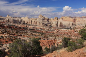
7. Waterpocket Fold, Capitol Reef National Park, Utah
The Colorado Plateau is a geologist’s paradise for several reasons. It is the preeminent showcase of relatively undisturbed sedimentary strata on the globe. Bound by mountains on all sides, including the mighty Rockies, The Plateau has somewhat mysteriously remained largely intact and undeformed since at least the Triassic, or roughly 250 million years. However, there are deformation structures within the province. The largest, most spectacular of these is a monocline known as The Waterpocket Fold in Capitol Reef National Park of Utah.
The Waterpocket Fold is a 100-mile long upwarp in the Earth’s crust, remnants of the powerful geologic forces that built the Rocky Mountains. These tectonic forces, known as the Laramide Orogeny, resulted in numerous monoclines, or single-flexure folds, across The Plateau. The Waterpocket Fold is by far the most impressive. To see this fold is to truly behold the power of Earth’s processes; those that can thrust mountains thousands of feet into the sky, and those that can bend hard rocks like silly putty.
The names of this surprising feature come from two histories:
The fold gets its name from the countless divots on its domed head that collect water after rain; thus water pockets. It is also called “Capitol Reef”: “Capitol” from the Navajo Sandstone domes resembling government buildings in Washington DC, and “Reef” from its standing as an incredibly formidable barrier to travel similar to coral reefs impeding boat travel in the ocean.
Main Attractions:
The Waterpocket Fold is the particular feature of interest in, or better yet is, the Capitol Reef. Within its impenetrable cliffs are arches, natural bridges, creeks with waterfalls, ruins, petroglyphs, deep canyons, and outstanding natural scenery. The fold gets its name from the countless divots on its domed head that collect water after rain; thus water pockets.
How to Get There:
Capitol Reef National Park is near the town of Fremont in central Utah. Highway 24 runs directly through the park.
Optimal Season:
Spring and fall are best, but Capitol Reef is nice any time of year. Summers are warm, but tolerable. Winter can bring snow and cold, although this brings intense beauty,
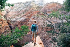
6. Zion National Park, Utah
How does one describe perhaps the most dramatic cliff and canyon topography on the planet? Try this: it’s like walking into the most dramatic cliff and canyon topography on the planet. The walls of Zion Canyon stretch up nearly 2000 feet over its floor. With its main access being from the bottom-up, very unique in the world of canyons, Zion presents an astonishing perspective that truly makes one feel minute. Zion owes its drama to (what else), its geology and the incredibly specific sequence of events that occurred.
What happened here?
Zion sits on the southwest margin of the Colorado Plateau Province, directly at its border with the Basin and Range Province. The Basin and Range is a vast area of the southwest from essentially Las Vegas down to Phoenix and out west to Los Angeles that has been subjected to extensional tectonics. That is, the crust is literally pulling itself apart like silly putty. Zion’s location is the reason for its existence. With the Basin and Range faulting and pulling downwards to the southwest, the Virgin River has been forced to flow out and down at a high rate while the margins of the Plateau “bounce” back up in buoyant resistance to the gravitational pull of the Basin and Range.
This dual-headed action has resulted in the extraordinary and incredibly dramatic landscape, and is also the reason that access is from the bottom instead of the top, like most canyons. Zion is an incredibly special place that presents a spectacle nearly unmatched on the planet. Why is it only #6 on this list, you ask? Crowds, plain and simple. Summer is when the throngs of people descend like locusts, when it’s over 100 degrees most days. Despite being one of the smaller National Parks, it receives roughly the same visitation as much larger parks like Grand Canyon, Yellowstone, and Yosemite. Ever tried to jam yourself into the crawlspace of your attic in the summer? Welcome to Zion! If you would truly like to enjoy this place fully, visit in the off-seasons such as spring or fall. Winter, when the cliffs are covered in snow, is particularly special.
Main Attractions:
Zion Canyon is the main attraction here, with massive, soaring walls of red-orange sandstone glowering down at the valleys below. “Yosemite Dressed in Red” also boasts arches, mesas, buttes, exhilarating cliff hiking, and in the northern Kolob Canyon part of the park, less crowds.
How to Get There:
Zion can be accessed easily from Las Vegas via I-15, which is partly why it’s so popular. The towns of Rockdale and Springdale are quaint, if not touristy, little towns right at the mouth of the canyon.
Optimal Season:
Summers are hot and crowded. Winter can be snowy and chilly, but drives away the crowds and drapes the red walls in crisp white. Spring and fall are the best seasons.
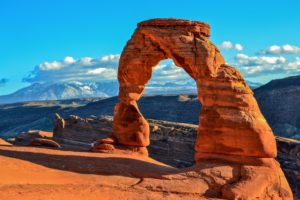
5. Arches National Park, Utah
Made famous in Edward Abbey’s classic Desert Solitaire, the Arches is an intensely special and truly one-of-a-kind place. Home to the largest concentration of natural rock arches in the world, Arches National Park is a stunning and mind-bending. Over 2000 arches have been discovered here, and more wait in the wilderness. The iconic symbol of Utah, if not the entire canyon country, is Delicate Arch. Presiding over a large amphitheater and framing the La Sal mountains to the east, Delicate Arch is truly magnificent.
Like most of the places on this list, Arches is the result of a very specific set of geologic events. First (and most importantly) vast deposits of salt were laid down as ancient seas filled and evaporated in ceaseless cycles of oscillating climate. Salt behaves strangely, not like other rocks as you might imagine. It “flows” when subjected to pressure, and deforms very easily. This deformation combined with upward flow has resulted in the incredibly and precisely sculpted arches, which would not exist without it.
Main Attraction:
Simply put: the Arches. Arches National Park also contains other incredibly unique salt deformation structures such as domes, strike valleys, grabens, and undrinkable saline springs.
How to Get There:
The Arches are easily accessed from the town of Moab, Utah. Moab has an airport and many amenities like hotels, restaurants, and shops.
Optimal Season:
Avoid the summers, as it is interminably hot and crowded. Winter can be chilly, but Delicate Arch draped in snow is a sight to behold. Spring and fall are the best seasons.
4. Grand Staircase-Escalante National Monument, Utah and Arizona
A rose by any name is still a rose. Nowhere is this saying more true than at The Staircase, or The Escalante if you prefer. The scale and twisted geology of this place is almost overwhelming at times, and its remoteness only adds to its splendor. Despite having 1.3 millions acres contained within the monument, it only houses 15-20 developed trails. making backcountry travel and navigation skills a must to see much of the area. The Staircase is about as wild as it gets in the Lower 48.
Wild sandstone hoodoos, mesas, and almost hauntingly twisted sedimentary formations greet visitors at every turn. The sediments in the Grand Staircase, named for its star-step like appearance from afar, record geologic history from the Permian to the late Cretaceous, or about 175 million years.
Recently this monument has come under attack from the Trump “administration”. Like Bears Ears, the Grand Staircase has seen a reduction in its size by over 50%. Surprising to nobody, mining companies have moved in to claim areas once made off-limits by the monument. Contact us to find out how you can help this special place be saved.
Main Attractions:
The Grand Staircase has it all. Here, explorers can find the heart of canyon country. From deeply-incised canyons to 10000 foot mountains, there is something for every adventure appetite here. Several new species of dinosaurs have been discovered here, as well as 650 species of bees, some endemic to GSENM.
How to Get There:
There are several points of access into the Grand Staircase. The town of Kanab, UT is the largest and provides the most amenities. The towns of Escalante and Boulder are classic canyon country towns. Page, AZ also offers good access.
Optimal Seasons:
There is a place for every season in the Grand Staircase, although summers are pretty warm. However, summer can be fabulous in the watery canyons, and cooling off under a showering spring is an excellent activity. Spring and fall are the best times to visit, and winter should probably be avoided.
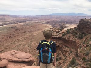
3. Canyonlands National Park, Utah
This is where the canyon country puts on its grandest display. Canyonlands National Park can be described in one sentence: this place is nuts! From the Island in the Sky to The Needles to The Maze, Canyonlands forcefully makes a case for the most spectacular scenery on the planet.
This massive park, one of the largest in the National Park system, is divided into three distinct provinces. We’ll begin there.
Island in the Sky
This district is wonderful for first-time visitors to the park. It provides expansive views to the other two, more remote districts and contains many easily-explored and very famous features. Mesa Arch and Upheaval Dome are wonderful features to explore. Grandview Point elicits outstanding, sweeping views from atop vertical cliffs plunging 1000 feet straight down.
The Needles
The Needles District explores carefully-sculpted geologic features known as hoodoos. Cut into multi-hued Permian-aged (280Ma) rock, this district retains the distinct look of a giant pincushion. Hikers can approach the Colorado River from here via a few different, rugged trails.
The Maze
Perhaps the most remote place in the lower 48, The Maze is precisely what it sounds like. A dizzying network of canyons and rock, The Maze is reserved for the most adventurous canyon country explorers. Not to be missed here is the Chocolate Drops, the Alligators Teeth, and the Land of the Standing Rocks.
Main Attractions:
There are too many to list here. Canyonlands is impossible to experience in a day or two, especially with the incredible variation between the districts. The Maze is easily the least popular, and Island in the Sky the most popular. If you have one day, do overlooks at Island in the Sky. Upheaval Dome is also not to be missed.
The Needles contains outrageous arches and rock formations, though most are accessed by relatively long (4+ mile one-way) trails.
The Maze is the absolute definition of wilderness and requires commitment just to get there. Enjoy!
How to Get There:
The easiest access into Canyonlands is from Moab, UT. Moab provides access to Island in the Sky and the Needles. If you want to access The Maze, be prepared to drive for at least 3-4 hours over 4WD roads.
Optimal Season:
Spring and fall are the best seasons to visit the Canyonlands (noticing a pattern?). Island in the Sky can be a fine summer destination, but the Needles and Maze should be approached carefully. Winter can be a dramatically-fabulous time to visit, but stay out of the water.
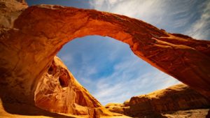
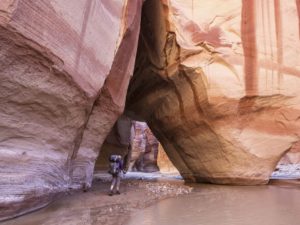
2. Vermillion Cliffs National Monument, Arizona
Home to perhaps the most famous geologic formation in the world, Vermillion Cliffs is one of the most sought after destinations in the southwest. Known for its difficult access, remote location, and stunning geology, this is one place that cannot be missed.
Look at your screensaver right now. Pick up a postcard. There’s a good chance the picture on it is from the Vermillion Cliffs. The Wave, the most famous, graces much of the marketing material for the American Southwest.
How Was the Wave Formed?
Although it is named “The Wave”, water has little to do with this feature. It is carved in the Jurassic Navajo Sandstone, interpreted as a massive, Sahara-like desert. Wind, time, and small amounts of seaonally-flowing water has sculpted The Wave to its current beauty. Permits to see this feature can be hard to come by, but it is certainly worth the wait. Read our blog covering how to get permits to see this feature.
There are several other destinations here, however, including the longest, deepest slot canyon in the United States (Buckskin Gulch), the outstanding White Pocket, and Paria Canyon.
Main Attractions:
Nakedly exposed geology is on tap here, and The Wave itself, along with the mind-bending formations found all across this outstanding wilderness, are musts for anyone interested in beauty.
How to Get There:
Best access is from the towns of Page, AZ or Kanab, UT, but all access requires 4WD and knowledge of how to use it.
Optimal Season:
Spring and fall are the best times of the year to visit (once again). Summers are very hot, but if a permit to The Wave is involved the date on your permit is the optimal season. Winters are chilly and can bring snow, but also create rare and fantastic photo opportunities.
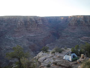
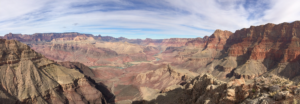
1. Grand Canyon National Park, Arizona
Truly the Grandaddy of them all, The Grand Canyon does and will always reign supreme as the jewel of the American Southwest. Overwhelming in its grandeur, humbling in its splendor, inspiring in its presence, this canyon is absolutely nothing short of grand.
There is very little to say about The Grand that has not been said in hyperbole for over 100 years. Teddy Roosevelt immediately designated it for protection shortly after his visit in 1904, and people have been coming in droves to gaze upon one of the official natural wonders of the world. Nearly 6 million people per year Grand Canyon, but it is not hard to find solitude on the trails and away from the busy parts of the park.
As one walks down the trails here, keep in mind that for each step is worth nearly 100,000 years. The rocks at the rim are roughly 260 million years old, and the rocks at the Colorado River in the inner gorge are roughly 1.9 billion years old. That means with 16,000 steps, you will have traveled 1.6 billion years back in time when you reach the river. Not bad for a day.
There is a lifetime’s worth of hikes, backpacking trips, and even scenic drives that await for the novice to the seasoned traveler. This is most certainly THE bucket list item.
Main Attraction:
A giant freaking hole in the ground, but a ridiculously beautiful hole.
How to Get Here:
Access South Rim from Flagstaff or Tusayan, AZ, and access to North Rim is best from Kanab, UT or Jacob Lake, AZ.
Optimal Seasons:
Seasons vary depending on activity and location. Late spring to early fall are optimal times on both rims, but fall to spring is best for being in the Inner Gorge.
Going Guided
Oftentimes the best way to experience these nearly overwhelming places is on a guided tour. Guides provide several things: safety, security, logistics, transportation, food, water, and a depth of knowledge gained over years of experience in these wild lands.
Many of the places listed here require keen navigation skills, lack water, and can present difficult challenges with climate, wildlife, exposure to heights, and elevation changes. Hiring a guide can eliminate all of those potential issues, and allow guests to simply enjoy their surroundings. Blue Marble Adventure GeoTourism provides outstanding service, top-of-the-line-gear, professional geologist/guides, and handles all logistics. Guarantee your best trip ever! Go Guided!
The Goat’s Final Word
There it is, the best geologic adventures in the West. The naked rock wildernesses of the Colorado Plateau provide limitless and life-changing experiences. These 10 locations are not only the best adventures in the southwest, they represent some of the best adventure and scenery in the world.
The bottom line: immediately drop that foolish chore list you are holding and start dreaming beyond your gutters. The greater world waits for you, but don’t wait for it.
Like our blog? Check out one of our guided tours through geologic time to Grand Canyon, Utah Canyon Country, and Arizona Red Rock Country.
Explore Further, Be Wild, See Through Time — Blue Marble Adventure GeoTourism
by The Goat | Aug 27, 2019 | Backpacking, Hiking
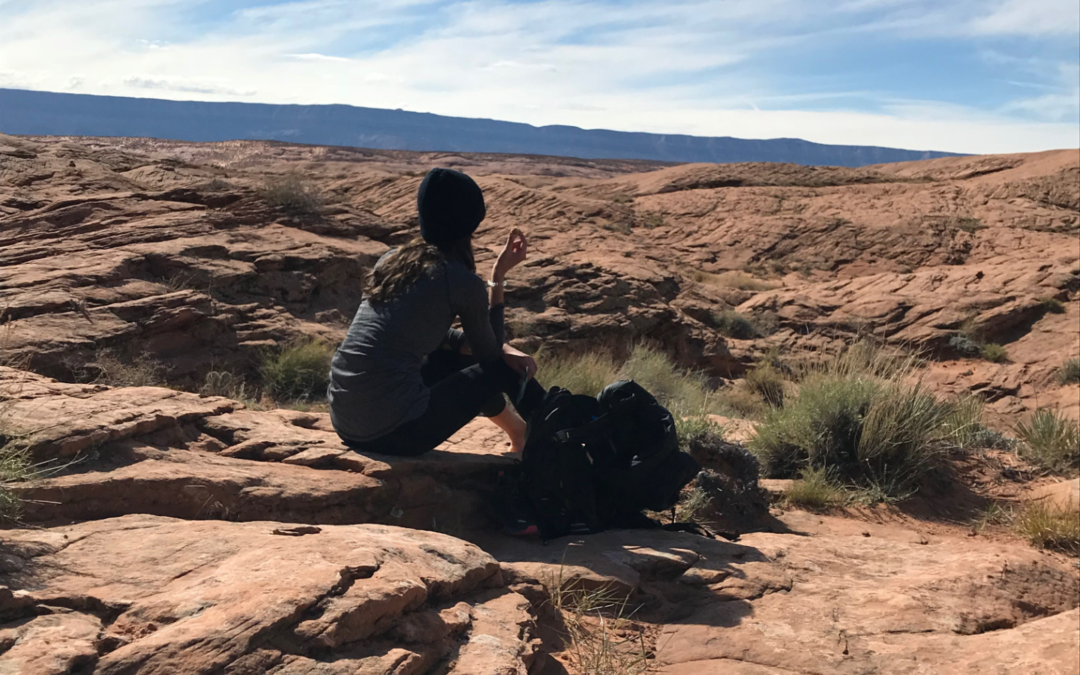
Pack Right and Hit the Trail!
One of the most frequent questions I get asked is “what should I pack?” This is a very important question for beginning hikers, as it nags at the hiker’s eternal struggle: What is necessary vs. what is extraneous weight? In almost every guidebook one can find a list of sometimes nearly 100 pieces of gear that you should own and pack. How are you supposed to sift through to figure out what is the most important? Don’t worry, The Goat is here to help!
Prioritizing gear is essentially the same as prioritizing life. What does one need to absolutely survive? Water, food, shelter. Though hopefully you never run into a situation where something becomes life and death, this is the basic rule of thumb on the trail: Pack things that will give you the greatest chance of staying safe. This becomes more in-depth the longer and more remote the trip, but for the purposes of this article we will focus on a 7-mile day hike in our region of the Colorado Plateau.
The Colorado Plateau is hot in the summer, cold in the winter, generally arid, rugged, and remote country. Route-finding can become difficult in places, and most hikes lack perennial water sources. Cell phone service can be spotty, and the wildlife, even the plant life, can be dangerous. Sounds like fun!
I will assume that you have a small (25-40L) daypack, that you are dressed appropriately for your adventure (hat, sunglasses, sturdy close-toed shoes/boots, light rain jacket), and that you will be bringing your camera.
1. Map & Compass (And the knowledge to use them) — This may very well save you life. It is difficult to stress the importance of knowing exactly where you are, and how to get from here to there. Should you become lost or disoriented, your map and navigating skills will be the thing upon which you rely to stay alive and find your way home. We advise taking a map-reading course (typically offered at most outdoor shops in 1-2 hour courses), and know how to use and understand how your compass can help you navigate on your map.
2. Water Bladder— We recommend a 3.0L bladder, which you can pick up for $15-25 at most outdoor stores. Your bladder should be puncture-resistant and provide easy drinking access in the form of an adjustable mouthpiece. Bladders are much more effective in keeping you hydrated, as they do not require stopping and fetching from your pack like a water bottle, and typically fit easily and snugly in a pouch in your daypack.
3. First-Aid Kit— This kit should include disinfectant, tweezers, blister relief, sutures, scissors, pain relief (Ibuprofen) and a few types of bandages (band-aids, gauze). It will cover all basic backcountry injuries such as cuts, bruises, and soreness.
4. Knife/Multi-tool— Either one is fine, but a multi-tool can be more useful as it may contain tweezers, scissors, a screwdriver, etc. all of which can be quite helpful in a pinch. In either case, your knife should be sharp, and the tool should be free of rust and in good working condition with all parts. This can be used for almost any backcountry task, including self-defense, fire-starting, cooking, first-aid, and gear-rigging.
5. Small Flashlight or Headlamp— Lights are necessary for navigation in dark places, and at night (obviously!). These are typically small and very lightweight, and you will be glad you have one if your adventure runs long, or if you are forced to spend a night out. It is also a good idea to have extra batteries for your light.
6. Water Purification— This can come in the form of iodine tablets, which are inexpensive and lightweight, or a full-blown apparatus, which can be more expensive but yields very safe, clean, and tasty water through filtered purification. Once again, you will be happy to have this in the event that you run out of water or need to provide water for pets, companions, etc.
7. Firestarting Materials— This can include almost anything that can start a fire. A flint, lighter, matches, or a spark generator are handy, and some kind of dry matter that can be used as kindling such as cotton balls, old man’s beard (that dry, green, mossy stuff on pine trees), or basically any very dry material. You can also pack a tube of fire paste. This should be very lightweight and compact, and you should practice starting a fire from scratch if it is something you have never done.
8. Cell Phone with a Location App— Any smartphone should be equipped with a way to track it should it become lost or stolen. This can be very handy if you become lost with it, as people will be easily able to track you movements. In the case you do not have a smartphone, a personal locator beacon, or simply telling people where you are going and when you will be back can be the difference between being found and not.
9. Small Survival Kit— This should include a small, loud, whistle, an insulating bivy sack (typically those shiny jobs), and a signaling mirror. This should be lightweight and compact. If you do happen to be stuck outside overnight, remember that lying directly on the ground will suck all your warmth away. It is a good idea to help your insulating apparatus with pine needles or some other way of staying off the ground.
10. Food Stuff — This should be a good mix of proteins, carbohydrates, and tasty, tasty fats. You will be burning plenty of calories on your adventure, so don’t be concerned with nutrition labels. Nuts, chocolates, peanut butter, granola, protein bars, and lunchmeat sandwiches are great trail foods.
Other Gear Ideas
- Doggie Bags for your pet waste (or your own) — Pack it in, pack it out people 🙂
- Toilet paper and trowel — see above
- Emergency contact info – Driver’s license or other photo ID, list of people to contact, medical info including allergies, blood type, etc. I wear dog tags that have all this information.
Clothing Do’s and Don’ts
Avoid cotton and denim on the trail. They do not breathe well, do not dry well, do not insulate well, and can literally kill you if they become wet and the temperature turns cold. If possible, wear synthetics and wool, as they do all the things that cotton and denim do not. Be sure you dress appropriately for the season and forecast, and be aware that weather is unpredictable, and that rain on the Colorado Plateau is just a cloud away.
Have fun, and I’ll see you out there!
May The Goat be always with you
For other Goatly Musings visit The Goat’s personal blog
Follow The Goat on Twitter and Instagram
Like us on Facebook
by The Goat | Aug 27, 2019 | Hiking
What are the Best Places to Desert Hike in Phoenix?
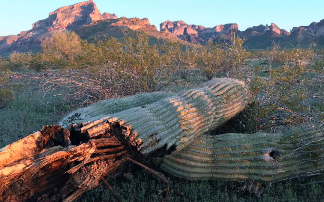
With so many hiking options in Arizona sometimes it can be hard to choose. Arizona has more designated wilderness and National Forest land than any state in the Union, including Alaska. Given this, you can be certain that you can find somewhere to be one with the Earth. Arizona is home to three National Parks (Grand Canyon, Petrified Forest, Saguaro), about 7 billion National Monuments (Agua Fria, Sonoran Desert, Chiricahua, Sunset Crater, et al) that preserve things from Puebloan Ruins to the magnificent and unique “sky islands” to still-active volcanoes to Old West Pioneer sites, and hundreds of thousands of acres of National Forest and BLM Land. All of this adds up to some incredibly diverse and spectacular hiking opportunities, many of which are right near the capital city of Phoenix.
The Valley of the Sun
Phoenix, with the 5th largest population in the country (which always gets an eyebrow-raising reaction from nearly every person to which I tell this fun fact), can be a surprising and veritable bonanza of hiking if one knows where to look (or even if they don’t). There are mountains on every edge of the valley and even some in the central valley which yield some of the best views of the city. Phoenix has been designated as some variation of the “best big city for enjoying the outdoors” by nearly every major outdoor and hiking publication (Outside, Backpacker, Climbing Magazine to name a couple).
The hiking is particularly interesting here, as the summits of the many Phoenix mountains lend a sense of just how vast this city is, especially at night when the twinkle from city lights below seem to stretch out beyond the horizon. What else would you expect from one of the largest cities in the nation? Here are five of the best places in The Valley to get out and see something beautiful, including some of the most interesting geology that one may find anywhere.
What Makes the Sonoran Desert look this way?
Phoenix is set in the geologic province known as the Basin and Range. The Basin and Range also contains the cities of Tucson, Las Vegas and Salt Lake City and stretches west nearly to Los Angeles, terminating at the San Andreas Fault. This province is precisely what it sounds like; large sediment-collecting basins studded by fault-bounded mountain ranges. Go ahead, take a look at a topographic map. Go Ahead, I’ll wait. What you’ve likely noticed is that all of the mountain ranges strike in the same direction; northwest to southeast.
This uniquely conforming layout is due the geologic forces at work, the tectonic stress known as extension. Roughly 15 million years ago, the North American Plate began to “slide” out over the Farallon and Pacific tectonic plates; that is, the western portion of North America was once rumpled and crumpled like a rug, and now that rug, having reached its maximum rumply thickness and the forces of the surface friction below being reduced, has began to slowly slide back out over the floor.
See for yourself!
Perform this experiment yourself with a rug in your home, and the result that will show is that while un-rumpling, the carpet will very likely have parallel linear features that resemble mountains, while between those mountains lie depressions, or basins. This action has created the landscape laid out before you (on a summit), and is the entire reason you are even standing on this particular summit looking out over 75 miles of a city in the desert.
Remember this basic fact – geology dictates topography. This is true everywhere you may travel in the world. From the tallest mountains to the deepest oceans, from canyons to mesas, from beaches to windswept plains, the geologic forces acting upon those areas for the preceding many millions of years have yielded the result you view right this moment. Enjoy! Here are The Goat’s Top 5 hiking areas in Phoenix:
Desert Hiking Tips
One Major Tip: If attempting any of these hikes in the summer it is strongly recommended to NOT. However, if you must, do the following:
Start Early (Like 430AM early)
Water (Like way more water than you think you need)
Bring More Water (see above)
Bring Even More Water (are you seeing a pattern?)
Every year several hikers die in these mountains. Scores more than that suffer severe dehydration, heat exhaustion, heat stroke, heart attacks, horrific sunburns, and injuries from falls (typically caused by carelessness and a lack of knowledge/preperation). This is a desert people, you’ve been warned!
5. McDowell-Sonoran Preserve
Located in the northeast valley, “The Preserve” as it is known to locals boasts nearly 30 hiking trails, rock climbing, mountain biking, and some of the most pristine desert in the Valley. The Nature Trail at the Gateway entrance near DC Ranch takes the hiker on a short jaunt that walks them through the flora, fauna, and geology that is found in the Preserve. McDowell-Sonoran Preserve protects, in particular, the unique desert environment known as a “bajada”, and ecosystem all its own made up from nothing more than centuries of storms washing out of the McDowell Mountains.
Bajadas are studded with an incredibly diverse flora and fauna, as they tend to contain more moisture that the typical desert landscape. Chollas, Saguaros, Hedgehog, and Barrel Cactus thrive here, and springtime brings a massive wildflower display. Mexican Poppies, Globemallows, Purple Asters, and the spectacular Prickly Pear reveal their astonishing colors but briefly in this desert, so don’t miss them!
Geologic features in the Preserve are numerous. For starters, the mountain range that appears as one is actually two, with the southern containing rocks nearly 1 billion years older than the northern range! Also found here is the feature known as Tom’s Thumb, a unique protrusion in the northern range sculpted from the welded tuff that composes this range. Students from Arizona State University discovered another unique geomorphological feature here, a massive landslide that is though to be only about 50 years old.
Want more about The Preserve? Check out The Goat blog.
4. Camelback Mountain/Squaw Peak
Known well to many Phoenicians, these mountains are rugged and beautiful. If you don’t mind the crowds, they are a perfect way to get out and see something beautiful. The summits of these mountains boast unparalleled views of the entire Valley of The Sun. To beat the crowds and elevate the thrill level, climb the south face. This route, known as the Echo Canyon Route, requires class IV climbing (helmet and ropes required). It is a great idea to hire a guiding service for this climb.
3. White Tank Mountain Park
See those mountains far in western sky? Those are the White Tank mountains. Long before Phoenix existed, the Hohokam peoples inhabited this area. The Hohokam are responsible for the many canals upon which Phoenix is built. In fact, the city is named for this very fact; new rising from ancient.
This is one of the only places in metro Phoenix where one can see a legitimate waterfall. Though the fall is not quite perennial (it dries up in the summer), it is quite a sight in the high season. February is the best time to view the falls, which are fed in part by the perennial springs that drew the Hohokam here. Some excellent metamorphic rocks, including the rare and beautiful Blue Marble can be found here (our favorite rock indeed).
2. Superstition Mountains
Lost gold mines, puebloan history, canyons, outcrops, and a gorgeous lake are just a few of the reasons that people flock to these mountains. Though most stay on highway 88 though the Tortilla Flat tourist trap, the wilderness is at its most wild when accessed from the south near Gold Canyon. Weaver’s Needle, a massive volcanic protrusion that dominates the central skyline of the range, is a favorite scenic area accessed along the Peralta Trail.
Don’t miss the Lost Dutchman’s State Park and its corresponding trails on the west side of the Wilderness. Legend has it that Jakob Waltz, a German prospector, was overheard bragging about a massive motherlode strike of gold in the rugged Superstitions (some context: Germans were often referred to as Dutch in this place and time). He left the bar, apparently headed back to his claim, and was never seen again. Where he went, nobody knows, and his alleged discovery disappeared with him.
1. Eagletail Wilderness
Okay, so this area is not technically in the valley, but that is part of its appeal. The Eagletail Mountains are located about 20 miles west of Buckeye; and this wilderness is true Sonoran. Golden Eagles soar above, Gila Monsters waddle below, and the saguaros stand stately in their unique manner. A giant granite monolith greets visitors upon entering, and natural arches, five in fact, were witnessed by The Goat on his last visit to this wondrous place. He also witnessed something else to his liking: not a single other hiker. To come here is to witness the High Sonoran desert in its truly wild state.
So there it is my friends! Now get out there and hit the trails, and may The Goat be with you.
Photo Courtesy of The Goat, Eagletail Monolith, Eagletail Wilderness
Going Guided
Hiking and exploring the Sonoran Desert is a special experience. Although it is possible to see these places yourself, hiring a guide is a great idea. For instance, guiding services provide logistical support, and plan everything for your best possible trip. They provide a great safety net on the trail, and are trained in backcountry medicine. Above all, they provide a depth of knowledge of the region that turns a walk into a true adventure.
Blue Marble Adventure GeoTourism provides all of the support you need, and pairs that with expert geologist/guides. Our backcountry meals use fresh ingredients, and are planned by a professional chef. Furthermore, we provide top-of-the-line gear and passion for the places we explore. In conclusion, you can visit National Parks, but going with a guide can create and even more memorable experience. Don’t be shy, and call us!
Read our blog!
For adventure hiking vacations in a geologic time machine, see our epic tours in Grand Canyon, Utah, and Arizona!
For geological musings read The Goat’s geology blog.
Follow us on Facebookand Instagram
Explore Further, Be Wild, See Through Time — Blue Marble Adventure GeoTourism